
| Memorials | : | 22 |
| Location | : | Rutherford, Gibson County, USA |
| Coordinate | : | 36.1198820, -89.0265080 |
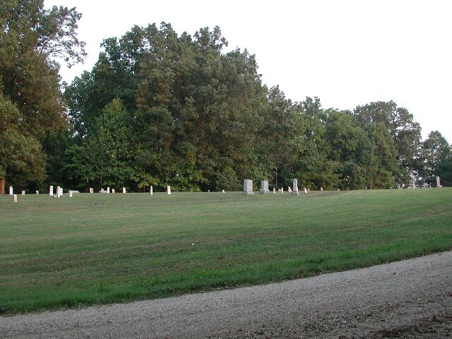
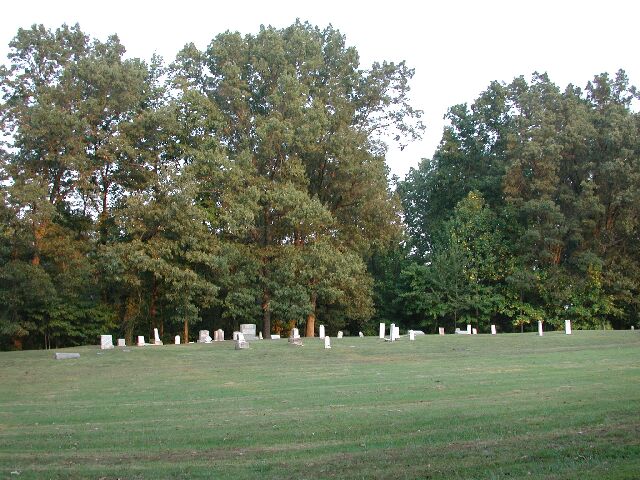
| Description | : | This Cemetery was established prior to the Civil War by Henry Flowers, Sr. Located approximately 2.5 miles west of Rutherford, TN. Travel out TN-105 0.9 mi., turn southwest (left) at Bell’s Chapel Road, then south (left) at first gravel road, Hamp Taylor Road/Flowers Chapel Road sign. Go 0.3 mi to the cemetery on the east (left) side. |
frequently asked questions (FAQ):
-
Where is Flowers Chapel Cemetery?
Flowers Chapel Cemetery is located at 33 Hamp Taylor Rd Rutherford, Gibson County ,Tennessee , 38369USA.
-
Flowers Chapel Cemetery cemetery's updated grave count on graveviews.com?
18 memorials
-
Where are the coordinates of the Flowers Chapel Cemetery?
Latitude: 36.1198820
Longitude: -89.0265080
Nearby Cemetories:
1. Wilkes Cemetery
Rutherford, Gibson County, USA
Coordinate: 36.1097380, -89.0214500
2. Taylor Family Cemetery
Rutherford, Gibson County, USA
Coordinate: 36.1049700, -89.0226300
3. Rutherford Cemetery
Rutherford, Gibson County, USA
Coordinate: 36.1258011, -88.9989014
4. Liberty Grove Cemetery
Rutherford, Gibson County, USA
Coordinate: 36.1439760, -89.0371100
5. Flowers - Wright Cemetery
Dyer, Gibson County, USA
Coordinate: 36.0951100, -89.0348700
6. Carroll Cemetery
Rutherford, Gibson County, USA
Coordinate: 36.1453900, -89.0140800
7. Thompson Cemetery
Rutherford, Gibson County, USA
Coordinate: 36.1047220, -89.0553430
8. Crockett Memorial Plot
Rutherford, Gibson County, USA
Coordinate: 36.1299620, -88.9871980
9. Bells Chapel Cemetery
Dyer, Gibson County, USA
Coordinate: 36.1164017, -89.0686035
10. Mount Olive Cemetery
Dyer, Gibson County, USA
Coordinate: 36.0807991, -89.0278015
11. Hopper Cemetery
Dyer, Gibson County, USA
Coordinate: 36.0936200, -88.9878680
12. Cowan Cemetery
Dyer, Gibson County, USA
Coordinate: 36.0978120, -89.0753020
13. New Victory MB Church Cemetery
Rutherford, Gibson County, USA
Coordinate: 36.1596780, -88.9978150
14. Old Bluff Cemetery
Rutherford, Gibson County, USA
Coordinate: 36.1417870, -88.9751880
15. Smithson-Askew Cemetery
Rutherford, Gibson County, USA
Coordinate: 36.1667300, -89.0159600
16. Crenshaw-Wyatt Cemetery
Dyer, Gibson County, USA
Coordinate: 36.0778090, -89.0589010
17. Keathley & Peel Family Cemetery
Gibson County, USA
Coordinate: 36.1651820, -88.9949470
18. Bobbitt Cemetery
Dyer, Gibson County, USA
Coordinate: 36.0774994, -88.9850006
19. North Union Cemetery
Kenton, Gibson County, USA
Coordinate: 36.1652985, -89.0736008
20. Keas Cemetery
Dyer, Gibson County, USA
Coordinate: 36.0769005, -88.9757996
21. Rossons Cemetery
Kenton, Gibson County, USA
Coordinate: 36.1799158, -89.0083141
22. Oakwood Cemetery
Dyer, Gibson County, USA
Coordinate: 36.0619011, -88.9875031
23. Apostolic Faith Tabernacle Cemetery
Dyer, Gibson County, USA
Coordinate: 36.0732460, -88.9674180
24. Good Hope Cemetery
Dyer, Gibson County, USA
Coordinate: 36.0477982, -89.0438995