
| Memorials | : | 5 |
| Location | : | Freedom, Carroll County, USA |
| Coordinate | : | 43.8205900, -71.0207400 |
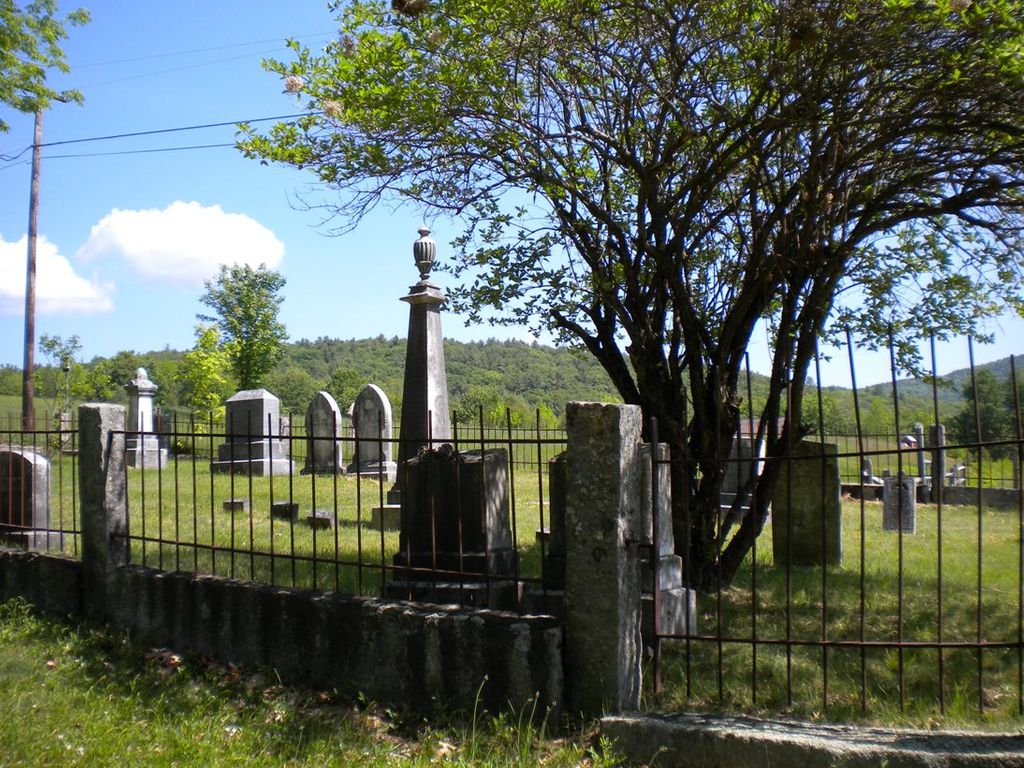
| Description | : | This cemetery may also be known as High Meadow or Lord yard. Directions: Start at the fountain in Freedom Town Square, proceed down Old Portland Road approximately six tenths of a mile to Scarboro Road on the left. Proceed up Scarboro Road to the first left which is the Black Road. At about one tenth of a mile up Black Road, the cemetery will be on your right surrounded by a wrought iron fence and granite posts. Directions and inscriptions for this cemetery courtesy of Dotty Brooks, author of Cemetery Records of Freedom New Hampshire. |
frequently asked questions (FAQ):
-
Where is Fowler Cemetery?
Fowler Cemetery is located at Freedom, Carroll County ,New Hampshire ,USA.
-
Fowler Cemetery cemetery's updated grave count on graveviews.com?
3 memorials
-
Where are the coordinates of the Fowler Cemetery?
Latitude: 43.8205900
Longitude: -71.0207400
Nearby Cemetories:
1. Meserve and McDaniel Cemetery
Freedom, Carroll County, USA
Coordinate: 43.8272220, -71.0130560
2. Lakeview Cemetery
Freedom, Carroll County, USA
Coordinate: 43.8107400, -71.0282500
3. Towle Cemetery
Freedom, Carroll County, USA
Coordinate: 43.8136000, -71.0336000
4. Prospect Cemetery
Freedom, Carroll County, USA
Coordinate: 43.8147000, -71.0357000
5. Foss Cemetery
Freedom, Carroll County, USA
Coordinate: 43.8316670, -71.0080560
6. Andrews Hill Cemetery
Freedom, Carroll County, USA
Coordinate: 43.8173000, -71.0444000
7. Watson Hill Cemetery
Freedom, Carroll County, USA
Coordinate: 43.8361000, -71.0486000
8. Moses-Young Cemetery
Freedom, Carroll County, USA
Coordinate: 43.8504800, -71.0317500
9. Brooks Cemetery
Freedom, Carroll County, USA
Coordinate: 43.8505900, -71.0066900
10. Cushing Corner Cemetery
Freedom, Carroll County, USA
Coordinate: 43.8239990, -71.0647550
11. Effingham Falls Cemetery
Effingham, Carroll County, USA
Coordinate: 43.7961000, -71.0518000
12. Sargent Cemetery
Freedom, Carroll County, USA
Coordinate: 43.8489000, -70.9943000
13. Swett Hill Cemetery
Freedom, Carroll County, USA
Coordinate: 43.8547000, -71.0183000
14. Parsons Cemetery
Freedom, Carroll County, USA
Coordinate: 43.7996830, -71.0583040
15. Bradbury Chase Cemetery
Freedom, Carroll County, USA
Coordinate: 43.7995580, -71.0583120
16. Judkins Cemetery
Freedom, Carroll County, USA
Coordinate: 43.8107600, -71.0673800
17. Thurston and Burnham Cemetery
Freedom, Carroll County, USA
Coordinate: 43.8394000, -71.0636000
18. Roberts Cemetery
Porter, Oxford County, USA
Coordinate: 43.8465200, -70.9853400
19. Sargent Cemetery
Porter, Oxford County, USA
Coordinate: 43.8487483, -70.9842183
20. Huntress Cemetery
York County, USA
Coordinate: 43.7893982, -70.9882965
21. Hubbard Cemetery
Porter, Oxford County, USA
Coordinate: 43.8228000, -70.9653000
22. Drew Cemetery
Freedom, Carroll County, USA
Coordinate: 43.8607000, -71.0327000
23. Philbrick Cemetery
Porter, Oxford County, USA
Coordinate: 43.8136100, -70.9623200
24. Emery Cemetery
Porter, Oxford County, USA
Coordinate: 43.8410988, -70.9677963