
| Memorials | : | 0 |
| Location | : | Porter, Oxford County, USA |
| Coordinate | : | 43.8465200, -70.9853400 |
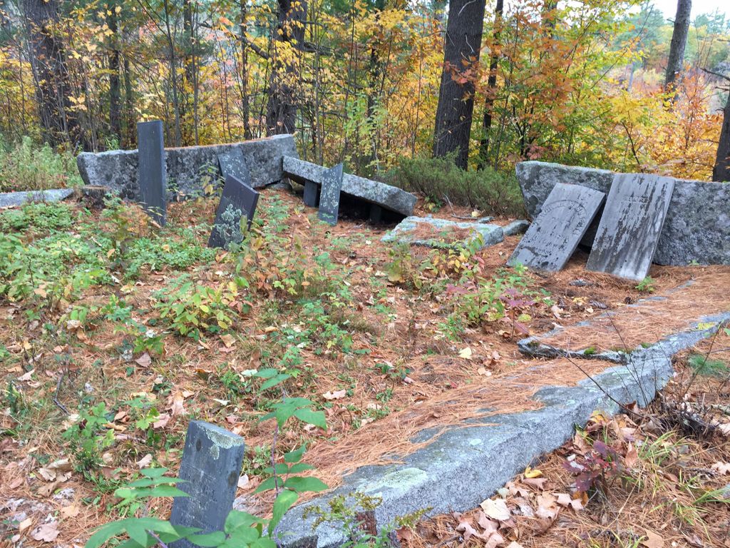
| Description | : | From its intersection with Dana Weeks Road, drive 0.25 miles southeast on Bickford Pond Road to the first house. The cemetery is on the left (north) side of the road, about 100 yards northwest from the barn. It is at the end of a long ridge and is surrounded by a split granite stone wall that is falling down. For more historical information, see: https://brownfieldcemeteries.com/roberts-cemetery/ |
frequently asked questions (FAQ):
-
Where is Roberts Cemetery?
Roberts Cemetery is located at Porter, Oxford County ,Maine ,USA.
-
Roberts Cemetery cemetery's updated grave count on graveviews.com?
0 memorials
-
Where are the coordinates of the Roberts Cemetery?
Latitude: 43.8465200
Longitude: -70.9853400
Nearby Cemetories:
1. Sargent Cemetery
Porter, Oxford County, USA
Coordinate: 43.8487483, -70.9842183
2. Sargent Cemetery
Freedom, Carroll County, USA
Coordinate: 43.8489000, -70.9943000
3. Raffy-Foote Cemetery
Porter, Oxford County, USA
Coordinate: 43.8447400, -70.9697000
4. Day-Stanley Cemetery
Porter, Oxford County, USA
Coordinate: 43.8457000, -70.9680300
5. Emery Cemetery
Porter, Oxford County, USA
Coordinate: 43.8410988, -70.9677963
6. Brooks Cemetery
Freedom, Carroll County, USA
Coordinate: 43.8505900, -71.0066900
7. Foss Cemetery
Freedom, Carroll County, USA
Coordinate: 43.8316670, -71.0080560
8. Swett Hill Cemetery
Freedom, Carroll County, USA
Coordinate: 43.8547000, -71.0183000
9. Hubbard Cemetery
Porter, Oxford County, USA
Coordinate: 43.8228000, -70.9653000
10. Meserve and McDaniel Cemetery
Freedom, Carroll County, USA
Coordinate: 43.8272220, -71.0130560
11. Floyd Cemetery
Porter, Oxford County, USA
Coordinate: 43.8494800, -70.9405900
12. Moses-Young Cemetery
Freedom, Carroll County, USA
Coordinate: 43.8504800, -71.0317500
13. Stanley Cemetery
Porter, Oxford County, USA
Coordinate: 43.8761200, -70.9606900
14. Pearl Cemetery
Porter, Oxford County, USA
Coordinate: 43.8361900, -70.9393600
15. Floyd-Pearl Cemetery
Porter, Oxford County, USA
Coordinate: 43.8627500, -70.9427500
16. Daniel Libby Cemetery
Porter, Oxford County, USA
Coordinate: 43.8333000, -70.9401600
17. Merrow-Gannett Cemetery
Eaton Center, Carroll County, USA
Coordinate: 43.8745200, -71.0153300
18. Gould Cemetery
Porter, Oxford County, USA
Coordinate: 43.8441700, -70.9358900
19. Fowler Cemetery
Freedom, Carroll County, USA
Coordinate: 43.8205900, -71.0207400
20. Philbrick Cemetery
Porter, Oxford County, USA
Coordinate: 43.8136100, -70.9623200
21. Drew Cemetery
Freedom, Carroll County, USA
Coordinate: 43.8607000, -71.0327000
22. McCartee Cemetery
Porter, Oxford County, USA
Coordinate: 43.8844430, -70.9770440
23. Wilkinson Cemetery
Eaton, Carroll County, USA
Coordinate: 43.8663900, -71.0331800
24. Fernald Cemetery
Eaton, Carroll County, USA
Coordinate: 43.8825600, -71.0159200