
| Memorials | : | 0 |
| Location | : | Freedom, Carroll County, USA |
| Coordinate | : | 43.8489000, -70.9943000 |
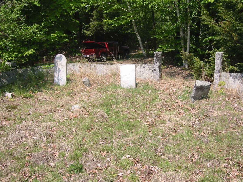
| Description | : | From its intersection with Swett Hill Road, drive southeast on Rice Hill Road 1.3 miles to a drive on the left (north) side and proceed up it for 475 feet. The small family cemetery is on the right (east) side of the road and is surrounded by a split granite wall. The gravestones in this cemetery have recently been restored and it is nicely maintained. |
frequently asked questions (FAQ):
-
Where is Sargent Cemetery?
Sargent Cemetery is located at Freedom, Carroll County ,New Hampshire ,USA.
-
Sargent Cemetery cemetery's updated grave count on graveviews.com?
0 memorials
-
Where are the coordinates of the Sargent Cemetery?
Latitude: 43.8489000
Longitude: -70.9943000
Nearby Cemetories:
1. Roberts Cemetery
Porter, Oxford County, USA
Coordinate: 43.8465200, -70.9853400
2. Sargent Cemetery
Porter, Oxford County, USA
Coordinate: 43.8487483, -70.9842183
3. Brooks Cemetery
Freedom, Carroll County, USA
Coordinate: 43.8505900, -71.0066900
4. Raffy-Foote Cemetery
Porter, Oxford County, USA
Coordinate: 43.8447400, -70.9697000
5. Swett Hill Cemetery
Freedom, Carroll County, USA
Coordinate: 43.8547000, -71.0183000
6. Day-Stanley Cemetery
Porter, Oxford County, USA
Coordinate: 43.8457000, -70.9680300
7. Foss Cemetery
Freedom, Carroll County, USA
Coordinate: 43.8316670, -71.0080560
8. Emery Cemetery
Porter, Oxford County, USA
Coordinate: 43.8410988, -70.9677963
9. Meserve and McDaniel Cemetery
Freedom, Carroll County, USA
Coordinate: 43.8272220, -71.0130560
10. Moses-Young Cemetery
Freedom, Carroll County, USA
Coordinate: 43.8504800, -71.0317500
11. Merrow-Gannett Cemetery
Eaton Center, Carroll County, USA
Coordinate: 43.8745200, -71.0153300
12. Drew Cemetery
Freedom, Carroll County, USA
Coordinate: 43.8607000, -71.0327000
13. Wilkinson Cemetery
Eaton, Carroll County, USA
Coordinate: 43.8663900, -71.0331800
14. Hubbard Cemetery
Porter, Oxford County, USA
Coordinate: 43.8228000, -70.9653000
15. Fowler Cemetery
Freedom, Carroll County, USA
Coordinate: 43.8205900, -71.0207400
16. Stanley Cemetery
Porter, Oxford County, USA
Coordinate: 43.8761200, -70.9606900
17. Fernald Cemetery
Eaton, Carroll County, USA
Coordinate: 43.8825600, -71.0159200
18. McCartee Cemetery
Porter, Oxford County, USA
Coordinate: 43.8844430, -70.9770440
19. Floyd Cemetery
Porter, Oxford County, USA
Coordinate: 43.8494800, -70.9405900
20. Floyd-Pearl Cemetery
Porter, Oxford County, USA
Coordinate: 43.8627500, -70.9427500
21. Smart Cemetery
Freedom, Carroll County, USA
Coordinate: 43.8598700, -71.0483200
22. Allard Cemetery
Freedom, Carroll County, USA
Coordinate: 43.8599600, -71.0485000
23. Watson Hill Cemetery
Freedom, Carroll County, USA
Coordinate: 43.8361000, -71.0486000
24. Pearl Cemetery
Porter, Oxford County, USA
Coordinate: 43.8361900, -70.9393600