
| Memorials | : | 0 |
| Location | : | Pocking, Landkreis Starnberg, Germany |
| Coordinate | : | 47.9659958, 11.2569561 |
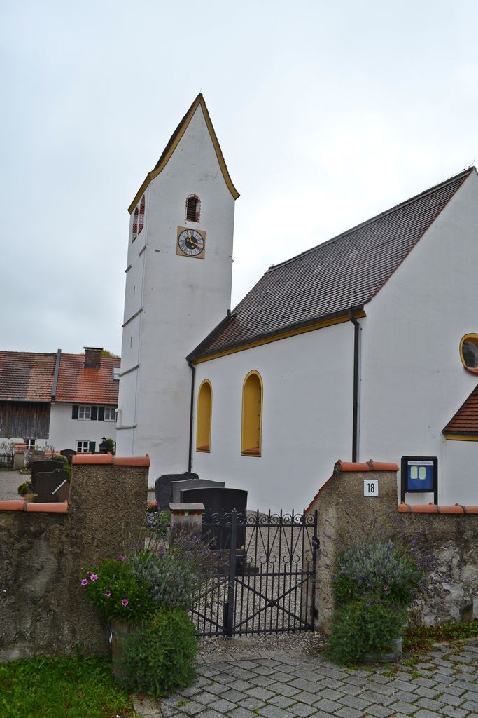
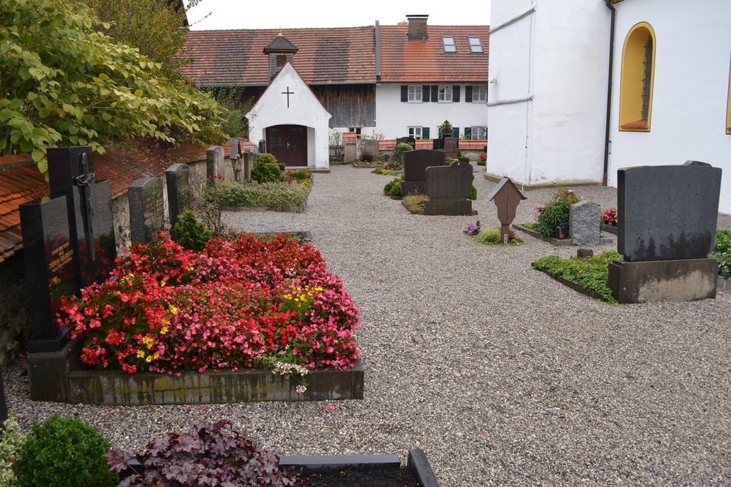
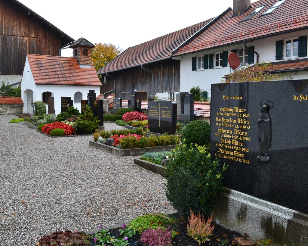
| Description | : | This Catholic cemetery is owned and managed by the St. Pius congregation in Pöcking. Friedhof Aschering surrounds the St. Sebastian Kirche. Aschering is a part of the village of Pöcking and was first mentioned in a document around 1010, as a gift of Emperor Heinrich II (Henry II, Holy Roman Emperor 973-1024) to the Cloister Polling. It is now (since 1972) a part of the village of of Pöcking, located West of Lake Starnberg, about 35km South of Munich, in Bavaria, GERMANY. St. Sebastian Church dates back to the 13th century, but was totally remodeled in 1758. Please note that the graves... Read More |
frequently asked questions (FAQ):
-
Where is Friedhof Aschering?
Friedhof Aschering is located at St. Sebastian Strasse Pocking, Landkreis Starnberg ,Bavaria (Bayern) ,Germany.
-
Friedhof Aschering cemetery's updated grave count on graveviews.com?
0 memorials
-
Where are the coordinates of the Friedhof Aschering?
Latitude: 47.9659958
Longitude: 11.2569561
Nearby Cemetories:
1. Traubing New Cemetery
Tutzing, Landkreis Starnberg, Germany
Coordinate: 47.9450531, 11.2541561
2. Kirchenfriedhof Traubing
Tutzing, Landkreis Starnberg, Germany
Coordinate: 47.9440918, 11.2582502
3. Neuer Friedhof Pöcking
Pocking, Landkreis Starnberg, Germany
Coordinate: 47.9680099, 11.2987900
4. Jüdischer Friedhof Feldafing
Feldafing, Landkreis Starnberg, Germany
Coordinate: 47.9525620, 11.2938840
5. Friedhof Feldafing
Feldafing, Landkreis Starnberg, Germany
Coordinate: 47.9526900, 11.2943300
6. St. Bartholomäus Kirchhof Maising
Maising, Landkreis Starnberg, Germany
Coordinate: 47.9861107, 11.2893600
7. Alter Friedhof Pöcking
Pocking, Landkreis Starnberg, Germany
Coordinate: 47.9673424, 11.3019686
8. Friedhof Perchting
Starnberg, Landkreis Starnberg, Germany
Coordinate: 48.0003777, 11.2748775
9. Wittelsbacher Friedhof
Andechs, Landkreis Starnberg, Germany
Coordinate: 47.9742012, 11.1823654
10. Klosterkirche Andechs
Andechs, Landkreis Starnberg, Germany
Coordinate: 47.9744200, 11.1823500
11. Waldfriedhof Tutzing
Tutzing, Landkreis Starnberg, Germany
Coordinate: 47.9123001, 11.2679996
12. Neuer Friedhof Tutzing
Tutzing, Landkreis Starnberg, Germany
Coordinate: 47.9118004, 11.2749996
13. Mausoleum Söcking
Starnberg, Landkreis Starnberg, Germany
Coordinate: 48.0026436, 11.3202034
14. Friedhof Söcking
Starnberg, Landkreis Starnberg, Germany
Coordinate: 48.0042229, 11.3223982
15. Kirchhof St. Martin
Herrsching, Landkreis Starnberg, Germany
Coordinate: 47.9976816, 11.1796717
16. Alter Friedhof
Tutzing, Landkreis Starnberg, Germany
Coordinate: 47.9070015, 11.2810001
17. Starnberg-St. Josefs Kirche
Starnberg, Landkreis Starnberg, Germany
Coordinate: 47.9977130, 11.3382250
18. Friedhof am Mitterweg
Herrsching, Landkreis Starnberg, Germany
Coordinate: 48.0011510, 11.1766550
19. Friedhof Herrsching
Herrsching, Landkreis Starnberg, Germany
Coordinate: 48.0012210, 11.1766950
20. Friedhof Ilkahöhe
Tutzing, Landkreis Starnberg, Germany
Coordinate: 47.8994350, 11.2545720
21. Friedhof Widdersberg
Widdersberg, Landkreis Starnberg, Germany
Coordinate: 48.0205990, 11.1983390
22. Friedhof Hanfelderstrasse
Starnberg, Landkreis Starnberg, Germany
Coordinate: 48.0041100, 11.3400000
23. Friedhof Aufkirchen
Berg am See, Landkreis Starnberg, Germany
Coordinate: 47.9570190, 11.3611760
24. Starnberg-Waldfriedhof
Starnberg, Landkreis Starnberg, Germany
Coordinate: 48.0146800, 11.3453700