
| Memorials | : | 0 |
| Location | : | Tutzing, Landkreis Starnberg, Germany |
| Coordinate | : | 47.9440918, 11.2582502 |
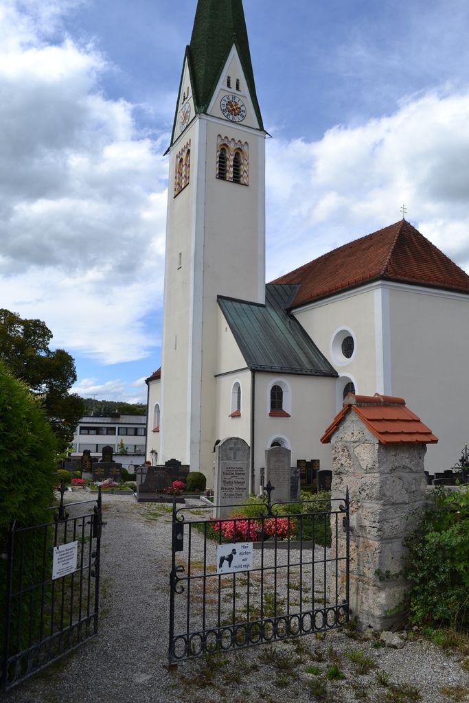
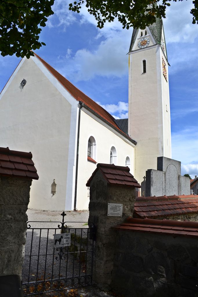
| Description | : | The Old Traubing Cemetery is surrounding the "Kirche St. Mariä Geburt" (St. Mary Holy Birth Church) in the middle of the village, located at "Pfarrweg". Traubing is now a part of the city of Tutzing in Upper Bavaria, just West of the Starnberg Lake. The "Bundesstrasse 2" runs right by it. It was first mentioned in A.D. 1005. For the current Findagrave listing of cemeteries in this area, click on the links below: Landkreis Starnberg (Starnberg County) Please note that the graves in Germany are not perpetual. After a certain period of repose (20-30 years) the graves are being leveled and re-used. There is no... Read More |
frequently asked questions (FAQ):
-
Where is Kirchenfriedhof Traubing?
Kirchenfriedhof Traubing is located at Pfarrweg in the village of Traubing Tutzing, Landkreis Starnberg ,Bavaria (Bayern) ,Germany.
-
Kirchenfriedhof Traubing cemetery's updated grave count on graveviews.com?
0 memorials
-
Where are the coordinates of the Kirchenfriedhof Traubing?
Latitude: 47.9440918
Longitude: 11.2582502
Nearby Cemetories:
1. Traubing New Cemetery
Tutzing, Landkreis Starnberg, Germany
Coordinate: 47.9450531, 11.2541561
2. Friedhof Aschering
Pocking, Landkreis Starnberg, Germany
Coordinate: 47.9659958, 11.2569561
3. Jüdischer Friedhof Feldafing
Feldafing, Landkreis Starnberg, Germany
Coordinate: 47.9525620, 11.2938840
4. Friedhof Feldafing
Feldafing, Landkreis Starnberg, Germany
Coordinate: 47.9526900, 11.2943300
5. Waldfriedhof Tutzing
Tutzing, Landkreis Starnberg, Germany
Coordinate: 47.9123001, 11.2679996
6. Neuer Friedhof Tutzing
Tutzing, Landkreis Starnberg, Germany
Coordinate: 47.9118004, 11.2749996
7. Neuer Friedhof Pöcking
Pocking, Landkreis Starnberg, Germany
Coordinate: 47.9680099, 11.2987900
8. Alter Friedhof Pöcking
Pocking, Landkreis Starnberg, Germany
Coordinate: 47.9673424, 11.3019686
9. Alter Friedhof
Tutzing, Landkreis Starnberg, Germany
Coordinate: 47.9070015, 11.2810001
10. Friedhof Ilkahöhe
Tutzing, Landkreis Starnberg, Germany
Coordinate: 47.8994350, 11.2545720
11. St. Bartholomäus Kirchhof Maising
Maising, Landkreis Starnberg, Germany
Coordinate: 47.9861107, 11.2893600
12. Friedhof Perchting
Starnberg, Landkreis Starnberg, Germany
Coordinate: 48.0003777, 11.2748775
13. Wittelsbacher Friedhof
Andechs, Landkreis Starnberg, Germany
Coordinate: 47.9742012, 11.1823654
14. Klosterkirche Andechs
Andechs, Landkreis Starnberg, Germany
Coordinate: 47.9744200, 11.1823500
15. Diemendorf Friedhof Tutzing
Tutzing, Landkreis Starnberg, Germany
Coordinate: 47.8852196, 11.2217464
16. Hohenried Cemetery
Bernried, Landkreis Weilheim-Schongau, Germany
Coordinate: 47.8770865, 11.2854587
17. Friedhof Aufkirchen
Berg am See, Landkreis Starnberg, Germany
Coordinate: 47.9570190, 11.3611760
18. Mausoleum Söcking
Starnberg, Landkreis Starnberg, Germany
Coordinate: 48.0026436, 11.3202034
19. Friedhof Söcking
Starnberg, Landkreis Starnberg, Germany
Coordinate: 48.0042229, 11.3223982
20. Kirchhof St. Martin
Herrsching, Landkreis Starnberg, Germany
Coordinate: 47.9976816, 11.1796717
21. Starnberg-St. Josefs Kirche
Starnberg, Landkreis Starnberg, Germany
Coordinate: 47.9977130, 11.3382250
22. Friedhof am Mitterweg
Herrsching, Landkreis Starnberg, Germany
Coordinate: 48.0011510, 11.1766550
23. Friedhof Herrsching
Herrsching, Landkreis Starnberg, Germany
Coordinate: 48.0012210, 11.1766950
24. Friedhof Hanfelderstrasse
Starnberg, Landkreis Starnberg, Germany
Coordinate: 48.0041100, 11.3400000