
| Memorials | : | 0 |
| Location | : | Feldafing, Landkreis Starnberg, Germany |
| Coordinate | : | 47.9525620, 11.2938840 |
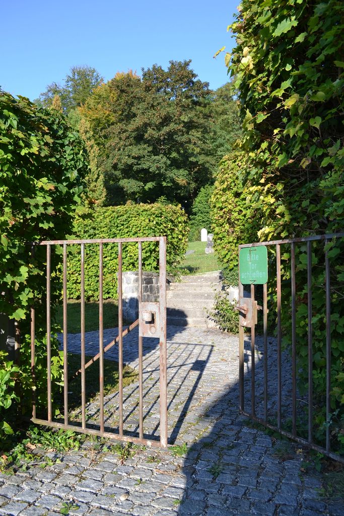
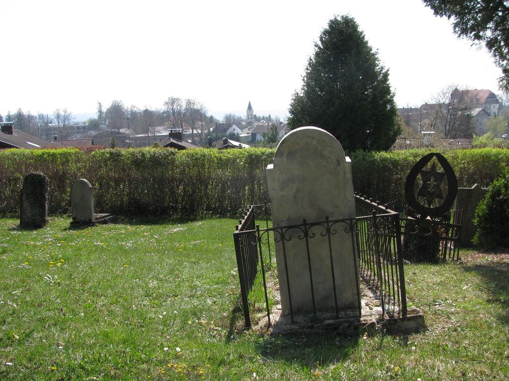
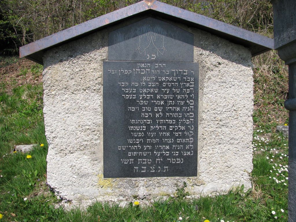
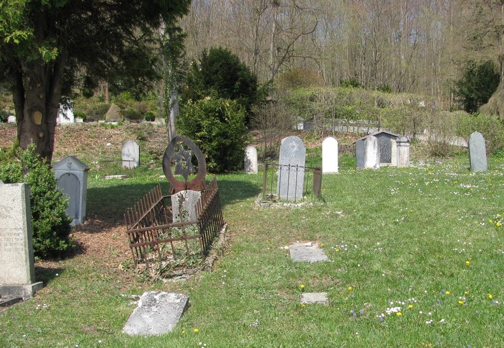
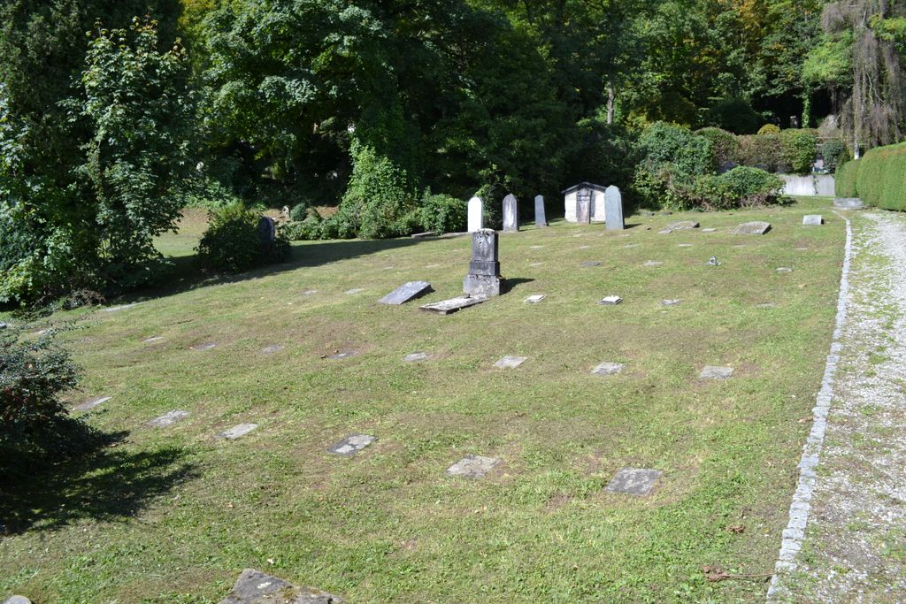
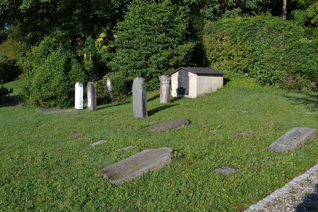
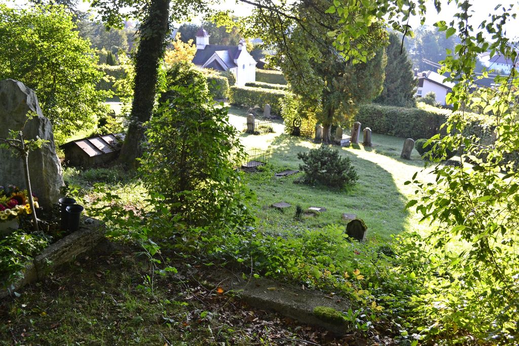
| Description | : | Right after World War II, from May 1945 until about March 1953 a Jewish Housing Complex (DP Camp Feldafing) existed in a former Nazi school in Feldafing, self managed, in which Jewish citizens, who survived the Holocaust, were waiting to be able to immigrate to Israel or other countries. Some of the people who died there, where buried in a small cemetery at Friedensweg, right next to the community cemetery. Actually the community donated a part of its cemetery property for this Jewish burial ground to be established. It is now is poor condition, with many markers toppled and impossible... Read More |
frequently asked questions (FAQ):
-
Where is Jüdischer Friedhof Feldafing?
Jüdischer Friedhof Feldafing is located at Feldafing, Landkreis Starnberg ,Bavaria (Bayern) ,Germany.
-
Jüdischer Friedhof Feldafing cemetery's updated grave count on graveviews.com?
0 memorials
-
Where are the coordinates of the Jüdischer Friedhof Feldafing?
Latitude: 47.9525620
Longitude: 11.2938840
Nearby Cemetories:
1. Friedhof Feldafing
Feldafing, Landkreis Starnberg, Germany
Coordinate: 47.9526900, 11.2943300
2. Alter Friedhof Pöcking
Pocking, Landkreis Starnberg, Germany
Coordinate: 47.9673424, 11.3019686
3. Neuer Friedhof Pöcking
Pocking, Landkreis Starnberg, Germany
Coordinate: 47.9680099, 11.2987900
4. Kirchenfriedhof Traubing
Tutzing, Landkreis Starnberg, Germany
Coordinate: 47.9440918, 11.2582502
5. Traubing New Cemetery
Tutzing, Landkreis Starnberg, Germany
Coordinate: 47.9450531, 11.2541561
6. Friedhof Aschering
Pocking, Landkreis Starnberg, Germany
Coordinate: 47.9659958, 11.2569561
7. St. Bartholomäus Kirchhof Maising
Maising, Landkreis Starnberg, Germany
Coordinate: 47.9861107, 11.2893600
8. Neuer Friedhof Tutzing
Tutzing, Landkreis Starnberg, Germany
Coordinate: 47.9118004, 11.2749996
9. Waldfriedhof Tutzing
Tutzing, Landkreis Starnberg, Germany
Coordinate: 47.9123001, 11.2679996
10. Friedhof Aufkirchen
Berg am See, Landkreis Starnberg, Germany
Coordinate: 47.9570190, 11.3611760
11. Alter Friedhof
Tutzing, Landkreis Starnberg, Germany
Coordinate: 47.9070015, 11.2810001
12. Friedhof Perchting
Starnberg, Landkreis Starnberg, Germany
Coordinate: 48.0003777, 11.2748775
13. Mausoleum Söcking
Starnberg, Landkreis Starnberg, Germany
Coordinate: 48.0026436, 11.3202034
14. Starnberg-St. Josefs Kirche
Starnberg, Landkreis Starnberg, Germany
Coordinate: 47.9977130, 11.3382250
15. Friedhof Söcking
Starnberg, Landkreis Starnberg, Germany
Coordinate: 48.0042229, 11.3223982
16. Friedhof Ilkahöhe
Tutzing, Landkreis Starnberg, Germany
Coordinate: 47.8994350, 11.2545720
17. Friedhof Hanfelderstrasse
Starnberg, Landkreis Starnberg, Germany
Coordinate: 48.0041100, 11.3400000
18. Sankt Valentin Dorfkirche
Starnberg, Landkreis Starnberg, Germany
Coordinate: 47.9987640, 11.3646330
19. Gemeindefriedhof Starnberg - Percha
Starnberg, Landkreis Starnberg, Germany
Coordinate: 48.0004616, 11.3668032
20. Kirchhof Mariä Himmelfahrt
Münsing, Landkreis Bad Tölz-Wolfratshausen, Germany
Coordinate: 47.9033796, 11.3669874
21. Neuer Friedhof Münsing
Münsing, Landkreis Bad Tölz-Wolfratshausen, Germany
Coordinate: 47.9016105, 11.3668153
22. Starnberg-Waldfriedhof
Starnberg, Landkreis Starnberg, Germany
Coordinate: 48.0146800, 11.3453700
23. Dorfkirche Herz Jesu Höhenrain
Berg, Landkreis Starnberg, Germany
Coordinate: 47.9313000, 11.3964730
24. Hohenried Cemetery
Bernried, Landkreis Weilheim-Schongau, Germany
Coordinate: 47.8770865, 11.2854587