
| Memorials | : | 2 |
| Location | : | Grizzly Flat, El Dorado County, USA |
| Coordinate | : | 38.6292420, -120.5127690 |
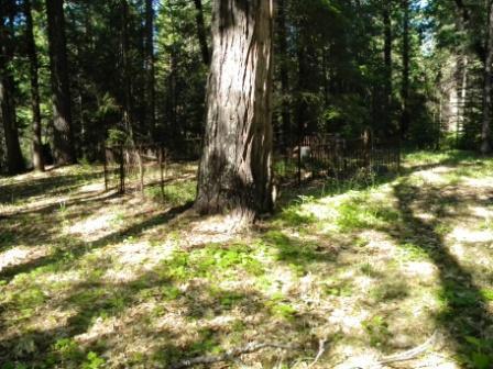
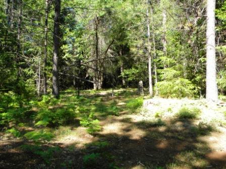
| Description | : | The Grizzly Flat Catholic Cemetery was lacated next to the Catholic Church in the original site of Grizzly Flat. The cemetery now sits by itself in the forest. Most of the markers are gone, there in no deliniation to identify this as a cemetery other than the two remaining family plots. The cemetery is located on private land and permission is required to visit it. All the markers that exist have been photographed and placed here on Findagrave. |
frequently asked questions (FAQ):
-
Where is Grizzly Flat Catholic Cemetery?
Grizzly Flat Catholic Cemetery is located at Grizzly Flat, El Dorado County ,California ,USA.
-
Grizzly Flat Catholic Cemetery cemetery's updated grave count on graveviews.com?
2 memorials
-
Where are the coordinates of the Grizzly Flat Catholic Cemetery?
Latitude: 38.6292420
Longitude: -120.5127690
Nearby Cemetories:
1. Grizzly Flats Cemetery
Grizzly Flat, El Dorado County, USA
Coordinate: 38.6351089, -120.5299301
2. Indian Diggings Cemetery
El Dorado County, USA
Coordinate: 38.5508003, -120.5849991
3. Andreason Cemetery
Apex, El Dorado County, USA
Coordinate: 38.5292015, -120.5800018
4. Fairplay Cemetery
Fair Play, El Dorado County, USA
Coordinate: 38.5924430, -120.6560610
5. Pleasant Valley Cemetery
Pleasant Valley, El Dorado County, USA
Coordinate: 38.6809196, -120.6651230
6. Newtown Cemetery
Newtown, El Dorado County, USA
Coordinate: 38.7050410, -120.6787310
7. Lockwood Station Cemetery
Volcano, Amador County, USA
Coordinate: 38.4882670, -120.5954040
8. Camino Cemetery
Camino, El Dorado County, USA
Coordinate: 38.7450981, -120.6564407
9. Oak Hill Cemetery
Placerville, El Dorado County, USA
Coordinate: 38.6768990, -120.7481003
10. Amador Memorial Cemetery
Pioneer, Amador County, USA
Coordinate: 38.4398918, -120.5428314
11. Blairs-Winkelman Cemetery
Camino, El Dorado County, USA
Coordinate: 38.7547140, -120.7098510
12. Volcano Catholic Cemetery
Volcano, Amador County, USA
Coordinate: 38.4459991, -120.6279984
13. Volcano Protestant Cemetery
Volcano, Amador County, USA
Coordinate: 38.4449997, -120.6269989
14. Smiths Flat Cemetery
Placerville, El Dorado County, USA
Coordinate: 38.7325287, -120.7552414
15. Jacquier Family Cemetery
Placerville, El Dorado County, USA
Coordinate: 38.7424420, -120.7602750
16. IOOF Cemetery
Fiddletown, Amador County, USA
Coordinate: 38.5026290, -120.7490990
17. Weberville Cemetery
Placerville, El Dorado County, USA
Coordinate: 38.7024170, -120.7901000
18. West Point Cemetery
West Point, Calaveras County, USA
Coordinate: 38.3999650, -120.5327220
19. Fiddletown Cemetery
Fiddletown, Amador County, USA
Coordinate: 38.5021300, -120.7577150
20. Dickinson Family Cemetery
Placerville, El Dorado County, USA
Coordinate: 38.7970450, -120.7269010
21. Nelsonville Cemetery
Placerville, El Dorado County, USA
Coordinate: 38.7894490, -120.7380720
22. Chinese Cemetery
Fiddletown, Amador County, USA
Coordinate: 38.5017600, -120.7699500
23. Andre Family Cemetery
Placerville, El Dorado County, USA
Coordinate: 38.7822250, -120.7466710
24. Uppertown Cemetery
Placerville, El Dorado County, USA
Coordinate: 38.7320900, -120.7890625