
| Memorials | : | 0 |
| Location | : | Liskeard, Cornwall Unitary Authority, England |
| Coordinate | : | 50.4658770, -4.4615280 |
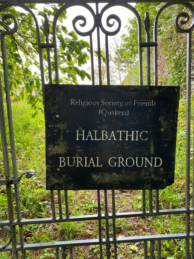
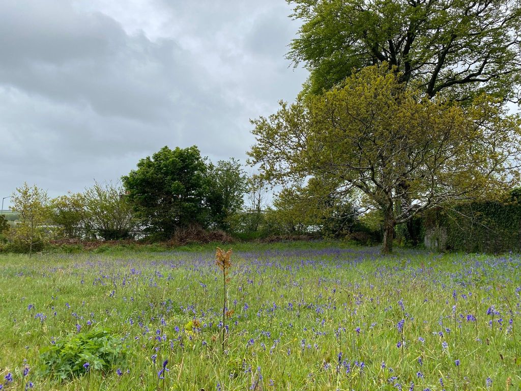
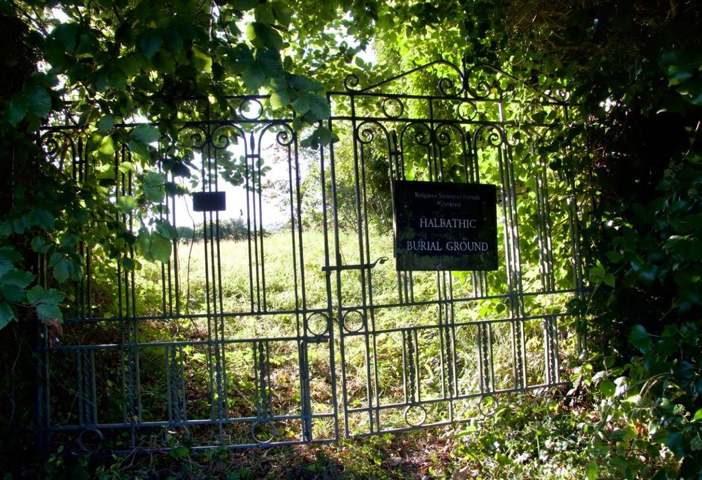
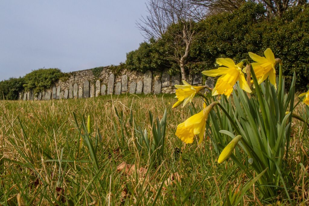
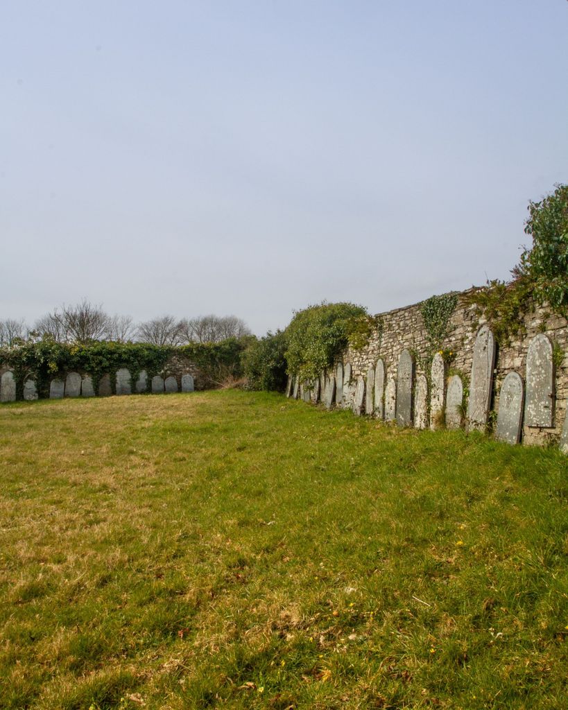
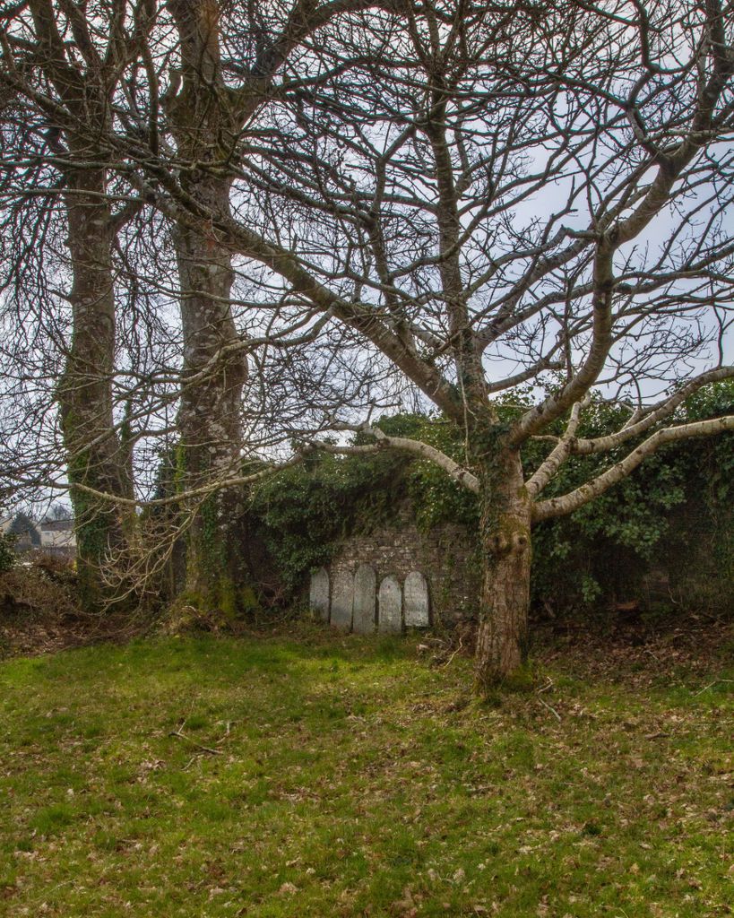
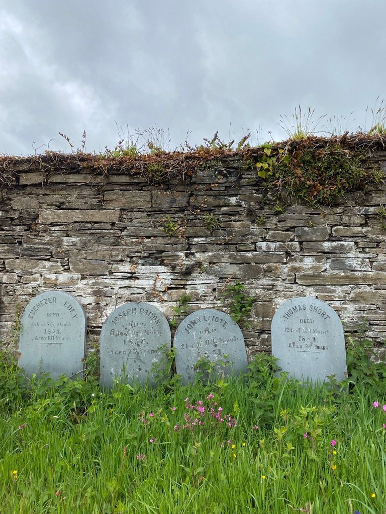
| Description | : | In 1688/9 Thomas Mounce gave land on his estate at Halbathick / Halbathic to be used for a Meeting House and Burial Ground for local Quakers. It was situated on the edge of Liskeard. The Meeting House is now a private house and the remaining headstones moved to the sides of the field .Many Quaker graves have always been unmarked from choice even by the most wealthy who preferred to be remembered by charitable endowments rather than grand tombstones. |
frequently asked questions (FAQ):
-
Where is Halbathick Quaker Burial Ground?
Halbathick Quaker Burial Ground is located at Trevecca Liskeard, Cornwall Unitary Authority ,Cornwall ,England.
-
Halbathick Quaker Burial Ground cemetery's updated grave count on graveviews.com?
0 memorials
-
Where are the coordinates of the Halbathick Quaker Burial Ground?
Latitude: 50.4658770
Longitude: -4.4615280
Nearby Cemetories:
1. Trevecca Cemetery
Liskeard, Cornwall Unitary Authority, England
Coordinate: 50.4642000, -4.4672000
2. St. Martin's Parish Churchyard
Liskeard, Cornwall Unitary Authority, England
Coordinate: 50.4533600, -4.4600000
3. Lanchard Municipal
Liskeard, Cornwall Unitary Authority, England
Coordinate: 50.4513600, -4.4685200
4. Dobwalls Methodist Churchyard
Liskeard, Cornwall Unitary Authority, England
Coordinate: 50.4581330, -4.5151630
5. All Saints Churchyard
Herodsfoot, Cornwall Unitary Authority, England
Coordinate: 50.4169100, -4.5131100
6. St Cuby's Graveyard
Duloe, Cornwall Unitary Authority, England
Coordinate: 50.3961907, -4.4850970
7. Golberdon Methodist Burial Ground
Golberdon, Cornwall Unitary Authority, England
Coordinate: 50.5167500, -4.3605400
8. Braddock Church Cemetery
Broadoak (Braddock), Cornwall Unitary Authority, England
Coordinate: 50.4294530, -4.5874990
9. Braddock Church
Broadoak (Braddock), Cornwall Unitary Authority, England
Coordinate: 50.4302900, -4.5889900
10. St. Anne Churchyard
Hessenford, Cornwall Unitary Authority, England
Coordinate: 50.3927900, -4.3817300
11. St. Melor Churchyard
Linkinhorne, Cornwall Unitary Authority, England
Coordinate: 50.5376040, -4.3728820
12. Callington Cemetery
Callington, Cornwall Unitary Authority, England
Coordinate: 50.4992660, -4.3194640
13. St. Martin-by-Looe Churchyard
Looe, Cornwall Unitary Authority, England
Coordinate: 50.3694180, -4.4471450
14. St Mary Churchyard
Callington, Cornwall Unitary Authority, England
Coordinate: 50.5035020, -4.3158890
15. Coads Green Methodist Church Cemetery
Coad's Green, Cornwall Unitary Authority, England
Coordinate: 50.5643053, -4.4126086
16. Boconnoc Estate Cemetery
Lostwithiel, Cornwall Unitary Authority, England
Coordinate: 50.4119410, -4.6029750
17. Boconnoc Parish Church
Boconnoc, Cornwall Unitary Authority, England
Coordinate: 50.4159600, -4.6094600
18. Looe Cemetery
Looe, Cornwall Unitary Authority, England
Coordinate: 50.3559600, -4.4609100
19. Holy Trinity Churchyard
Bolventor, Cornwall Unitary Authority, England
Coordinate: 50.5602100, -4.5708200
20. St. Meubred Churchyard
Cardinham, Cornwall Unitary Authority, England
Coordinate: 50.4879010, -4.6474830
21. St. Erney Churchyard
Landrake, Cornwall Unitary Authority, England
Coordinate: 50.4085300, -4.2943000
22. Treburley Cemetery
Callington, Cornwall Unitary Authority, England
Coordinate: 50.5755556, -4.3308333
23. St Mary's Botus Fleming
Botus Fleming, Cornwall Unitary Authority, England
Coordinate: 50.4298100, -4.2483700
24. St Briochus Churchyard
Lezant, Cornwall Unitary Authority, England
Coordinate: 50.5878210, -4.3484720