
| Memorials | : | 0 |
| Location | : | Conington, South Cambridgeshire District, England |
| Coordinate | : | 52.2768320, -0.0665850 |
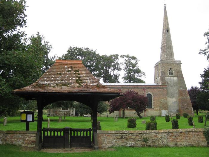
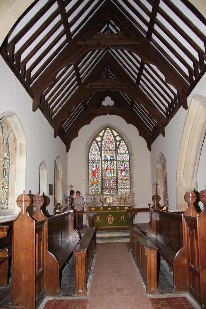
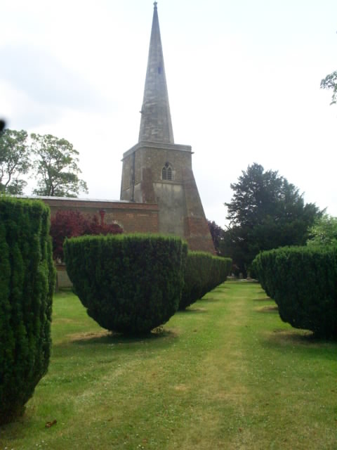
| Description | : | St Mary’s church is located on School Lane in the small village of Conington, two miles south of Fenstanton. The oldest part of St Mary’s is the 14th century west tower, built of stones collected from the village fields. The church is entered from the west through the tower by way of a rusticated doorway dating from the time the nave was rebuilt by Dingley Askham in 1737. The chancel was rebuilt by W.M. Fawcett in 1871. Restorations occurred in 1902 and 1911 when the broach spire was rebuilt. The nave contains what has been described... Read More |
frequently asked questions (FAQ):
-
Where is St Mary Churchyard?
St Mary Churchyard is located at School Lane Conington, South Cambridgeshire District ,Cambridgeshire , CB23 4LREngland.
-
St Mary Churchyard cemetery's updated grave count on graveviews.com?
0 memorials
-
Where are the coordinates of the St Mary Churchyard?
Latitude: 52.2768320
Longitude: -0.0665850
Nearby Cemetories:
1. Elsworth Particular Baptist Chapelyard
Elsworth, South Cambridgeshire District, England
Coordinate: 52.2559800, -0.0686500
2. St. Peter and St. Paul Churchyard
Fenstanton, Huntingdonshire District, England
Coordinate: 52.3009610, -0.0653900
3. Fenstanton Cemetery
Fenstanton, Huntingdonshire District, England
Coordinate: 52.3013000, -0.0650700
4. St Mary Churchyard
Fen Drayton, South Cambridgeshire District, England
Coordinate: 52.2948320, -0.0369930
5. St. Peter's Churchyard
Boxworth, South Cambridgeshire District, England
Coordinate: 52.2620660, -0.0257910
6. Church of All Saints
Knapwell, South Cambridgeshire District, England
Coordinate: 52.2491000, -0.0447000
7. Hemingford Grey Cemetery
Hemingford Grey, Huntingdonshire District, England
Coordinate: 52.3162700, -0.1008800
8. St. John the Baptist Churchyard
Holywell, Huntingdonshire District, England
Coordinate: 52.3189200, -0.0402900
9. All Saints Churchyard
Lolworth, South Cambridgeshire District, England
Coordinate: 52.2583600, 0.0020200
10. St John the Baptist Churchyard
Papworth St Agnes, South Cambridgeshire District, England
Coordinate: 52.2641300, -0.1414700
11. St. Andrew's Churchyard
Swavesey, South Cambridgeshire District, England
Coordinate: 52.3050100, -0.0025700
12. Saint James Churchyard
Hemingford Grey, Huntingdonshire District, England
Coordinate: 52.3206701, -0.1051653
13. St Ives Public Cemetery
St Ives, Huntingdonshire District, England
Coordinate: 52.3264600, -0.0744300
14. All Saints Churchyard
St Ives, Huntingdonshire District, England
Coordinate: 52.3265800, -0.0794490
15. St. Ives All Saints Churchyard
St Ives, Huntingdonshire District, England
Coordinate: 52.3265900, -0.0794200
16. St Ives Church Cemetery
St Ives, Huntingdonshire District, England
Coordinate: 52.3287800, -0.0821800
17. St Margaret of Antioch Churchyard
Hemingford Abbots, Huntingdonshire District, England
Coordinate: 52.3237400, -0.1192820
18. Over Baptist Cemetery
Over, South Cambridgeshire District, England
Coordinate: 52.3127700, 0.0081700
19. Cambourne Burial Ground
Cambourne, South Cambridgeshire District, England
Coordinate: 52.2179190, -0.0682910
20. St. Mary's Churchyard
Over, South Cambridgeshire District, England
Coordinate: 52.3177400, 0.0119500
21. St Mary The Virgin
Houghton, Huntingdonshire District, England
Coordinate: 52.3320200, -0.1213200
22. Houghton Chapel
Houghton, Huntingdonshire District, England
Coordinate: 52.3322400, -0.1219200
23. St Peter and St Paul Churchyard
Dry Drayton, South Cambridgeshire District, England
Coordinate: 52.2389600, 0.0197800
24. Houghton and Wyton Burial Ground
Wyton, Huntingdonshire District, England
Coordinate: 52.3352100, -0.1135900