
| Memorials | : | 0 |
| Location | : | Schalkwijk, Houten Municipality, Netherlands |
| Coordinate | : | 51.9910100, 5.1933300 |
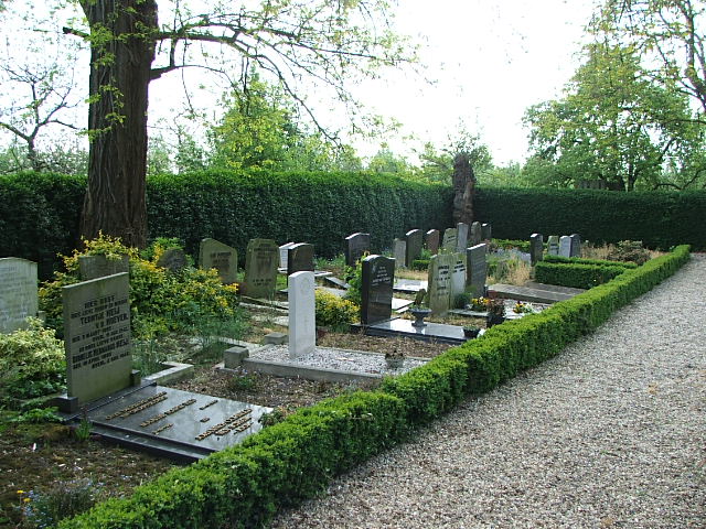
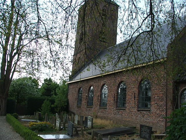
| Description | : | Schalkwijk is 15 kilometres south-south-east of Utrecht, and 56 kilometres west of Arnhem. The Protestant churchyard adjoins the church, which is in the centre of Schalkwijk, on the south side of the road to Houten. |
frequently asked questions (FAQ):
-
Where is Schalkwijk Protestant Churchyard?
Schalkwijk Protestant Churchyard is located at Schalkwijk, Houten Municipality ,Utrecht ,Netherlands.
-
Schalkwijk Protestant Churchyard cemetery's updated grave count on graveviews.com?
0 memorials
-
Where are the coordinates of the Schalkwijk Protestant Churchyard?
Latitude: 51.9910100
Longitude: 5.1933300
Nearby Cemetories:
1. Schalkwijk Roman Catholic Cemetery
Schalkwijk, Houten Municipality, Netherlands
Coordinate: 51.9949500, 5.1845200
2. Culemborg General Cemetery
Culemborg, Culemborg Municipality, Netherlands
Coordinate: 51.9632800, 5.2311300
3. Joodse begraafplaats Culemborg
Culemborg Municipality, Netherlands
Coordinate: 51.9626100, 5.2322500
4. Tull En 't Waal Protestant Cemetery
Tull en 't Waal, Houten Municipality, Netherlands
Coordinate: 52.0017900, 5.1330300
5. Vreeswijk Protestant Cemetery
Vreeswijk, Nieuwegein Municipality, Netherlands
Coordinate: 52.0048700, 5.0974600
6. Vianen Protestant Cemetery
Vianen, Vianen Municipality, Netherlands
Coordinate: 51.9867800, 5.0891100
7. Joodse Begraafplaats
Vianen Municipality, Netherlands
Coordinate: 51.9862400, 5.0874000
8. Sint-Barbarakerk Begraafplaats
Bunnik, Bunnik Municipality, Netherlands
Coordinate: 52.0662689, 5.2050647
9. Noorderveld
Nieuwegein, Nieuwegein Municipality, Netherlands
Coordinate: 52.0421660, 5.1026720
10. Beusichem Algemene Begraafplaats
Beusichem, Buren Municipality, Netherlands
Coordinate: 51.9482800, 5.2960800
11. R.K. Begraafplaats Drieklinken
Driebergen-Rijsenburg, Utrechtse Heuvelrug Municipality, Netherlands
Coordinate: 52.0535356, 5.2747502
12. Kerkveld Algemene Begraafplaats
Nieuwegein, Nieuwegein Municipality, Netherlands
Coordinate: 52.0371800, 5.0857400
13. Hervormde Begraafplaats Nederlangbroek
Langbroek, Wijk bij Duurstede Municipality, Netherlands
Coordinate: 52.0114502, 5.3274783
14. Heicop General Cemetery
Hei- en Boeicop, Zederik Municipality, Netherlands
Coordinate: 51.9478600, 5.0672500
15. Utrecht Tolsteeg Cemetery
Utrecht, Utrecht Municipality, Netherlands
Coordinate: 52.0724100, 5.1318400
16. Wijk-Bij-Duurstede General Cemetery
Wijk bij Duurstede, Wijk bij Duurstede Municipality, Netherlands
Coordinate: 51.9751800, 5.3388600
17. Utrecht Kovelswade Algemene Begraafplaats
Utrecht, Utrecht Municipality, Netherlands
Coordinate: 52.0759735, 5.1351638
18. Joodse Begraafplaats Beesd
Beesd, Geldermalsen Municipality, Netherlands
Coordinate: 51.8986210, 5.1895010
19. Utrecht Sint-Barbara Roman Catholic Cemetery
Utrecht, Utrecht Municipality, Netherlands
Coordinate: 52.0539430, 5.0832590
20. Joodse Begraafplaats Steenstraat
Wijk bij Duurstede Municipality, Netherlands
Coordinate: 51.9757500, 5.3432200
21. Joodse Begraafplaats Heijmanspad
Wijk bij Duurstede Municipality, Netherlands
Coordinate: 51.9709900, 5.3428500
22. Utrecht Soestbergen Algemene Begraafplaats
Utrecht, Utrecht Municipality, Netherlands
Coordinate: 52.0776100, 5.1295100
23. Sint Nicolaas Kerk
IJsselstein, IJsselstein Municipality, Netherlands
Coordinate: 52.0206960, 5.0449240
24. Doorn Nieuwe Algemene Begraafplaats
Doorn, Utrechtse Heuvelrug Municipality, Netherlands
Coordinate: 52.0484200, 5.3203200