
| Memorials | : | 0 |
| Location | : | Wijk bij Duurstede, Wijk bij Duurstede Municipality, Netherlands |
| Coordinate | : | 51.9751800, 5.3388600 |
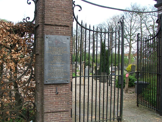
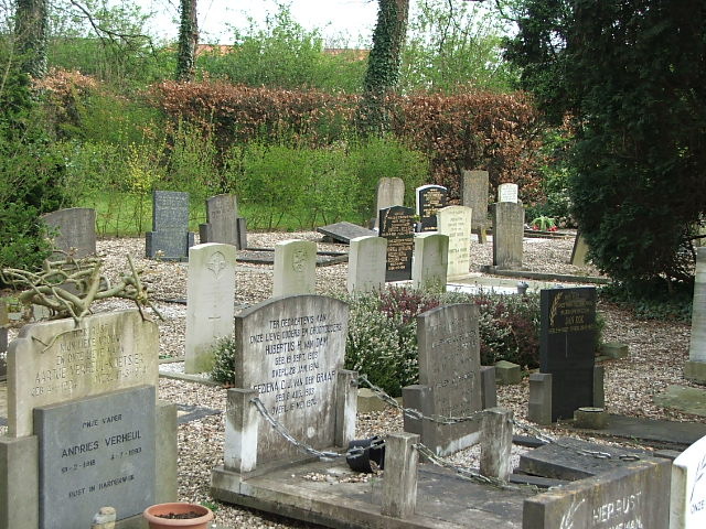
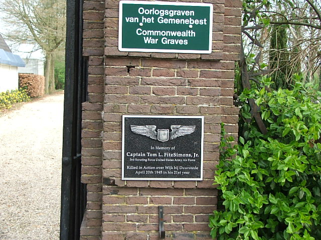
| Description | : | Wijk-bij-Duurstede is 27 kilometres south-east of Utrecht, and 45 kilometres east of Arnhem. This cemetery is about 100 metres from the centre of the village, on the road to Houten. In its north-eastern part are the graves of 4 British soldiers, and in the south-eastern part are the graves of 3 British soldiers. Three of the seven are not identified. |
frequently asked questions (FAQ):
-
Where is Wijk-Bij-Duurstede General Cemetery?
Wijk-Bij-Duurstede General Cemetery is located at Wijk bij Duurstede, Wijk bij Duurstede Municipality ,Utrecht ,Netherlands.
-
Wijk-Bij-Duurstede General Cemetery cemetery's updated grave count on graveviews.com?
0 memorials
-
Where are the coordinates of the Wijk-Bij-Duurstede General Cemetery?
Latitude: 51.9751800
Longitude: 5.3388600
Nearby Cemetories:
1. Joodse Begraafplaats Steenstraat
Wijk bij Duurstede Municipality, Netherlands
Coordinate: 51.9757500, 5.3432200
2. Joodse Begraafplaats Heijmanspad
Wijk bij Duurstede Municipality, Netherlands
Coordinate: 51.9709900, 5.3428500
3. Hervormde Begraafplaats Nederlangbroek
Langbroek, Wijk bij Duurstede Municipality, Netherlands
Coordinate: 52.0114502, 5.3274783
4. Beusichem Algemene Begraafplaats
Beusichem, Buren Municipality, Netherlands
Coordinate: 51.9482800, 5.2960800
5. Huis Doorn
Doorn, Utrechtse Heuvelrug Municipality, Netherlands
Coordinate: 52.0314140, 5.3386660
6. Maurik Roman Catholic Cemetery
Maurik, Buren Municipality, Netherlands
Coordinate: 51.9617100, 5.4302500
7. Joodse begraafplaats
Buren Municipality, Netherlands
Coordinate: 51.9125800, 5.3296490
8. Buren Old General Cemetery
Buren, Buren Municipality, Netherlands
Coordinate: 51.9122100, 5.3298600
9. Nieuwe Begraafplaats
Leersum, Utrechtse Heuvelrug Municipality, Netherlands
Coordinate: 52.0163800, 5.4197400
10. Oude Algemene Begraafplaats
Doorn, Utrechtse Heuvelrug Municipality, Netherlands
Coordinate: 52.0397100, 5.3459400
11. Joodse begraafplaats Culemborg
Culemborg Municipality, Netherlands
Coordinate: 51.9626100, 5.2322500
12. R.K. Begraafplaats Buren
Buren, Buren Municipality, Netherlands
Coordinate: 51.9090374, 5.3216018
13. Culemborg General Cemetery
Culemborg, Culemborg Municipality, Netherlands
Coordinate: 51.9632800, 5.2311300
14. Doorn Nieuwe Algemene Begraafplaats
Doorn, Utrechtse Heuvelrug Municipality, Netherlands
Coordinate: 52.0484200, 5.3203200
15. Algemene Begraafplaats Zoelen en Kerk-Avezaath
Zoelen, Buren Municipality, Netherlands
Coordinate: 51.9064740, 5.3880700
16. Oude Begraafplaats
Amerongen, Utrechtse Heuvelrug Municipality, Netherlands
Coordinate: 51.9989844, 5.4677837
17. Amerongen Holleweg General Cemetery
Amerongen, Utrechtse Heuvelrug Municipality, Netherlands
Coordinate: 52.0030000, 5.4665700
18. R.K. Begraafplaats Drieklinken
Driebergen-Rijsenburg, Utrechtse Heuvelrug Municipality, Netherlands
Coordinate: 52.0535356, 5.2747502
19. Nieuwe Begraafplaats
Driebergen-Rijsenburg, Utrechtse Heuvelrug Municipality, Netherlands
Coordinate: 52.0641100, 5.3100900
20. Schalkwijk Protestant Churchyard
Schalkwijk, Houten Municipality, Netherlands
Coordinate: 51.9910100, 5.1933300
21. Buurmalsen General Cemetery
Buurmalsen, Geldermalsen Municipality, Netherlands
Coordinate: 51.8873500, 5.2817100
22. Katholieke Begraafplaats
Maarn, Utrechtse Heuvelrug Municipality, Netherlands
Coordinate: 52.0673700, 5.3790400
23. Schalkwijk Roman Catholic Cemetery
Schalkwijk, Houten Municipality, Netherlands
Coordinate: 51.9949500, 5.1845200
24. Geldermalsen General Cemetery
Geldermalsen, Geldermalsen Municipality, Netherlands
Coordinate: 51.8804000, 5.2984400