
| Memorials | : | 0 |
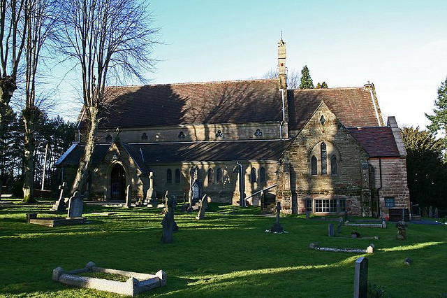
| Location | : | Bromsgrove, Bromsgrove District, England |
frequently asked questions (FAQ):
-
Where is Holy Trinity Church Cemetery?
Holy Trinity Church Cemetery is located at No GPS information available Add GPSTwatling, Bromsgrove Bromsgrove, Bromsgrove District ,Worcestershire ,England.
-
Holy Trinity Church Cemetery cemetery's updated grave count on graveviews.com?
0 memorials
Nearby Cemetories:
1. St. Leonard's Churchyard
Beoley, Bromsgrove District, England
Coordinate: 52.3622100, -2.0476300
2. Holy Trinity and St Mary Churchyard
Dodford, Bromsgrove District, England
Coordinate: 52.4215800, -2.1391200
3. Holy Trinity Churchyard
Lickey, Bromsgrove District, England
Coordinate: 52.4247940, -2.1180030
4. Holy Trinity Churchyard Extension
Lickey, Bromsgrove District, England
Coordinate: 52.3073925, -2.0757422
5. St. Mary's Churchyard
Wythall, Bromsgrove District, England
6. Wythall Cemetery
Wythall, Bromsgrove District, England
Coordinate: 52.2493950, -1.9415010
7. Holy Trinity Churchyard
Belbroughton, Bromsgrove District, England
Coordinate: 52.3349750, -2.0654960
8. St Leonard Churchyard
Frankley, Bromsgrove District, England
Coordinate: 52.3338169, -2.0635085
9. St Martin Churchyard
Bromsgrove District, England
Coordinate: 52.3363100, -2.0674300
10. St. Bartholomew's Churchyard
Tardebigge, Bromsgrove District, England
Coordinate: 52.3343560, -2.0645280
11. Christ Church Additional Cemetery
Catshill, Bromsgrove District, England
Coordinate: 52.3266220, -2.0706270
12. Christ Church Churchyard
Catshill, Bromsgrove District, England
Coordinate: 52.3351920, -2.0588680
13. North Bromsgrove Cemetery
Catshill, Bromsgrove District, England
Coordinate: 52.3622100, -2.0476300
14. Hagley Cemetery
Hagley, Bromsgrove District, England
Coordinate: 52.4215800, -2.1391200
15. St John the Baptist Churchyard
Hagley, Bromsgrove District, England
Coordinate: 52.4247940, -2.1180030
16. St. Michaels & All Angels Churchyard
Stoke Prior, Bromsgrove District, England
Coordinate: 52.3073925, -2.0757422
17. St. Michaels and All Angels Churchyard
Stoke Prior, Bromsgrove District, England
18. Astwood Bank Cemetery
Bromsgrove, Bromsgrove District, England
Coordinate: 52.2493950, -1.9415010
19. Bromsgrove Cemetery
Bromsgrove, Bromsgrove District, England
Coordinate: 52.3349750, -2.0654960
20. Bromsgrove Friends Burial Ground
Bromsgrove, Bromsgrove District, England
Coordinate: 52.3338169, -2.0635085
21. Bromsgrove New Cemetery
Bromsgrove, Bromsgrove District, England
Coordinate: 52.3363100, -2.0674300
22. St John the Baptist Churchyard
Bromsgrove, Bromsgrove District, England
Coordinate: 52.3343560, -2.0645280
23. St. Peter's Churchyard
Bromsgrove, Bromsgrove District, England
Coordinate: 52.3266220, -2.0706270
24. United Reform Church Churchyard
Bromsgrove, Bromsgrove District, England
Coordinate: 52.3351920, -2.0588680