
| Memorials | : | 2 |
| Location | : | Finger, McNairy County, USA |
| Coordinate | : | 35.3291700, -88.5166300 |
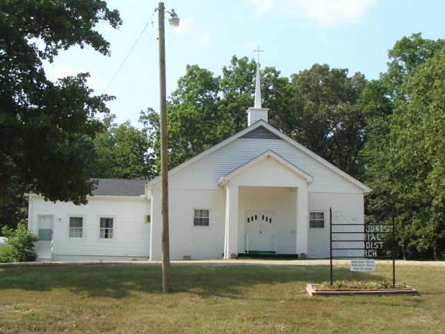
| Description | : | From Hwy 45 turn east onto Hwy 199/Finger-Leapwood Road. The road turns south immediately after the railroad tracks. Go about 5 miles. The Church is on the left and the cemetery is across the street. |
frequently asked questions (FAQ):
-
Where is Maggie Jones United Methodist Church Cemetery?
Maggie Jones United Methodist Church Cemetery is located at 8138 Finger/Leapwood Rd. (Hwy 199) Finger, McNairy County ,Tennessee , 38334USA.
-
Maggie Jones United Methodist Church Cemetery cemetery's updated grave count on graveviews.com?
2 memorials
-
Where are the coordinates of the Maggie Jones United Methodist Church Cemetery?
Latitude: 35.3291700
Longitude: -88.5166300
Nearby Cemetories:
1. Ingraham Cemetery
Finger, McNairy County, USA
Coordinate: 35.3266150, -88.5151560
2. Plunk Cemetery
Finger, McNairy County, USA
Coordinate: 35.3382988, -88.5333023
3. Hendrix Cemetery
Finger, McNairy County, USA
Coordinate: 35.3189590, -88.5338280
4. Baucum Cemetery (Defunct)
McNairy County, USA
Coordinate: 35.3302994, -88.4935989
5. Alexander Cemetery
Finger, McNairy County, USA
Coordinate: 35.3029830, -88.5120090
6. Blakeley Cemetery
Adamsville, McNairy County, USA
Coordinate: 35.3156050, -88.4795500
7. Lanes Chapel Cemetery
Finger, McNairy County, USA
Coordinate: 35.3312510, -88.5639110
8. Wharton Cemetery
Purdy, McNairy County, USA
Coordinate: 35.2898140, -88.5192220
9. Rocky Knob Church Cemetery
Finger, McNairy County, USA
Coordinate: 35.3541985, -88.4783020
10. Malone Cemetery
Finger, McNairy County, USA
Coordinate: 35.3602440, -88.5572960
11. Hopewell Church Cemetery
Finger, McNairy County, USA
Coordinate: 35.3758011, -88.5203018
12. Anderson Slave Cemetery
Finger, McNairy County, USA
Coordinate: 35.3598000, -88.5659000
13. White Plains Cemetery
Finger, McNairy County, USA
Coordinate: 35.3731670, -88.5516960
14. Mars Hill Cemetery
Adamsville, McNairy County, USA
Coordinate: 35.2954310, -88.4607290
15. Beaty Cemetery
Forty Forks, McNairy County, USA
Coordinate: 35.2901030, -88.5676270
16. O'Neal Cemetery
McNairy County, USA
Coordinate: 35.3671410, -88.4553990
17. Dunn Cemetery
Bethel Springs, McNairy County, USA
Coordinate: 35.2666290, -88.5355270
18. Mount Carmel Cemetery
Finger, McNairy County, USA
Coordinate: 35.3424988, -88.6003036
19. Sweetlips Cemetery
Sweet Lips, Chester County, USA
Coordinate: 35.3992004, -88.5205994
20. Beauty Hill Church Cemetery
Purdy, McNairy County, USA
Coordinate: 35.2621840, -88.5426830
21. Hardin Cemetery
Adamsville, McNairy County, USA
Coordinate: 35.3231010, -88.4285965
22. Liberty Church Cemetery
Forty Forks, McNairy County, USA
Coordinate: 35.2770890, -88.5806060
23. Old Oak Grove Cemetery
Henderson, Chester County, USA
Coordinate: 35.3879000, -88.5727200
24. Kerby Family Cemetery
Finger, McNairy County, USA
Coordinate: 35.3656810, -88.5971940