
| Memorials | : | 18 |
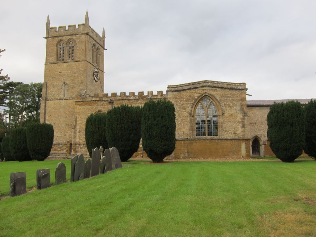
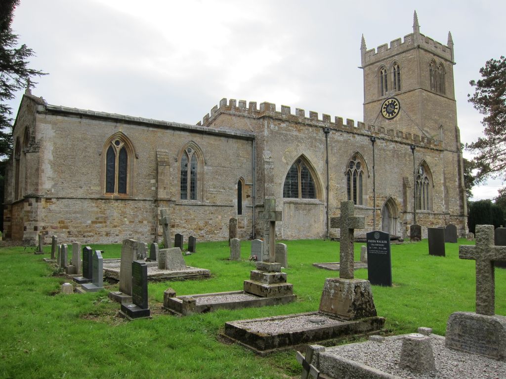
| Location | : | Cottesbrooke, Daventry District, England |
| Coordinate | : | 52.3552260, -0.9588300 |
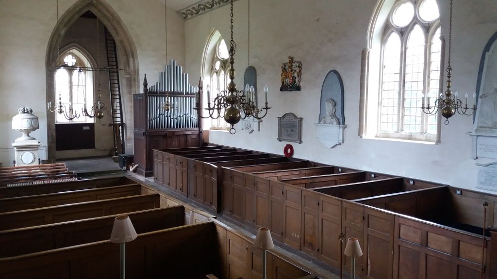
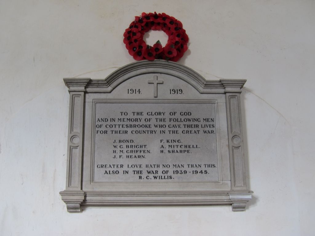
| Description | : | All Saints Cottesbrooke is late 13th century, with 18th century alterations. The church is grade I listed. It is notable for its three-decker pulpit and box pews. There is also a two storey pew, the top storey of which was reserved for the Langham family, who owned Cottesbrooke Hall from the 17th century. This two storey pew has a fireplace for comfort, and a lower set of seating for their servants. There are numerous 17th and 18th century memorials to members of the Langham family throughout the church. Two of the most interesting of the tombs are a monument to... Read More |
frequently asked questions (FAQ):
-
Where is All Saints Churchyard?
All Saints Churchyard is located at Main Street Cottesbrooke, Daventry District ,Northamptonshire , NN6 8PQEngland.
-
All Saints Churchyard cemetery's updated grave count on graveviews.com?
18 memorials
-
Where are the coordinates of the All Saints Churchyard?
Latitude: 52.3552260
Longitude: -0.9588300
Nearby Cemetories:
1. St James Churchyard
Hollowell, Daventry District, England
Coordinate: 52.3404638, -0.9912752
2. St Etheldreda Churchyard
Guilsborough, Daventry District, England
Coordinate: 52.3480310, -1.0089780
3. St Andrew Churchyard
Spratton, Daventry District, England
Coordinate: 52.3243520, -0.9483460
4. Saint Michael's Churchyard
Haselbech, Daventry District, England
Coordinate: 52.3891890, -0.9556720
5. All Saints Churchyard
Lamport, Daventry District, England
Coordinate: 52.3637900, -0.8883600
6. All Saints Churchyard
Naseby, Daventry District, England
Coordinate: 52.3968790, -0.9889740
7. St Denys' Church
Northampton Borough, England
Coordinate: 52.3271318, -1.0182438
8. Saint Mary the Virgin
Maidwell, Daventry District, England
Coordinate: 52.3854950, -0.9007770
9. St Peter and St Paul Churchyard
Scaldwell, Daventry District, England
Coordinate: 52.3459100, -0.8732100
10. St. Denys' Churchyard
Cold Ashby, Daventry District, England
Coordinate: 52.3806000, -1.0372700
11. Saint Catherine
Draughton, Daventry District, England
Coordinate: 52.3840770, -0.8821840
12. All Saints Churchyard
Holdenby, Daventry District, England
Coordinate: 52.3021000, -0.9868100
13. St. Deny's Churchyard
Kelmarsh, Daventry District, England
Coordinate: 52.4060590, -0.9207120
14. East Haddon Churchyard
East Haddon, Daventry District, England
Coordinate: 52.3076000, -1.0224800
15. All Saints Churchyard
Pitsford, Daventry District, England
Coordinate: 52.3066700, -0.8952200
16. Independent Chapel Burial Yard
Old, Daventry District, England
Coordinate: 52.3514947, -0.8506201
17. Saint Andrew Churchyard
Old, Daventry District, England
Coordinate: 52.3503600, -0.8484200
18. St Botolph Churchyard
Church Brampton, Daventry District, England
Coordinate: 52.2849866, -0.9486724
19. All Saints Churchyard
Clipston, Daventry District, England
Coordinate: 52.4273400, -0.9517300
20. All Saints Churchyard
West Haddon, Daventry District, England
Coordinate: 52.3409590, -1.0764700
21. Spencer Estate Grounds
Althorp, Daventry District, England
Coordinate: 52.2839190, -0.9889520
22. Baptist Graveyard
Clipston, Daventry District, England
Coordinate: 52.4296989, -0.9582000
23. St. Michael and All Angels Churchyard
Winwick, Daventry District, England
Coordinate: 52.3589063, -1.0820887
24. St John the Baptist Churchyard
Boughton, Daventry District, England
Coordinate: 52.2861187, -0.8971496