
| Memorials | : | 1 |
| Location | : | Crestview Hills, Kenton County, USA |
| Coordinate | : | 39.0304020, -84.5756360 |
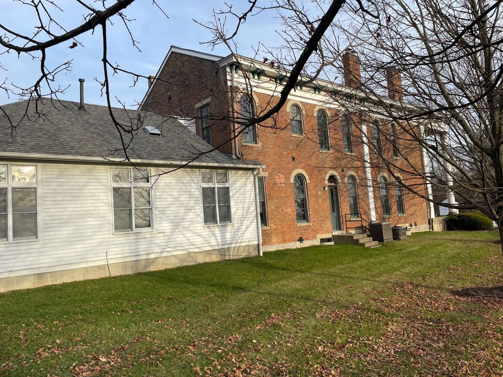
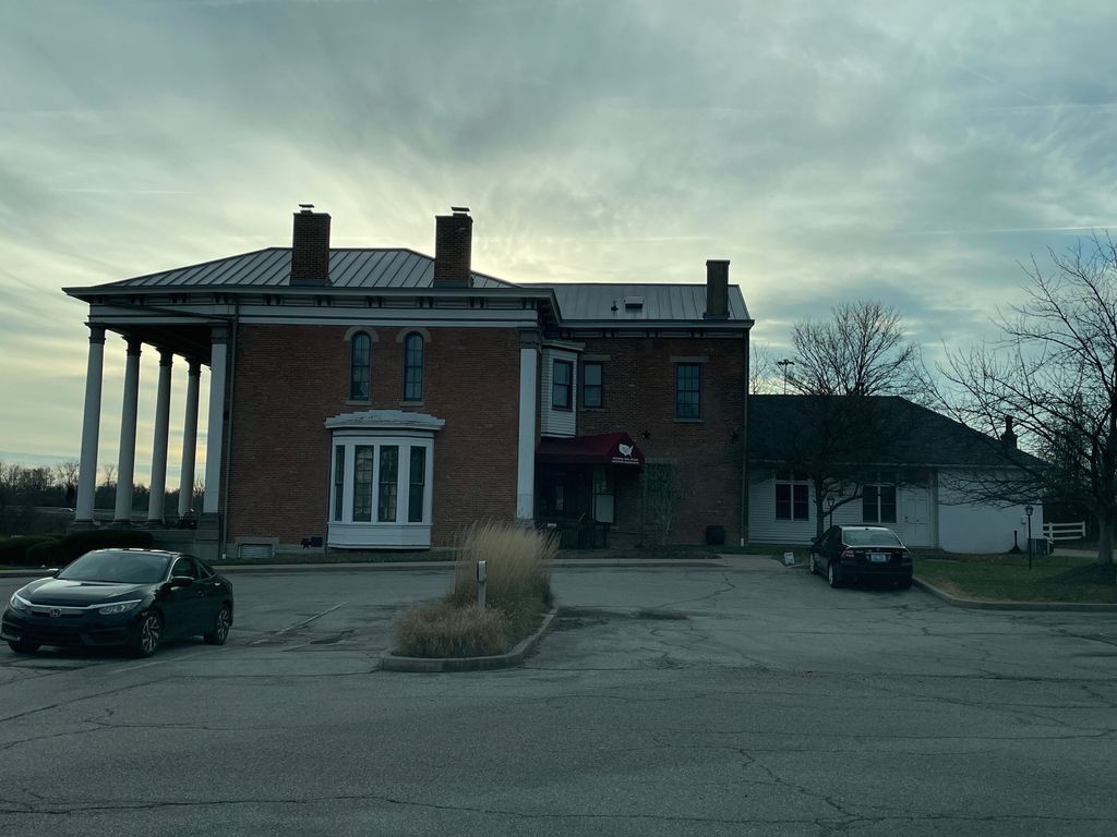
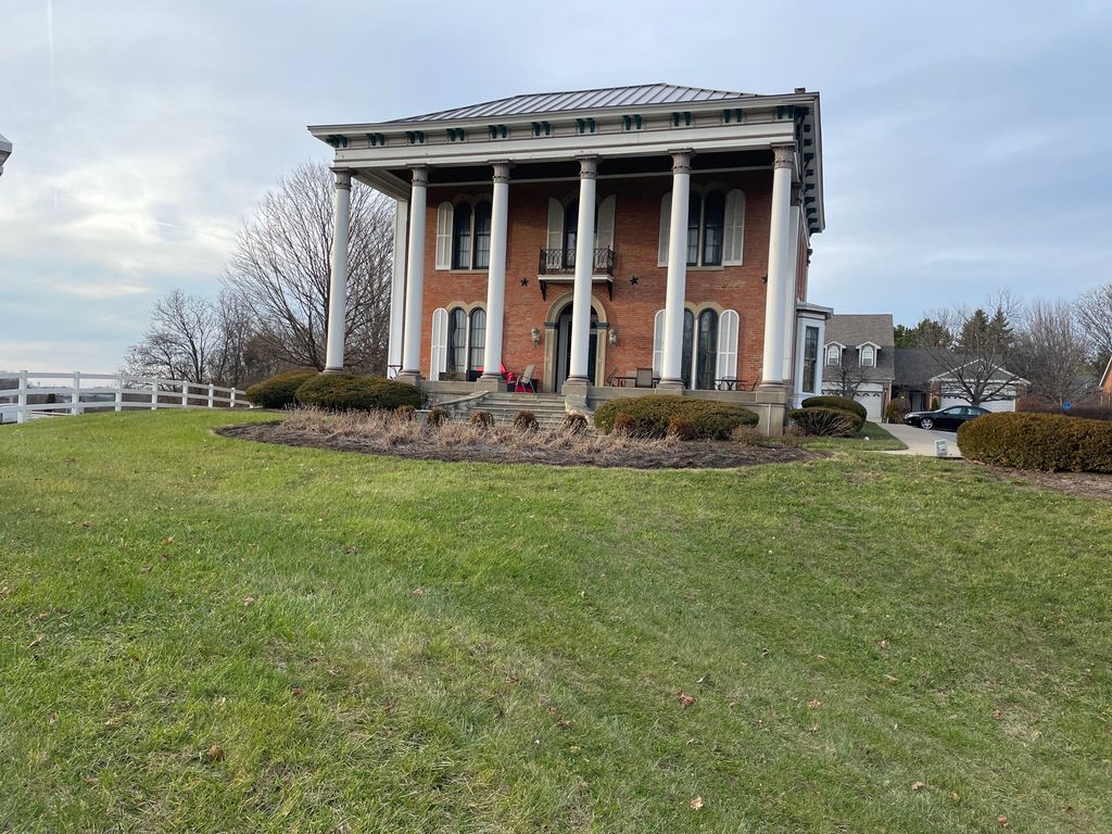
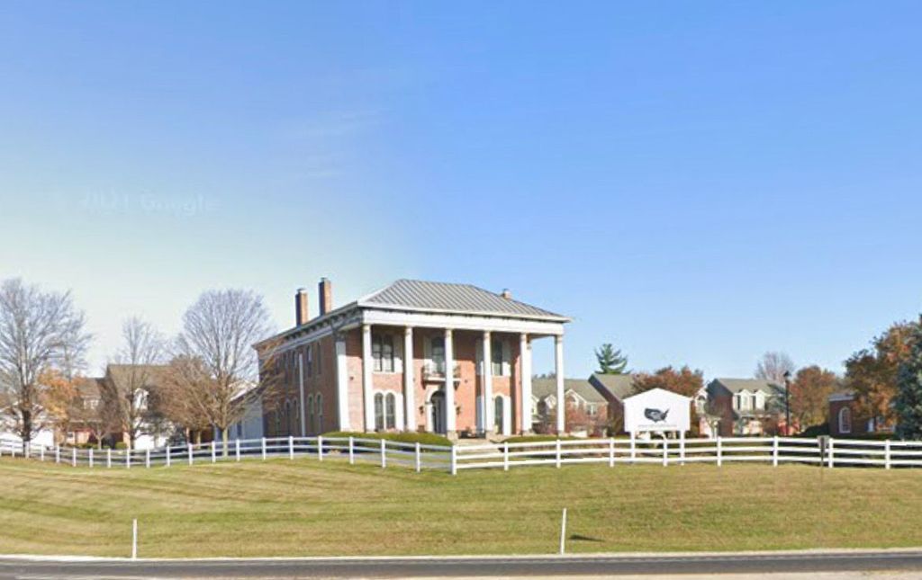
| Description | : | Located in what is now Crestview Hills Estates in Ft. Mitchell, Kenton County, KY. Former Beechwood Farm occupying 1,000 acres. A relative of the Leathers family last saw the Beechwood Farm Cemetery in the 1920's. As late as 1939, a relative reported had been abandoned, with grave markers remaining. To this day, it is said that there are remnants of headstones/footstones in the backyards of a few properties. The cemetery use to be in the center of a plowed field and surrounded by a picket fence. The home, a large brick colonial was torn down, making... Read More |
frequently asked questions (FAQ):
-
Where is Beechwood Farm Cemetery?
Beechwood Farm Cemetery is located at Crestview Hills, Kenton County ,Kentucky ,USA.
-
Beechwood Farm Cemetery cemetery's updated grave count on graveviews.com?
1 memorials
-
Where are the coordinates of the Beechwood Farm Cemetery?
Latitude: 39.0304020
Longitude: -84.5756360

Nearby Cemetories:
1. Perry Family Burying Ground
Lakeside Park, Kenton County, USA
Coordinate: 39.0333600, -84.5724130
2. Casey Cemetery
Edgewood, Kenton County, USA
Coordinate: 39.0254170, -84.5865000
3. Dry Creek Baptist Church Cemetery
Edgewood, Kenton County, USA
Coordinate: 39.0183330, -84.5769440
4. Forest Lawn Memorial Park
Erlanger, Kenton County, USA
Coordinate: 39.0163994, -84.5932999
5. Stevenson Cemetery (Defunct)
Edgewood, Kenton County, USA
Coordinate: 39.0163320, -84.5980660
6. Highland Pet Cemetery
Fort Mitchell, Kenton County, USA
Coordinate: 39.0384507, -84.5483047
7. Northern Kentucky Police K-9 Memorial
Fort Mitchell, Kenton County, USA
Coordinate: 39.0387149, -84.5476438
8. Saint Mary's Cemetery
Fort Mitchell, Kenton County, USA
Coordinate: 39.0438995, -84.5500031
9. French Cemetery
Elsmere, Kenton County, USA
Coordinate: 39.0077780, -84.5944500
10. Highland Cemetery
Fort Mitchell, Kenton County, USA
Coordinate: 39.0475006, -84.5457993
11. Yager Cemetery
Erlanger, Kenton County, USA
Coordinate: 39.0027780, -84.5933330
12. Mary E. Smith Cemetery
Elsmere, Kenton County, USA
Coordinate: 39.0029060, -84.5938560
13. Holy Guardian Angels Cemetery
Edgewood, Kenton County, USA
Coordinate: 39.0269444, -84.5358330
14. Saldridge Cemetery
Crescent Springs, Kenton County, USA
Coordinate: 39.0620860, -84.5690090
15. LaBare Cemetery
Crescent Springs, Kenton County, USA
Coordinate: 39.0631570, -84.5596300
16. Riggs Cemetery (Defunct)
Crescent Springs, Kenton County, USA
Coordinate: 39.0494440, -84.6138890
17. Saint John Cemetery
Fort Mitchell, Kenton County, USA
Coordinate: 39.0619011, -84.5550003
18. Reinhart Family Cemetery
Crescent Springs, Kenton County, USA
Coordinate: 39.0672510, -84.5707150
19. Flournoy Family Cemetery
Crescent Springs, Kenton County, USA
Coordinate: 39.0672830, -84.5706660
20. Walton Cemetery
Hebron, Boone County, USA
Coordinate: 39.0456700, -84.6198900
21. Tupman Cemetery
Villa Hills, Kenton County, USA
Coordinate: 39.0528600, -84.6153440
22. Scott Cemetery
Edgewood, Kenton County, USA
Coordinate: 39.0013890, -84.5422220
23. Jarrell Cemetery
Erlanger, Kenton County, USA
Coordinate: 38.9901000, -84.5754870
24. Saint Pius X Seminary Cemetery
Florence, Boone County, USA
Coordinate: 39.0289460, -84.6280990