| Memorials | : | 0 |
| Location | : | Parsons, Decatur County, USA |
| Coordinate | : | 35.7191020, -88.1053980 |
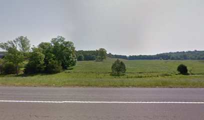
| Description | : | The cemetery is located on US-641 N, 5.0 mi. north of Parsons, on the property of George Bell. The property is the first farm on the east (right) after crossing Storms Creek and the cemetery is to the west of the barn, under the shade of a large solitary tree. Two of the headstones are broken and only the bottom portion of one stone exists. The stones have been removed from the graves and are leaning against the tree. It appears that other graves exist at the site but one hundred sixty plus years have built inches of soil and... Read More |
frequently asked questions (FAQ):
-
Where is Jennings Cemetery?
Jennings Cemetery is located at 5124 TN-69 Parsons, Decatur County ,Tennessee ,USA.
-
Jennings Cemetery cemetery's updated grave count on graveviews.com?
0 memorials
-
Where are the coordinates of the Jennings Cemetery?
Latitude: 35.7191020
Longitude: -88.1053980
Nearby Cemetories:
1. Walker Cemetery
Parsons, Decatur County, USA
Coordinate: 35.7120360, -88.1066540
2. Moore Chapel Cemetery
Jeannette, Decatur County, USA
Coordinate: 35.7302250, -88.1059110
3. Bowman Cemetery
Jeannette, Decatur County, USA
Coordinate: 35.7317350, -88.1147700
4. Cheney Cemetery
Parsons, Decatur County, USA
Coordinate: 35.7219840, -88.1262170
5. Jeanette Cemetery
Jeannette, Decatur County, USA
Coordinate: 35.7378370, -88.1004330
6. Houston Cemetery
Parsons, Decatur County, USA
Coordinate: 35.7037230, -88.0904280
7. Lewis Family Cemetery
Jeannette, Decatur County, USA
Coordinate: 35.7422500, -88.1117700
8. Wilkins Cemetery
Parsons, Decatur County, USA
Coordinate: 35.7051000, -88.0772050
9. Long Cemetery
Decatur County, USA
Coordinate: 35.7032430, -88.1356640
10. Arnold Cemetery
Decatur County, USA
Coordinate: 35.7210999, -88.1417007
11. Apostolic Church of Jesus Christ Cemetery
Parsons, Decatur County, USA
Coordinate: 35.6871480, -88.1106520
12. Walker Cemetery
Decatur County, USA
Coordinate: 35.7153015, -88.0658035
13. Bible Hill Church Cemetery
Parsons, Decatur County, USA
Coordinate: 35.7025880, -88.1425340
14. Decatur County Memorial Gardens
Parsons, Decatur County, USA
Coordinate: 35.6838580, -88.1127480
15. Suttles Chapel Cemetery
Parsons, Decatur County, USA
Coordinate: 35.7562710, -88.1063310
16. McMurry Cemetery
Parsons, Decatur County, USA
Coordinate: 35.6864650, -88.1294860
17. Stills Cemetery
Parsons, Decatur County, USA
Coordinate: 35.6848660, -88.1269820
18. Cross Roads Church Cemetery
Parsons, Decatur County, USA
Coordinate: 35.6814030, -88.1150360
19. Hendrix Cemetery
Bible Hill, Decatur County, USA
Coordinate: 35.7293220, -88.1518250
20. Stills Cemetery
Yellow Springs, Decatur County, USA
Coordinate: 35.7577960, -88.1301680
21. Hill Cemetery
Parsons, Decatur County, USA
Coordinate: 35.6914190, -88.1505980
22. Hays Cemetery
Bible Hill, Decatur County, USA
Coordinate: 35.6914070, -88.1505910
23. Miller Cemetery
Decatur County, USA
Coordinate: 35.7321990, -88.0489400
24. Gabbard Cemetery
Parsons, Decatur County, USA
Coordinate: 35.6875340, -88.1507260

