
| Memorials | : | 0 |
| Location | : | Parsons, Decatur County, USA |
| Coordinate | : | 35.7120360, -88.1066540 |
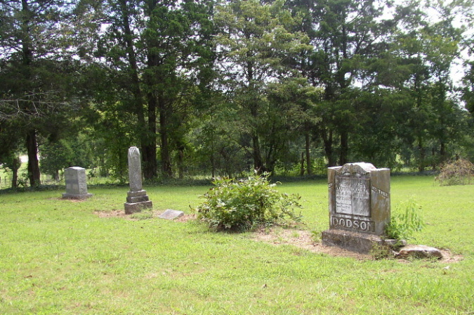
| Description | : | Walker Cemetery is located on Hwy 69S, abt one-half mile outside Parsons City limits, on the left, on Storms Loop Road. The cemetery can be seen from the highway. From intersection of US-641 & Main St., in Parsons, travel north on US-641/Tennessee Ave., going 4.5 mi.; turning west (left) onto Storms Loop & to the cemetery on the west (left) side of the driveway. On the earlier topographical maps this cemetery is called Hendrix, after names of some of the early burials, where the Walker family was much later & probably owned the property. |
frequently asked questions (FAQ):
-
Where is Walker Cemetery?
Walker Cemetery is located at Storms Loop Parsons, Decatur County ,Tennessee , 38363USA.
-
Walker Cemetery cemetery's updated grave count on graveviews.com?
0 memorials
-
Where are the coordinates of the Walker Cemetery?
Latitude: 35.7120360
Longitude: -88.1066540
Nearby Cemetories:
1. Jennings Cemetery
Parsons, Decatur County, USA
Coordinate: 35.7191020, -88.1053980
2. Houston Cemetery
Parsons, Decatur County, USA
Coordinate: 35.7037230, -88.0904280
3. Moore Chapel Cemetery
Jeannette, Decatur County, USA
Coordinate: 35.7302250, -88.1059110
4. Cheney Cemetery
Parsons, Decatur County, USA
Coordinate: 35.7219840, -88.1262170
5. Bowman Cemetery
Jeannette, Decatur County, USA
Coordinate: 35.7317350, -88.1147700
6. Wilkins Cemetery
Parsons, Decatur County, USA
Coordinate: 35.7051000, -88.0772050
7. Apostolic Church of Jesus Christ Cemetery
Parsons, Decatur County, USA
Coordinate: 35.6871480, -88.1106520
8. Long Cemetery
Decatur County, USA
Coordinate: 35.7032430, -88.1356640
9. Jeanette Cemetery
Jeannette, Decatur County, USA
Coordinate: 35.7378370, -88.1004330
10. Decatur County Memorial Gardens
Parsons, Decatur County, USA
Coordinate: 35.6838580, -88.1127480
11. Arnold Cemetery
Decatur County, USA
Coordinate: 35.7210999, -88.1417007
12. Lewis Family Cemetery
Jeannette, Decatur County, USA
Coordinate: 35.7422500, -88.1117700
13. Bible Hill Church Cemetery
Parsons, Decatur County, USA
Coordinate: 35.7025880, -88.1425340
14. Cross Roads Church Cemetery
Parsons, Decatur County, USA
Coordinate: 35.6814030, -88.1150360
15. McMurry Cemetery
Parsons, Decatur County, USA
Coordinate: 35.6864650, -88.1294860
16. Stills Cemetery
Parsons, Decatur County, USA
Coordinate: 35.6848660, -88.1269820
17. Walker Cemetery
Decatur County, USA
Coordinate: 35.7153015, -88.0658035
18. Hendrix Cemetery
Bible Hill, Decatur County, USA
Coordinate: 35.7293220, -88.1518250
19. Hill Cemetery
Parsons, Decatur County, USA
Coordinate: 35.6914190, -88.1505980
20. Hays Cemetery
Bible Hill, Decatur County, USA
Coordinate: 35.6914070, -88.1505910
21. Gabbard Cemetery
Parsons, Decatur County, USA
Coordinate: 35.6875340, -88.1507260
22. Suttles Chapel Cemetery
Parsons, Decatur County, USA
Coordinate: 35.7562710, -88.1063310
23. Lunsford Cemetery
Parsons, Decatur County, USA
Coordinate: 35.6684530, -88.0829530
24. Hawkes Cemetery
Parsons, Decatur County, USA
Coordinate: 35.7190470, -88.1657000