
| Memorials | : | 6 |
| Location | : | Parsons, Decatur County, USA |
| Coordinate | : | 35.7562710, -88.1063310 |
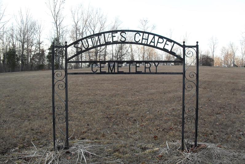
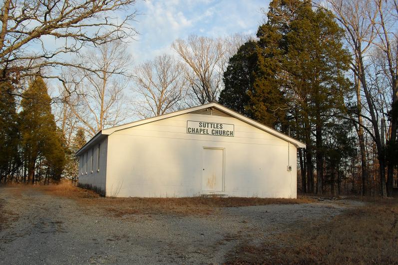
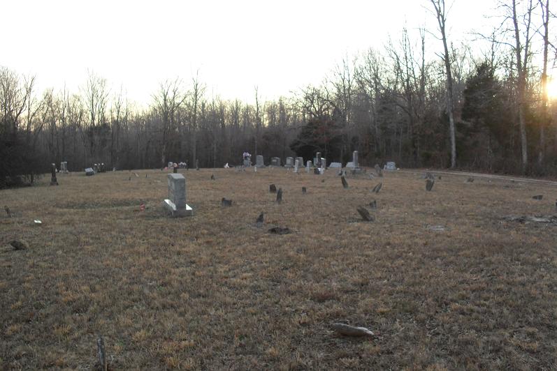
| Description | : | Suttles Chapel Cemetery is located about a mile north of Jeannette on the road from Jeannette to Holladay. It is indicated on the U.S.G.S. Sugar Tree quadrangle (1986) south of Little Lick Creek. The cemetery dates to the early nineteenth century as indicated by the large number of fieldstone-marked graves and is much older than the adjacent church. There may 200 or more fieldstone-marked and unmarked graves. Note that some of the fieldstones have names and dates scratched on them. However, at best these can only be read under the most favorable light. Suttles Chapel seems to have been the... Read More |
frequently asked questions (FAQ):
-
Where is Suttles Chapel Cemetery?
Suttles Chapel Cemetery is located at 280 Suttles Chapel Road Parsons, Decatur County ,Tennessee , 38363USA.
-
Suttles Chapel Cemetery cemetery's updated grave count on graveviews.com?
6 memorials
-
Where are the coordinates of the Suttles Chapel Cemetery?
Latitude: 35.7562710
Longitude: -88.1063310
Nearby Cemetories:
1. Lewis Family Cemetery
Jeannette, Decatur County, USA
Coordinate: 35.7422500, -88.1117700
2. Jeanette Cemetery
Jeannette, Decatur County, USA
Coordinate: 35.7378370, -88.1004330
3. Stills Cemetery
Yellow Springs, Decatur County, USA
Coordinate: 35.7577960, -88.1301680
4. Bawcum Cemetery
Cozette, Decatur County, USA
Coordinate: 35.7696770, -88.0826580
5. Bowman Cemetery
Jeannette, Decatur County, USA
Coordinate: 35.7317350, -88.1147700
6. Moore Chapel Cemetery
Jeannette, Decatur County, USA
Coordinate: 35.7302250, -88.1059110
7. Gibson Cemetery
Yellow Springs, Decatur County, USA
Coordinate: 35.7585700, -88.1412850
8. Bawcum Cemetery
Akins Chapel, Decatur County, USA
Coordinate: 35.7823020, -88.0856120
9. Oak Grove Church Cemetery
Sugar Tree, Decatur County, USA
Coordinate: 35.7592360, -88.0661490
10. Cub Creek Hall Cemetery
Parsons, Decatur County, USA
Coordinate: 35.7529410, -88.1492770
11. Jennings Cemetery
Parsons, Decatur County, USA
Coordinate: 35.7191020, -88.1053980
12. Cheney Cemetery
Parsons, Decatur County, USA
Coordinate: 35.7219840, -88.1262170
13. Walker Cemetery
Parsons, Decatur County, USA
Coordinate: 35.7120360, -88.1066540
14. Arnold Cemetery
Decatur County, USA
Coordinate: 35.7210999, -88.1417007
15. Hendrix Cemetery
Bible Hill, Decatur County, USA
Coordinate: 35.7293220, -88.1518250
16. Gulledge Cemetery
Decatur County, USA
Coordinate: 35.7392006, -88.1643982
17. Miller Cemetery
Decatur County, USA
Coordinate: 35.7321990, -88.0489400
18. Walker Cemetery
Decatur County, USA
Coordinate: 35.7153015, -88.0658035
19. Houston Cemetery
Parsons, Decatur County, USA
Coordinate: 35.7037230, -88.0904280
20. Hendrix Cemetery
Decatur County, USA
Coordinate: 35.7481003, -88.0391998
21. Hendrix Cemetery
Cozette, Decatur County, USA
Coordinate: 35.7481130, -88.0387250
22. Wilkins Cemetery
Parsons, Decatur County, USA
Coordinate: 35.7051000, -88.0772050
23. Baker Cemetery
Decatur County, USA
Coordinate: 35.7536011, -88.0369034
24. Yellow Springs Church Cemetery
Yellow Springs, Decatur County, USA
Coordinate: 35.8115110, -88.1233210