
| Memorials | : | 0 |
| Location | : | Black Mountain, Buncombe County, USA |
| Coordinate | : | 35.4992500, -82.2713700 |
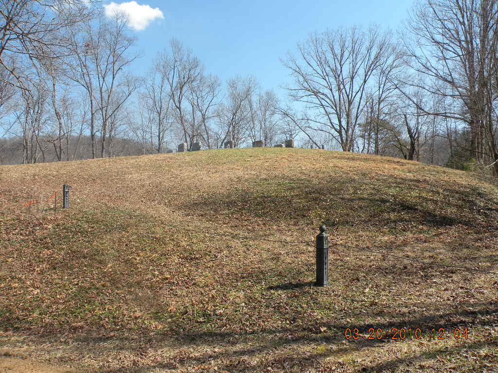
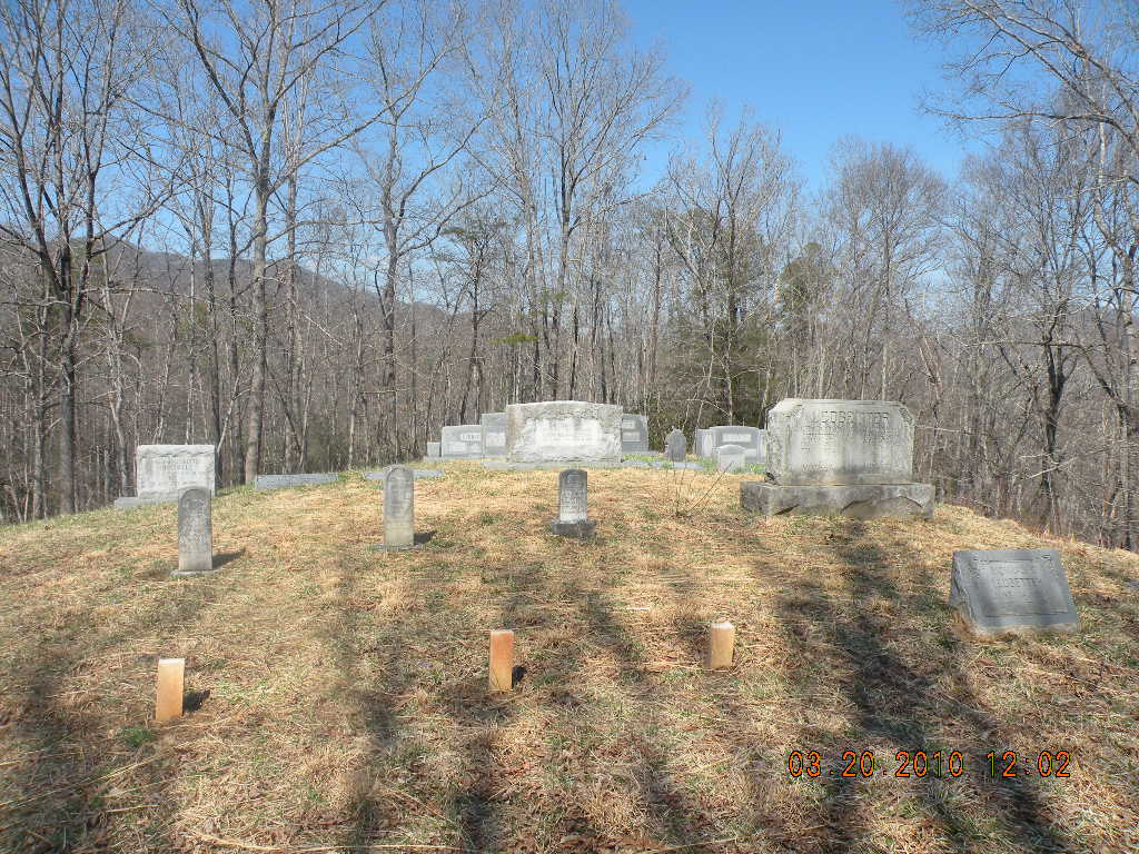
| Description | : | The Ledbetter Family Cemetery is located on NC #9 South of Black Mountain approx 11 miles. It will be on the right side of #9 just before you get to the driveway to Broad River Baptist Church (Church drive is on left of #9). A gravel drive will lead up a knoll and split, you take the right fork to the cemetery which is within walking distance of NC #9 if the cable is across the drive. This is a private cemetery. It is well kept and all but three graves are marked with inscriptions. The three unmarked are denoted... Read More |
frequently asked questions (FAQ):
-
Where is Ledbetter Family Cemetery?
Ledbetter Family Cemetery is located at NC #9 South Black Mountain, Buncombe County ,North Carolina , 28711USA.
-
Ledbetter Family Cemetery cemetery's updated grave count on graveviews.com?
0 memorials
-
Where are the coordinates of the Ledbetter Family Cemetery?
Latitude: 35.4992500
Longitude: -82.2713700
Nearby Cemetories:
1. Broad River Baptist Church Cemetery
Black Mountain, Buncombe County, USA
Coordinate: 35.5008300, -82.2689800
2. Old Broad River Cemetery
Black Mountain, Buncombe County, USA
Coordinate: 35.4894400, -82.2733280
3. Gilliam Family Cemetery
Buncombe County, USA
Coordinate: 35.5114040, -82.2655770
4. Ledbetter-Gilliam Family Cemetery
Buncombe County, USA
Coordinate: 35.5107630, -82.2584800
5. Bald Mountain Baptist Church Cemetery
Buncombe County, USA
Coordinate: 35.4703690, -82.2637050
6. Searcy Family Cemetery
Henderson County, USA
Coordinate: 35.4708150, -82.2826950
7. Stroud Family Cemetery
Black Mountain, Buncombe County, USA
Coordinate: 35.5297330, -82.2538600
8. Laurel Springs Baptist Church Cemetery
Fairview, Buncombe County, USA
Coordinate: 35.5235600, -82.3001100
9. Red Top Cemetery
Buncombe County, USA
Coordinate: 35.5043000, -82.2269000
10. Hill Cemetery
Bat Cave, Henderson County, USA
Coordinate: 35.4608002, -82.2960968
11. Conner Cemetery
Bat Cave, Henderson County, USA
Coordinate: 35.4575005, -82.2981033
12. Nesbitt Chapel Cemetery
Fairview, Buncombe County, USA
Coordinate: 35.5368004, -82.3066025
13. Stone Mountain Missionary Baptist Church Cemetery
Black Mountain, Buncombe County, USA
Coordinate: 35.5333400, -82.2301900
14. Episcopal Church of the Transfiguration Cemetery
Bat Cave, Henderson County, USA
Coordinate: 35.4501200, -82.2800600
15. Bat Cave Baptist Church Cemetery
Bat Cave, Henderson County, USA
Coordinate: 35.4503420, -82.2892850
16. East of Gerton
Gerton, Henderson County, USA
Coordinate: 35.4773890, -82.3387500
17. Edney Family Cemetery
Bat Cave, Henderson County, USA
Coordinate: 35.4403960, -82.2958910
18. Barnwell Baptist Church Cemetery
Henderson County, USA
Coordinate: 35.4483000, -82.3164700
19. Bearwallow Cemetery
Gerton, Henderson County, USA
Coordinate: 35.4809900, -82.3510300
20. Wilkey Baptist Church Cemetery
Buncombe County, USA
Coordinate: 35.5675350, -82.2870830
21. Chimney Rock Baptist Church Cemetery
Lake Lure, Rutherford County, USA
Coordinate: 35.4382380, -82.2301020
22. Chestnut Hill Baptist Church Cemetery
Fairview, Buncombe County, USA
Coordinate: 35.5567000, -82.3204000
23. Barnwell Family Cemetery
Edneyville, Henderson County, USA
Coordinate: 35.4391000, -82.3244640
24. Buffalo Cemetery
Lake Lure, Rutherford County, USA
Coordinate: 35.4611250, -82.1910620