
| Memorials | : | 0 |
| Location | : | Covington, Kenton County, USA |
| Coordinate | : | 38.9689350, -84.5025500 |
| Description | : | The cemetery is located about 100 feet south of the Oak Ridge Church Cemetery on the property of the Oak Ridge Baptist Church on the east side of Taylor Mill Road (Kentucky State Highway 16). |
frequently asked questions (FAQ):
-
Where is Lighthouse Memorial Gardens?
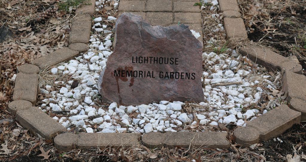
Lighthouse Memorial Gardens is located at 6056 Taylor Mill Road (Kentucky State Highway 16) Covington, Kenton County ,Kentucky , 41015USA.
-
Lighthouse Memorial Gardens cemetery's updated grave count on graveviews.com?
0 memorials
-
Where are the coordinates of the Lighthouse Memorial Gardens?
Latitude: 38.9689350
Longitude: -84.5025500
Nearby Cemetories:
1. Oak Ridge Church Cemetery
Latonia Lakes, Kenton County, USA
Coordinate: 38.9691460, -84.5024180
2. Osborn Cemetery
Latonia Lakes, Kenton County, USA
Coordinate: 38.9661110, -84.5016670
3. Richard Richardson Cemetery
Latonia Lakes, Kenton County, USA
Coordinate: 38.9741670, -84.5027780
4. Minter Cemetery
Covington, Kenton County, USA
Coordinate: 38.9642300, -84.5055100
5. Lipscomb-Richardson Cemetery
Latonia Lakes, Kenton County, USA
Coordinate: 38.9736100, -84.4958300
6. Bannister Cemetery
Taylor Mill, Kenton County, USA
Coordinate: 38.9758333, -84.5111110
7. Klette Cemetery
Latonia Lakes, Kenton County, USA
Coordinate: 38.9616670, -84.4944400
8. George W Perry Cemetery
Latonia Lakes, Kenton County, USA
Coordinate: 38.9728800, -84.4883400
9. Cox Cemetery
Covington, Kenton County, USA
Coordinate: 38.9716670, -84.5188890
10. Augustus Richardson Cemetery
Latonia Lakes, Kenton County, USA
Coordinate: 38.9811110, -84.5141670
11. William Mardis Family Cemetery
Independence, Kenton County, USA
Coordinate: 38.9613800, -84.4800100
12. Ashford Road Cemetery
Independence, Kenton County, USA
Coordinate: 38.9528850, -84.4892100
13. Woodsdale Cemetery
Taylor Mill, Kenton County, USA
Coordinate: 38.9898900, -84.5064530
14. John Richardson Cemetery
Latonia Lakes, Kenton County, USA
Coordinate: 38.9855560, -84.5194440
15. Martin Family Cemetery
Taylor Mill, Kenton County, USA
Coordinate: 38.9909400, -84.4997650
16. William Richardson Cemetery
Taylor Mill, Kenton County, USA
Coordinate: 38.9905560, -84.5094440
17. Pelly Cemetery
Latonia Lakes, Kenton County, USA
Coordinate: 38.9611110, -84.5294440
18. Wolf Family Cemetery
Taylor Mill, Kenton County, USA
Coordinate: 38.9926920, -84.4980570
19. Pruett - Mardis Cemetery
Independence, Kenton County, USA
Coordinate: 38.9463900, -84.4817100
20. Armstrong Cemetery #2
Ryland Heights, Kenton County, USA
Coordinate: 38.9820600, -84.4695400
21. Wayman Cemetery
Independence, Kenton County, USA
Coordinate: 38.9847220, -84.5347220
22. Floral Hills Memorial Gardens
Taylor Mill, Kenton County, USA
Coordinate: 38.9986000, -84.5028000
23. White Cemetery
Ryland Heights, Kenton County, USA
Coordinate: 38.9628600, -84.4642900
24. Stephens Cemetery
Ryland Heights, Kenton County, USA
Coordinate: 38.9374570, -84.4977570