
| Memorials | : | 0 |
| Location | : | Independence, Kenton County, USA |
| Coordinate | : | 38.9463900, -84.4817100 |
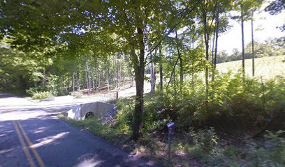
| Description | : | This is a graveyard located off of Pruett Road, but it is on private property with “no trepassing” signs posted. The cemetery is listed as Pruett-Mardis Cemetery on pages 71-72 of Small Kenton County, Kentucky, Cemeteries, published by the Kenton County Historical Society, Cemetery Committee, and on pages 71-72 of Kenton County Cemeteries, published by the Kenton County Historical Society, Covington, Kentucky, 1981. The cemetery is cross referenced as Mardis-Pruett Cemetery on page 53 of Small Kenton County, Kentucky, Cemeteries, published by the Kenton County Historical Society, Cemetery Committee, and on page 53 of Kenton County Cemeteries, published... Read More |
frequently asked questions (FAQ):
-
Where is Pruett - Mardis Cemetery?
Pruett - Mardis Cemetery is located at 3910 Pruitt Road Independence, Kenton County ,Kentucky , 41015USA.
-
Pruett - Mardis Cemetery cemetery's updated grave count on graveviews.com?
0 memorials
-
Where are the coordinates of the Pruett - Mardis Cemetery?
Latitude: 38.9463900
Longitude: -84.4817100
Nearby Cemetories:
1. Petty Cemetery
Ryland, Kenton County, USA
Coordinate: 38.9391000, -84.4847100
2. Ashford Road Cemetery
Independence, Kenton County, USA
Coordinate: 38.9528850, -84.4892100
3. William Mardis Family Cemetery
Independence, Kenton County, USA
Coordinate: 38.9613800, -84.4800100
4. Stephens Cemetery
Ryland Heights, Kenton County, USA
Coordinate: 38.9374570, -84.4977570
5. Klette Cemetery
Latonia Lakes, Kenton County, USA
Coordinate: 38.9616670, -84.4944400
6. White Cemetery
Ryland Heights, Kenton County, USA
Coordinate: 38.9628600, -84.4642900
7. White Cemetery
Ryland Heights, Kenton County, USA
Coordinate: 38.9625000, -84.4583330
8. Osborn Cemetery
Latonia Lakes, Kenton County, USA
Coordinate: 38.9661110, -84.5016670
9. Minter Cemetery
Covington, Kenton County, USA
Coordinate: 38.9642300, -84.5055100
10. George W Perry Cemetery
Latonia Lakes, Kenton County, USA
Coordinate: 38.9728800, -84.4883400
11. Lighthouse Memorial Gardens
Covington, Kenton County, USA
Coordinate: 38.9689350, -84.5025500
12. Oak Ridge Church Cemetery
Latonia Lakes, Kenton County, USA
Coordinate: 38.9691460, -84.5024180
13. Lipscomb-Richardson Cemetery
Latonia Lakes, Kenton County, USA
Coordinate: 38.9736100, -84.4958300
14. Grizzell Family Cemetery
Independence, Kenton County, USA
Coordinate: 38.9260320, -84.5089030
15. Richard Richardson Cemetery
Latonia Lakes, Kenton County, USA
Coordinate: 38.9741670, -84.5027780
16. Armstrong Cemetery #2
Ryland Heights, Kenton County, USA
Coordinate: 38.9820600, -84.4695400
17. Bannister Cemetery
Taylor Mill, Kenton County, USA
Coordinate: 38.9758333, -84.5111110
18. Adams Cemetery
Visalia, Kenton County, USA
Coordinate: 38.9088889, -84.4861111
19. Cox Cemetery
Covington, Kenton County, USA
Coordinate: 38.9716670, -84.5188890
20. Pelly Cemetery
Latonia Lakes, Kenton County, USA
Coordinate: 38.9611110, -84.5294440
21. Simmons Cemetery
Visalia, Kenton County, USA
Coordinate: 38.9069440, -84.4677780
22. McCollum Cemetery
Independence, Kenton County, USA
Coordinate: 38.9431490, -84.5350520
23. Augustus Richardson Cemetery
Latonia Lakes, Kenton County, USA
Coordinate: 38.9811110, -84.5141670
24. Martin Family Cemetery
Taylor Mill, Kenton County, USA
Coordinate: 38.9909400, -84.4997650