
| Memorials | : | 0 |
| Location | : | Covington, Kenton County, USA |
| Coordinate | : | 38.9642300, -84.5055100 |
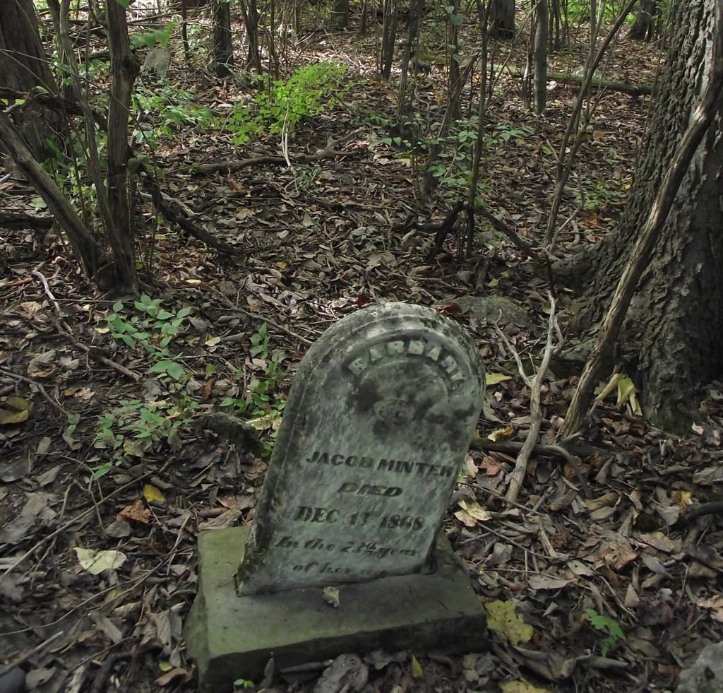
| Description | : | This cemtery is located on Taylor Mill Road. Going south from I 275 it is on the west side about 1/2 way between Rte 2047 & Lillards Dr about 400 yds west into the old Shor property, now belonging to Boyers. Three marked stones & at least six un-marked stones (rocks) are there. |
frequently asked questions (FAQ):
-
Where is Minter Cemetery?
Minter Cemetery is located at Covington, Kenton County ,Kentucky ,USA.
-
Minter Cemetery cemetery's updated grave count on graveviews.com?
0 memorials
-
Where are the coordinates of the Minter Cemetery?
Latitude: 38.9642300
Longitude: -84.5055100
Nearby Cemetories:
1. Osborn Cemetery
Latonia Lakes, Kenton County, USA
Coordinate: 38.9661110, -84.5016670
2. Lighthouse Memorial Gardens
Covington, Kenton County, USA
Coordinate: 38.9689350, -84.5025500
3. Oak Ridge Church Cemetery
Latonia Lakes, Kenton County, USA
Coordinate: 38.9691460, -84.5024180
4. Klette Cemetery
Latonia Lakes, Kenton County, USA
Coordinate: 38.9616670, -84.4944400
5. Richard Richardson Cemetery
Latonia Lakes, Kenton County, USA
Coordinate: 38.9741670, -84.5027780
6. Lipscomb-Richardson Cemetery
Latonia Lakes, Kenton County, USA
Coordinate: 38.9736100, -84.4958300
7. Bannister Cemetery
Taylor Mill, Kenton County, USA
Coordinate: 38.9758333, -84.5111110
8. Cox Cemetery
Covington, Kenton County, USA
Coordinate: 38.9716670, -84.5188890
9. George W Perry Cemetery
Latonia Lakes, Kenton County, USA
Coordinate: 38.9728800, -84.4883400
10. Ashford Road Cemetery
Independence, Kenton County, USA
Coordinate: 38.9528850, -84.4892100
11. Augustus Richardson Cemetery
Latonia Lakes, Kenton County, USA
Coordinate: 38.9811110, -84.5141670
12. Pelly Cemetery
Latonia Lakes, Kenton County, USA
Coordinate: 38.9611110, -84.5294440
13. William Mardis Family Cemetery
Independence, Kenton County, USA
Coordinate: 38.9613800, -84.4800100
14. John Richardson Cemetery
Latonia Lakes, Kenton County, USA
Coordinate: 38.9855560, -84.5194440
15. Woodsdale Cemetery
Taylor Mill, Kenton County, USA
Coordinate: 38.9898900, -84.5064530
16. Pruett - Mardis Cemetery
Independence, Kenton County, USA
Coordinate: 38.9463900, -84.4817100
17. William Richardson Cemetery
Taylor Mill, Kenton County, USA
Coordinate: 38.9905560, -84.5094440
18. Martin Family Cemetery
Taylor Mill, Kenton County, USA
Coordinate: 38.9909400, -84.4997650
19. Stephens Cemetery
Ryland Heights, Kenton County, USA
Coordinate: 38.9374570, -84.4977570
20. Wolf Family Cemetery
Taylor Mill, Kenton County, USA
Coordinate: 38.9926920, -84.4980570
21. Petty Cemetery
Ryland, Kenton County, USA
Coordinate: 38.9391000, -84.4847100
22. Wayman Cemetery
Independence, Kenton County, USA
Coordinate: 38.9847220, -84.5347220
23. McCollum Cemetery
Independence, Kenton County, USA
Coordinate: 38.9431490, -84.5350520
24. White Cemetery
Ryland Heights, Kenton County, USA
Coordinate: 38.9628600, -84.4642900