
| Memorials | : | 0 |
| Location | : | Independence, Kenton County, USA |
| Coordinate | : | 38.9528850, -84.4892100 |
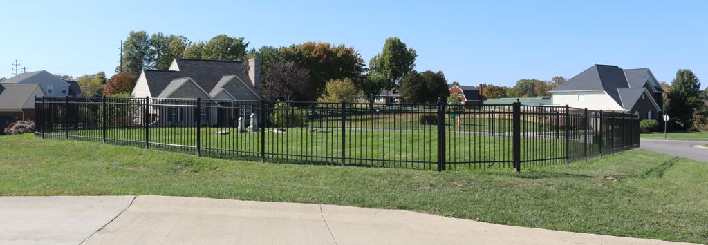
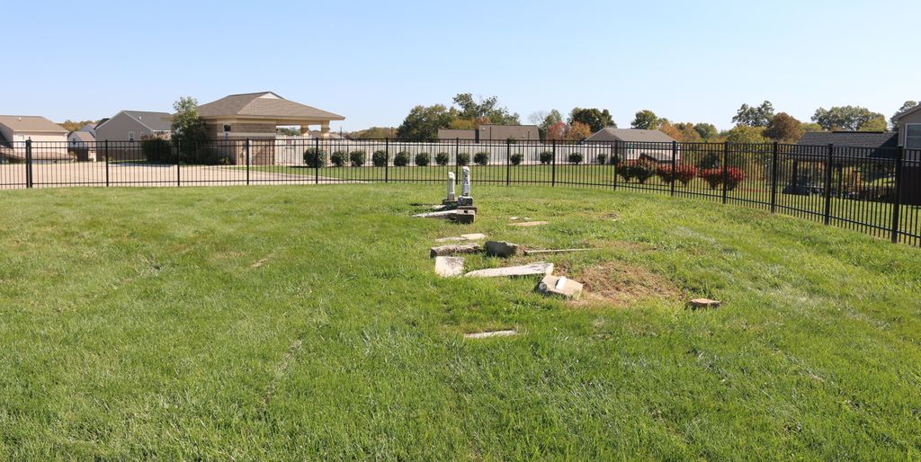
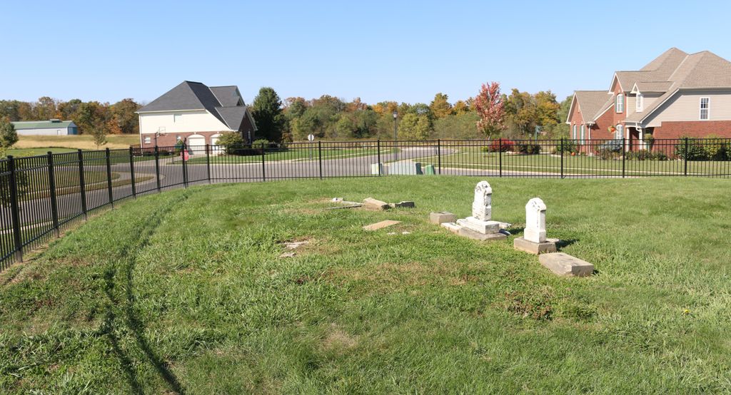
| Description | : | Located at southwest corner of Ashford Road and Waterford Court in Ashford subdivision across road from Mills Park. This was originally called Coleman Road. The Cemetery is next to the community pool. |
frequently asked questions (FAQ):
-
Where is Ashford Road Cemetery?
Ashford Road Cemetery is located at 3535 Ashford Road Independence, Kenton County ,Kentucky , 41015USA.
-
Ashford Road Cemetery cemetery's updated grave count on graveviews.com?
0 memorials
-
Where are the coordinates of the Ashford Road Cemetery?
Latitude: 38.9528850
Longitude: -84.4892100
Nearby Cemetories:
1. Pruett - Mardis Cemetery
Independence, Kenton County, USA
Coordinate: 38.9463900, -84.4817100
2. Klette Cemetery
Latonia Lakes, Kenton County, USA
Coordinate: 38.9616670, -84.4944400
3. William Mardis Family Cemetery
Independence, Kenton County, USA
Coordinate: 38.9613800, -84.4800100
4. Petty Cemetery
Ryland, Kenton County, USA
Coordinate: 38.9391000, -84.4847100
5. Osborn Cemetery
Latonia Lakes, Kenton County, USA
Coordinate: 38.9661110, -84.5016670
6. Stephens Cemetery
Ryland Heights, Kenton County, USA
Coordinate: 38.9374570, -84.4977570
7. Minter Cemetery
Covington, Kenton County, USA
Coordinate: 38.9642300, -84.5055100
8. Lighthouse Memorial Gardens
Covington, Kenton County, USA
Coordinate: 38.9689350, -84.5025500
9. Oak Ridge Church Cemetery
Latonia Lakes, Kenton County, USA
Coordinate: 38.9691460, -84.5024180
10. George W Perry Cemetery
Latonia Lakes, Kenton County, USA
Coordinate: 38.9728800, -84.4883400
11. Lipscomb-Richardson Cemetery
Latonia Lakes, Kenton County, USA
Coordinate: 38.9736100, -84.4958300
12. White Cemetery
Ryland Heights, Kenton County, USA
Coordinate: 38.9628600, -84.4642900
13. Richard Richardson Cemetery
Latonia Lakes, Kenton County, USA
Coordinate: 38.9741670, -84.5027780
14. White Cemetery
Ryland Heights, Kenton County, USA
Coordinate: 38.9625000, -84.4583330
15. Bannister Cemetery
Taylor Mill, Kenton County, USA
Coordinate: 38.9758333, -84.5111110
16. Cox Cemetery
Covington, Kenton County, USA
Coordinate: 38.9716670, -84.5188890
17. Grizzell Family Cemetery
Independence, Kenton County, USA
Coordinate: 38.9260320, -84.5089030
18. Pelly Cemetery
Latonia Lakes, Kenton County, USA
Coordinate: 38.9611110, -84.5294440
19. Armstrong Cemetery #2
Ryland Heights, Kenton County, USA
Coordinate: 38.9820600, -84.4695400
20. Augustus Richardson Cemetery
Latonia Lakes, Kenton County, USA
Coordinate: 38.9811110, -84.5141670
21. McCollum Cemetery
Independence, Kenton County, USA
Coordinate: 38.9431490, -84.5350520
22. Martin Family Cemetery
Taylor Mill, Kenton County, USA
Coordinate: 38.9909400, -84.4997650
23. Woodsdale Cemetery
Taylor Mill, Kenton County, USA
Coordinate: 38.9898900, -84.5064530
24. John Richardson Cemetery
Latonia Lakes, Kenton County, USA
Coordinate: 38.9855560, -84.5194440