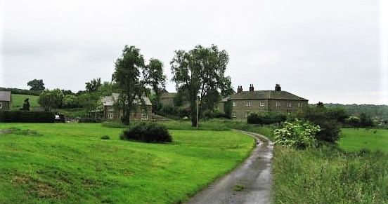
| Memorials | : | 58 |
| Location | : | Harrogate Borough, England |
| Website | : | heritage.quaker.org.uk/files/Bainbridge%20LM.pdf |
| Coordinate | : | 54.2488730, -1.6896440 |
| Description | : | This is an ancient Quaker burial ground. Please see above link and this link for more infomation: https://www.google.com/search?q=map+of+low+ellington%2C+england&rlz=1C1AVFC_enUS800US800&oq=map+of+low+ellington%2C+england&aqs=chrome..69i57.11269j0j15&sourceid=chrome&ie=UTF-8 |
frequently asked questions (FAQ):
-
Where is Low Ellington Friends Burial Ground?
Low Ellington Friends Burial Ground is located at Ripon HG4 4PE, UK Harrogate Borough ,North Yorkshire ,England.
-
Low Ellington Friends Burial Ground cemetery's updated grave count on graveviews.com?
2 memorials
-
Where are the coordinates of the Low Ellington Friends Burial Ground?
Latitude: 54.2488730
Longitude: -1.6896440
Nearby Cemetories:
1. St Mary Churchyard
Thornton Watlass, Hambleton District, England
Coordinate: 54.2627000, -1.6445300
2. St. Paul's Churchyard
Healey, Harrogate Borough, England
Coordinate: 54.2211220, -1.7208450
3. Jervaulx Abbey
East Witton, Richmondshire District, England
Coordinate: 54.2670280, -1.7379870
4. St. Mary the Virgin Churchyard
Masham, Harrogate Borough, England
Coordinate: 54.2212500, -1.6538320
5. St. Oswald's Churchyard
Thornton Steward, Richmondshire District, England
Coordinate: 54.2776700, -1.7398000
6. Thorp Perrow Pet Cemetery
Bedale, Hambleton District, England
Coordinate: 54.2631350, -1.6050920
7. St. Mary's Chapel Snape Castle
Snape, Hambleton District, England
Coordinate: 54.2544470, -1.5991790
8. St Mary Chapel
Snape, Hambleton District, England
Coordinate: 54.2543950, -1.5991040
9. St John the Evangelist Churchyard
East Witton, Richmondshire District, England
Coordinate: 54.2696020, -1.7760850
10. St. Andrew's Churchyard
Finghall, Richmondshire District, England
Coordinate: 54.3068300, -1.7085500
11. St Michael Churchyard
Well, Hambleton District, England
Coordinate: 54.2334600, -1.5900500
12. St Simon and St Jude Roman Catholic Churchyard
Ulshaw Bridge, Richmondshire District, England
Coordinate: 54.2809800, -1.7771600
13. St Patrick Churchyard
Patrick Brompton, Richmondshire District, England
Coordinate: 54.3112400, -1.6647300
14. St Gregory Churchyard
Crakehall, Hambleton District, England
Coordinate: 54.3046690, -1.6255660
15. Crakehall and Langthorne Cemetery
Crakehall, Hambleton District, England
Coordinate: 54.3086800, -1.6272800
16. St. Gregory Churchyard
Bedale, Hambleton District, England
Coordinate: 54.2911330, -1.5936010
17. St James Churchyard
Grewelthorpe, Harrogate Borough, England
Coordinate: 54.1822150, -1.6487290
18. West Tanfield Methodist Chapelyard
West Tanfield, Hambleton District, England
Coordinate: 54.2065210, -1.5904340
19. St. Nicholas' Churchyard
West Tanfield, Hambleton District, England
Coordinate: 54.2036840, -1.5906360
20. St Michael and All Angels Churchyard Spennithorne
Spennithorne, Richmondshire District, England
Coordinate: 54.2960200, -1.7910200
21. St John the Evangelist Churchyard
Mickley, Harrogate Borough, England
Coordinate: 54.1878300, -1.6117000
22. St. Mary and St. Alkelda Churchyard
Middleham, Richmondshire District, England
Coordinate: 54.2864000, -1.8074000
23. Spennithorne & Harmby Cemetery
Harmby, Richmondshire District, England
Coordinate: 54.3002500, -1.7989900
24. St. Andrew's Churchyard
Kirkby Malzeard, Harrogate Borough, England
Coordinate: 54.1658250, -1.6410510


