
| Memorials | : | 23 |
| Location | : | Patrick Brompton, Richmondshire District, England |
| Coordinate | : | 54.3112400, -1.6647300 |
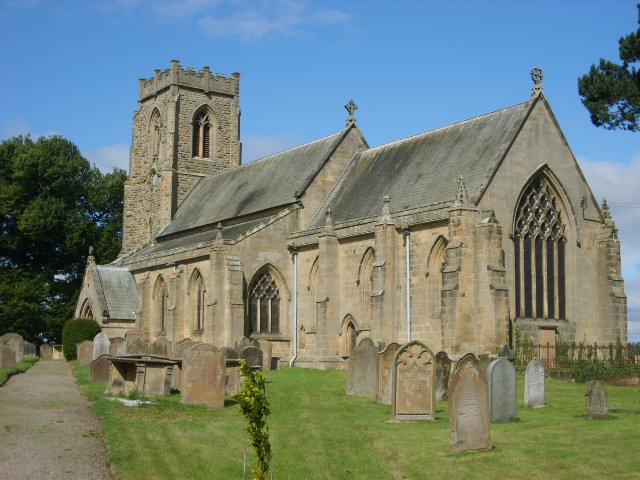
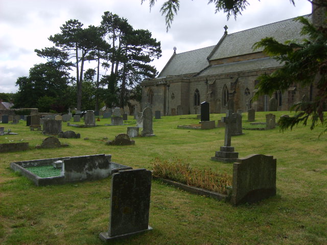
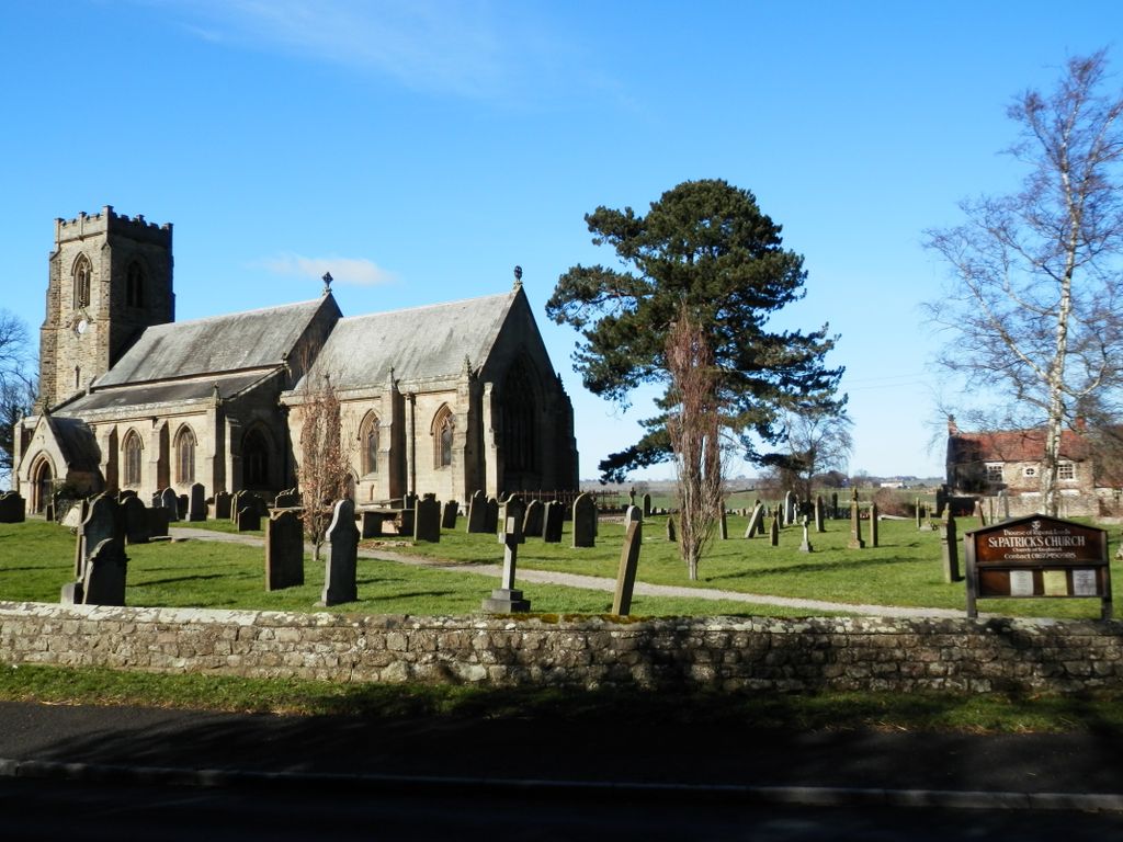
| Description | : | Patrick Brompton is a village and civil parish in the Richmondshire district of North Yorkshire, England, situated about 4 miles (6.4 km) west of Bedale. It lies on the A684. It had a population of 167 in the 2011 census. St Patrick's Church is located in the centre of the village as well as the village pub, called The Green Tree. The church, dating from 13th/14th century and restored in 1864, is a Grade I listed building. Several of the tombs in the churchyard are Grade II listed. |
frequently asked questions (FAQ):
-
Where is St Patrick Churchyard?
St Patrick Churchyard is located at Church Road Patrick Brompton, Richmondshire District ,North Yorkshire , DL8 1JNEngland.
-
St Patrick Churchyard cemetery's updated grave count on graveviews.com?
23 memorials
-
Where are the coordinates of the St Patrick Churchyard?
Latitude: 54.3112400
Longitude: -1.6647300

Nearby Cemetories:
1. Crakehall and Langthorne Cemetery
Crakehall, Hambleton District, England
Coordinate: 54.3086800, -1.6272800
2. St Gregory Churchyard
Crakehall, Hambleton District, England
Coordinate: 54.3046690, -1.6255660
3. St. Andrew's Churchyard
Finghall, Richmondshire District, England
Coordinate: 54.3068300, -1.7085500
4. St Mary Churchyard
Hornby, Richmondshire District, England
Coordinate: 54.3388470, -1.6594880
5. St Oswald Churchyard
Hauxwell, Richmondshire District, England
Coordinate: 54.3333300, -1.7333300
6. Holy Trinity Churchyard
Tunstall, Richmondshire District, England
Coordinate: 54.3572840, -1.6683920
7. St. Gregory Churchyard
Bedale, Hambleton District, England
Coordinate: 54.2911330, -1.5936010
8. St Mary Churchyard
Thornton Watlass, Hambleton District, England
Coordinate: 54.2627000, -1.6445300
9. St. Oswald's Churchyard
Thornton Steward, Richmondshire District, England
Coordinate: 54.2776700, -1.7398000
10. Thorp Perrow Pet Cemetery
Bedale, Hambleton District, England
Coordinate: 54.2631350, -1.6050920
11. Jervaulx Abbey
East Witton, Richmondshire District, England
Coordinate: 54.2670280, -1.7379870
12. St Andrew Churchyard
Great Fencote, Hambleton District, England
Coordinate: 54.3366300, -1.5662200
13. Low Ellington Friends Burial Ground
Harrogate Borough, England
Coordinate: 54.2488730, -1.6896440
14. St Paulinus Roman Catholic Churchyard
Brough with St Giles, Richmondshire District, England
Coordinate: 54.3779100, -1.6698900
15. St John the Baptist Churchyard
Leeming, Hambleton District, England
Coordinate: 54.2990400, -1.5497100
16. St Anne Churchyard
Catterick, Richmondshire District, England
Coordinate: 54.3768500, -1.6319800
17. Catterick Cemetery
Catterick, Richmondshire District, England
Coordinate: 54.3774700, -1.6349100
18. St. Mary's Chapel Snape Castle
Snape, Hambleton District, England
Coordinate: 54.2544470, -1.5991790
19. St Mary Chapel
Snape, Hambleton District, England
Coordinate: 54.2543950, -1.5991040
20. St Mary Churchyard
Kirkby Fleetham, Hambleton District, England
Coordinate: 54.3561750, -1.5691590
21. St Simon and St Jude Roman Catholic Churchyard
Ulshaw Bridge, Richmondshire District, England
Coordinate: 54.2809800, -1.7771600
22. St John The Evangelist Churchyard
Hipswell, Richmondshire District, England
Coordinate: 54.3798700, -1.7130100
23. St Radegund Churchyard
Scruton, Hambleton District, England
Coordinate: 54.3275320, -1.5398210
24. Catterick Garrison Military Cemetery
Hipswell, Richmondshire District, England
Coordinate: 54.3803100, -1.7138300