
| Memorials | : | 0 |
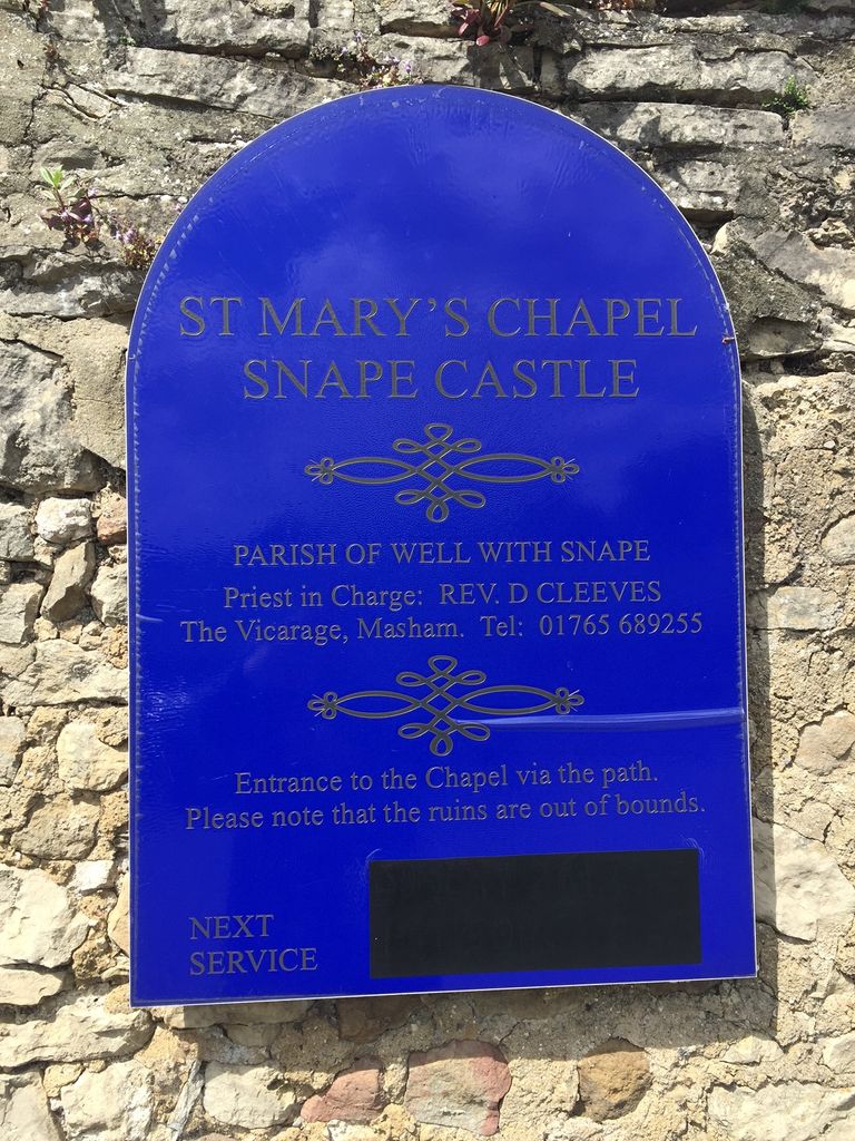
| Location | : | Snape, Hambleton District, England |
| Coordinate | : | 54.2543950, -1.5991040 |
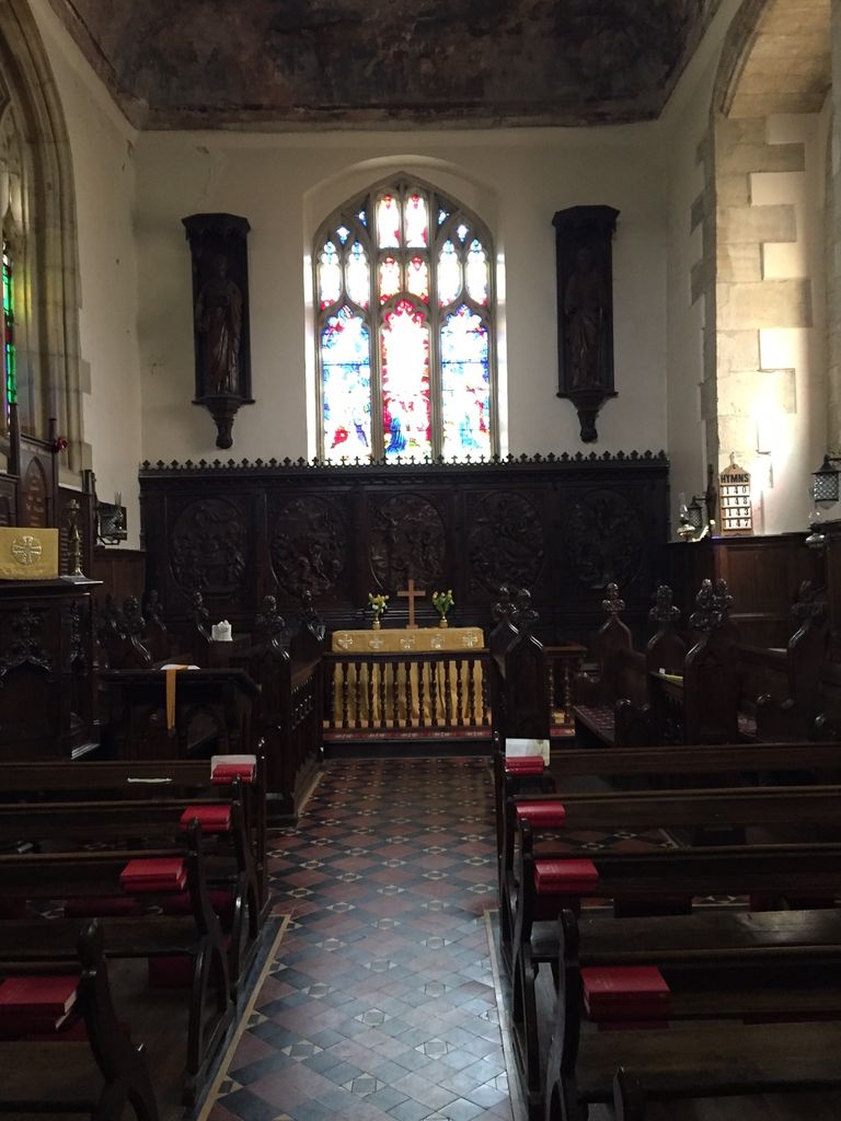
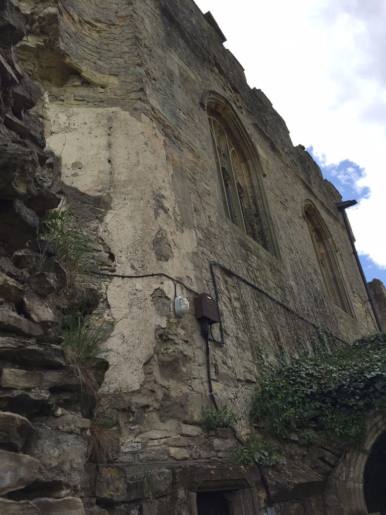
| Description | : | The castle chapel is first recorded in the early years of the 15th century. It is located on an upper floor on the south side of the castle, approached by way of an external stair leading to another internal stair and then to the chapel itself. A small vestry is at the top of the stair, and links to a passage from the castle (now blocked). The chapel was renovated around 1720, but by the late 18th century it had fallen into disuse and was used as a storage area for grain and rapeseed. Then in 1802 William Millbank scavenged... Read More |
frequently asked questions (FAQ):
-
Where is St Mary Chapel?
St Mary Chapel is located at Snape Castle Snape, Hambleton District ,North Yorkshire , DL8 2TJEngland.
-
St Mary Chapel cemetery's updated grave count on graveviews.com?
0 memorials
-
Where are the coordinates of the St Mary Chapel?
Latitude: 54.2543950
Longitude: -1.5991040
Nearby Cemetories:
1. St. Mary's Chapel Snape Castle
Snape, Hambleton District, England
Coordinate: 54.2544470, -1.5991790
2. Thorp Perrow Pet Cemetery
Bedale, Hambleton District, England
Coordinate: 54.2631350, -1.6050920
3. St Michael Churchyard
Well, Hambleton District, England
Coordinate: 54.2334600, -1.5900500
4. St Mary Churchyard
Thornton Watlass, Hambleton District, England
Coordinate: 54.2627000, -1.6445300
5. St. Gregory Churchyard
Bedale, Hambleton District, England
Coordinate: 54.2911330, -1.5936010
6. St Lambert Churchyard
Burneston, Hambleton District, England
Coordinate: 54.2592940, -1.5273040
7. St. Mary the Virgin Churchyard
Masham, Harrogate Borough, England
Coordinate: 54.2212500, -1.6538320
8. West Tanfield Methodist Chapelyard
West Tanfield, Hambleton District, England
Coordinate: 54.2065210, -1.5904340
9. St. Nicholas' Churchyard
West Tanfield, Hambleton District, England
Coordinate: 54.2036840, -1.5906360
10. St Gregory Churchyard
Crakehall, Hambleton District, England
Coordinate: 54.3046690, -1.6255660
11. St John the Baptist Churchyard
Leeming, Hambleton District, England
Coordinate: 54.2990400, -1.5497100
12. Low Ellington Friends Burial Ground
Harrogate Borough, England
Coordinate: 54.2488730, -1.6896440
13. Crakehall and Langthorne Cemetery
Crakehall, Hambleton District, England
Coordinate: 54.3086800, -1.6272800
14. St Michael Churchyard
Kirklington, Hambleton District, England
Coordinate: 54.2242770, -1.5126140
15. St John the Evangelist Churchyard
Mickley, Harrogate Borough, England
Coordinate: 54.1878300, -1.6117000
16. St Patrick Churchyard
Patrick Brompton, Richmondshire District, England
Coordinate: 54.3112400, -1.6647300
17. St Mary the Virgin Churchyard
North Stainley, Harrogate Borough, England
Coordinate: 54.1881600, -1.5627900
18. All Saints Churchyard
Pickhill, Hambleton District, England
Coordinate: 54.2470500, -1.4700700
19. St James Churchyard
Grewelthorpe, Harrogate Borough, England
Coordinate: 54.1822150, -1.6487290
20. St. Paul's Churchyard
Healey, Harrogate Borough, England
Coordinate: 54.2211220, -1.7208450
21. St Radegund Churchyard
Scruton, Hambleton District, England
Coordinate: 54.3275320, -1.5398210
22. Jervaulx Abbey
East Witton, Richmondshire District, England
Coordinate: 54.2670280, -1.7379870
23. St. Andrew's Churchyard
Finghall, Richmondshire District, England
Coordinate: 54.3068300, -1.7085500
24. St. Michael and All Angels Churchyard
Maunby, Hambleton District, England
Coordinate: 54.2725530, -1.4606140