
| Memorials | : | 0 |
| Location | : | Crakehall, Hambleton District, England |
| Coordinate | : | 54.3086800, -1.6272800 |
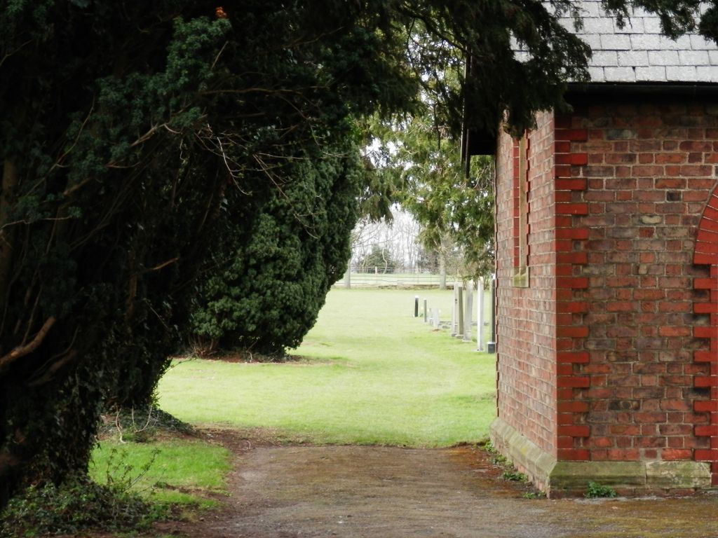
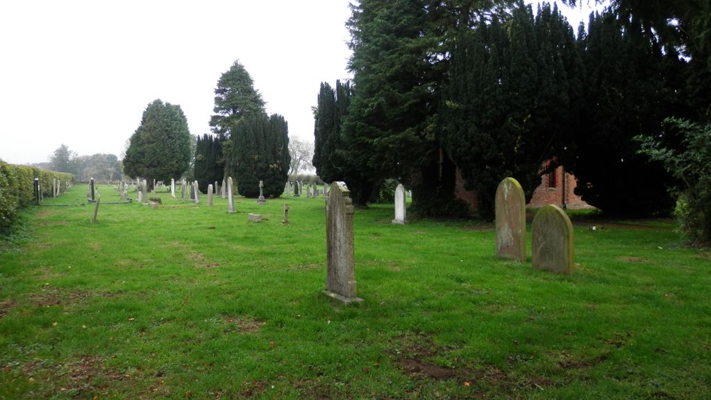
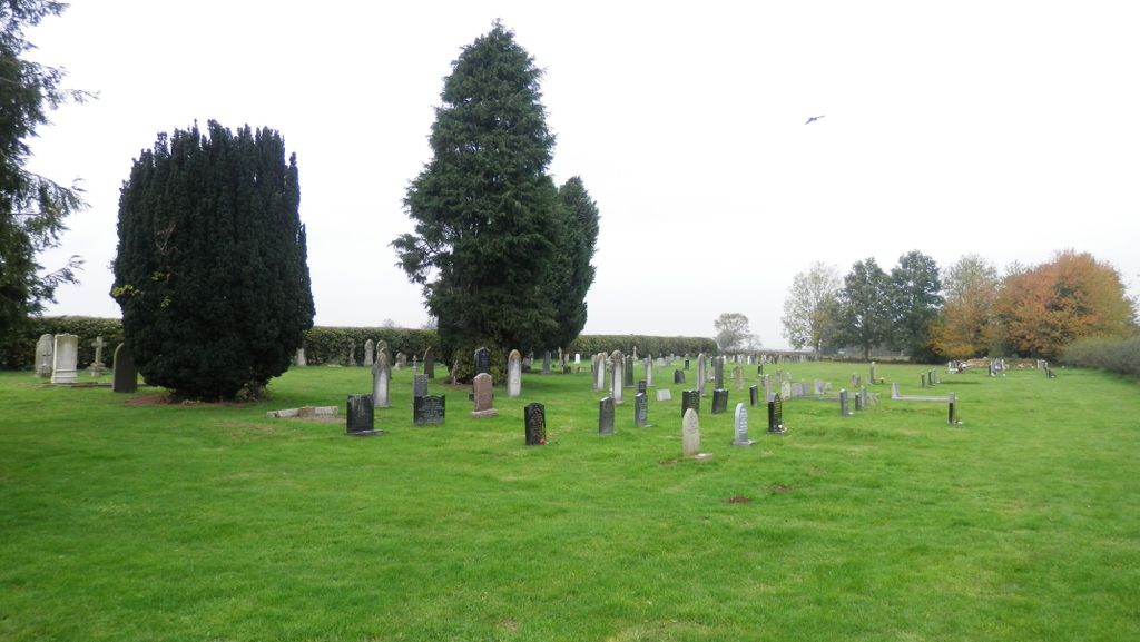
| Description | : | Small cemetery located to the right of the minor road leading from Crakehall to Hackforth, along a farm track called Green Gate Lane. The only signposting is "GREENGATE FARM" and "FREE RANGE EGGS" |
frequently asked questions (FAQ):
-
Where is Crakehall and Langthorne Cemetery?
Crakehall and Langthorne Cemetery is located at Crakehall, Hambleton District ,North Yorkshire ,England.
-
Crakehall and Langthorne Cemetery cemetery's updated grave count on graveviews.com?
0 memorials
-
Where are the coordinates of the Crakehall and Langthorne Cemetery?
Latitude: 54.3086800
Longitude: -1.6272800
Nearby Cemetories:
1. St Gregory Churchyard
Crakehall, Hambleton District, England
Coordinate: 54.3046690, -1.6255660
2. St Patrick Churchyard
Patrick Brompton, Richmondshire District, England
Coordinate: 54.3112400, -1.6647300
3. St. Gregory Churchyard
Bedale, Hambleton District, England
Coordinate: 54.2911330, -1.5936010
4. St Mary Churchyard
Hornby, Richmondshire District, England
Coordinate: 54.3388470, -1.6594880
5. St Andrew Churchyard
Great Fencote, Hambleton District, England
Coordinate: 54.3366300, -1.5662200
6. St John the Baptist Churchyard
Leeming, Hambleton District, England
Coordinate: 54.2990400, -1.5497100
7. St Mary Churchyard
Thornton Watlass, Hambleton District, England
Coordinate: 54.2627000, -1.6445300
8. Thorp Perrow Pet Cemetery
Bedale, Hambleton District, England
Coordinate: 54.2631350, -1.6050920
9. St. Andrew's Churchyard
Finghall, Richmondshire District, England
Coordinate: 54.3068300, -1.7085500
10. Holy Trinity Churchyard
Tunstall, Richmondshire District, England
Coordinate: 54.3572840, -1.6683920
11. St Radegund Churchyard
Scruton, Hambleton District, England
Coordinate: 54.3275320, -1.5398210
12. St. Mary's Chapel Snape Castle
Snape, Hambleton District, England
Coordinate: 54.2544470, -1.5991790
13. St Mary Chapel
Snape, Hambleton District, England
Coordinate: 54.2543950, -1.5991040
14. St Mary Churchyard
Kirkby Fleetham, Hambleton District, England
Coordinate: 54.3561750, -1.5691590
15. St Oswald Churchyard
Hauxwell, Richmondshire District, England
Coordinate: 54.3333300, -1.7333300
16. St Anne Churchyard
Catterick, Richmondshire District, England
Coordinate: 54.3768500, -1.6319800
17. Catterick Cemetery
Catterick, Richmondshire District, England
Coordinate: 54.3774700, -1.6349100
18. Low Ellington Friends Burial Ground
Harrogate Borough, England
Coordinate: 54.2488730, -1.6896440
19. St. Oswald's Churchyard
Thornton Steward, Richmondshire District, England
Coordinate: 54.2776700, -1.7398000
20. St. Wilfrid Churchyard
Great Langton, Hambleton District, England
Coordinate: 54.3598870, -1.5367380
21. St Paulinus Roman Catholic Churchyard
Brough with St Giles, Richmondshire District, England
Coordinate: 54.3779100, -1.6698900
22. St Lambert Churchyard
Burneston, Hambleton District, England
Coordinate: 54.2592940, -1.5273040
23. Jervaulx Abbey
East Witton, Richmondshire District, England
Coordinate: 54.2670280, -1.7379870
24. St Michael Churchyard
Well, Hambleton District, England
Coordinate: 54.2334600, -1.5900500