
| Memorials | : | 5 |
| Location | : | Snape, Hambleton District, England |
| Coordinate | : | 54.2544470, -1.5991790 |
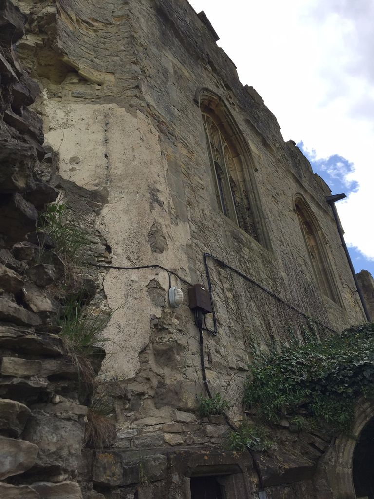
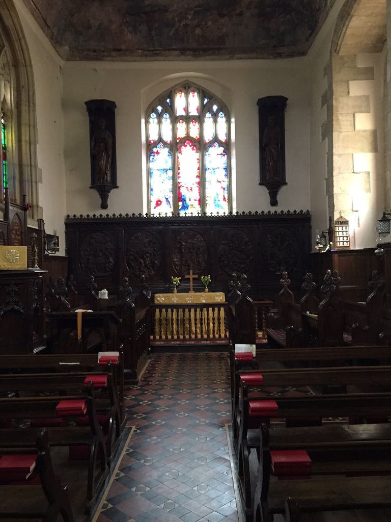
| Description | : | As early as 1725 the Earl of Oxford found the ceiling much deteriorated. The storage of grain and rape-seed in the chapel then hastened the degeneration of the painting to a point of total destruction through what one newspaper report in 1888 describes as ‘the peeling and crumbling away of the ceiling’. Even as late as the first years of the twentieth century angels bearing shields could still be seen, together with several other figures from the twelfth chapter of Revelation including the woman clothed with the sun and her child, St Michael and the dragon and God. The... Read More |
frequently asked questions (FAQ):
-
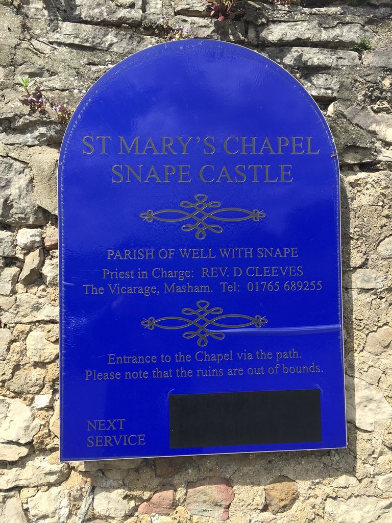
Where is St. Mary's Chapel Snape Castle?
St. Mary's Chapel Snape Castle is located at Snape, Hambleton District ,North Yorkshire ,England.
-
St. Mary's Chapel Snape Castle cemetery's updated grave count on graveviews.com?
0 memorials
-
Where are the coordinates of the St. Mary's Chapel Snape Castle?
Latitude: 54.2544470
Longitude: -1.5991790
Nearby Cemetories:
1. St Mary Chapel
Snape, Hambleton District, England
Coordinate: 54.2543950, -1.5991040
2. Thorp Perrow Pet Cemetery
Bedale, Hambleton District, England
Coordinate: 54.2631350, -1.6050920
3. St Michael Churchyard
Well, Hambleton District, England
Coordinate: 54.2334600, -1.5900500
4. St Mary Churchyard
Thornton Watlass, Hambleton District, England
Coordinate: 54.2627000, -1.6445300
5. St. Gregory Churchyard
Bedale, Hambleton District, England
Coordinate: 54.2911330, -1.5936010
6. St Lambert Churchyard
Burneston, Hambleton District, England
Coordinate: 54.2592940, -1.5273040
7. St. Mary the Virgin Churchyard
Masham, Harrogate Borough, England
Coordinate: 54.2212500, -1.6538320
8. West Tanfield Methodist Chapelyard
West Tanfield, Hambleton District, England
Coordinate: 54.2065210, -1.5904340
9. St. Nicholas' Churchyard
West Tanfield, Hambleton District, England
Coordinate: 54.2036840, -1.5906360
10. St Gregory Churchyard
Crakehall, Hambleton District, England
Coordinate: 54.3046690, -1.6255660
11. St John the Baptist Churchyard
Leeming, Hambleton District, England
Coordinate: 54.2990400, -1.5497100
12. Low Ellington Friends Burial Ground
Harrogate Borough, England
Coordinate: 54.2488730, -1.6896440
13. Crakehall and Langthorne Cemetery
Crakehall, Hambleton District, England
Coordinate: 54.3086800, -1.6272800
14. St Michael Churchyard
Kirklington, Hambleton District, England
Coordinate: 54.2242770, -1.5126140
15. St John the Evangelist Churchyard
Mickley, Harrogate Borough, England
Coordinate: 54.1878300, -1.6117000
16. St Patrick Churchyard
Patrick Brompton, Richmondshire District, England
Coordinate: 54.3112400, -1.6647300
17. St Mary the Virgin Churchyard
North Stainley, Harrogate Borough, England
Coordinate: 54.1881600, -1.5627900
18. All Saints Churchyard
Pickhill, Hambleton District, England
Coordinate: 54.2470500, -1.4700700
19. St James Churchyard
Grewelthorpe, Harrogate Borough, England
Coordinate: 54.1822150, -1.6487290
20. St. Paul's Churchyard
Healey, Harrogate Borough, England
Coordinate: 54.2211220, -1.7208450
21. St Radegund Churchyard
Scruton, Hambleton District, England
Coordinate: 54.3275320, -1.5398210
22. Jervaulx Abbey
East Witton, Richmondshire District, England
Coordinate: 54.2670280, -1.7379870
23. St. Andrew's Churchyard
Finghall, Richmondshire District, England
Coordinate: 54.3068300, -1.7085500
24. St. Michael and All Angels Churchyard
Maunby, Hambleton District, England
Coordinate: 54.2725530, -1.4606140