
| Memorials | : | 6 |
| Location | : | Finghall, Richmondshire District, England |
| Coordinate | : | 54.3068300, -1.7085500 |
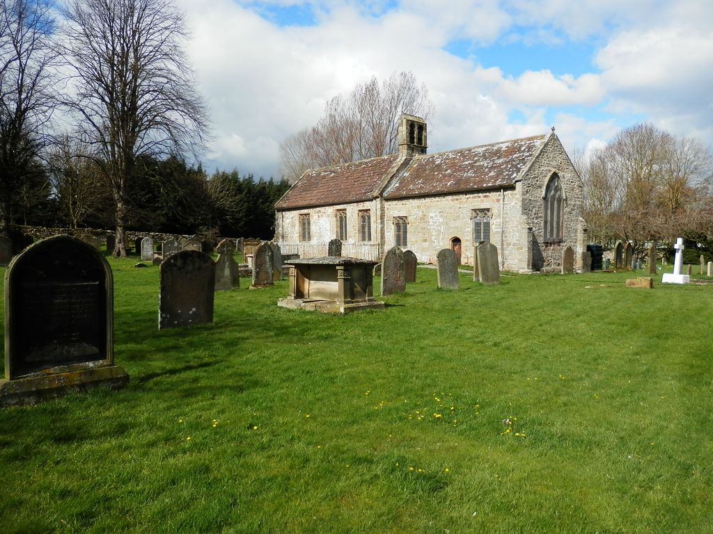
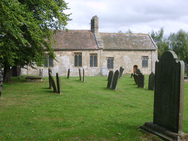
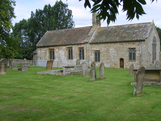
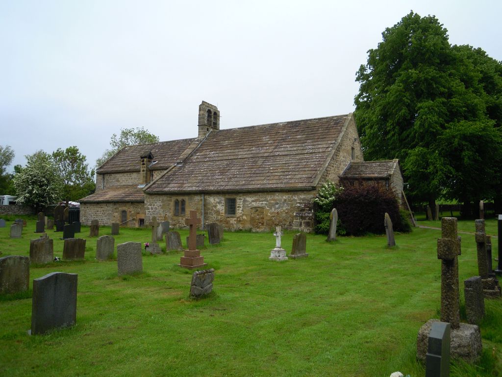
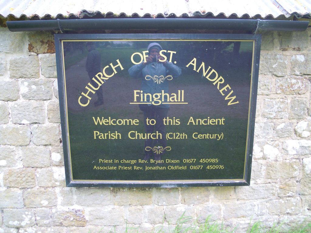
| Description | : | This 12th century church is the parish church of Finghall, it must once have served the villagers of nearby Akebar. Fields close to the church show earthworks from a former village, whilst other fields are full of residential caravans. |
frequently asked questions (FAQ):
-
Where is St. Andrew's Churchyard?
St. Andrew's Churchyard is located at Chapel Lane Finghall, Richmondshire District ,North Yorkshire , DL8 5LYEngland.
-
St. Andrew's Churchyard cemetery's updated grave count on graveviews.com?
6 memorials
-
Where are the coordinates of the St. Andrew's Churchyard?
Latitude: 54.3068300
Longitude: -1.7085500

Nearby Cemetories:
1. St Patrick Churchyard
Patrick Brompton, Richmondshire District, England
Coordinate: 54.3112400, -1.6647300
2. St Oswald Churchyard
Hauxwell, Richmondshire District, England
Coordinate: 54.3333300, -1.7333300
3. St. Oswald's Churchyard
Thornton Steward, Richmondshire District, England
Coordinate: 54.2776700, -1.7398000
4. St Mary Churchyard
Hornby, Richmondshire District, England
Coordinate: 54.3388470, -1.6594880
5. Jervaulx Abbey
East Witton, Richmondshire District, England
Coordinate: 54.2670280, -1.7379870
6. Crakehall and Langthorne Cemetery
Crakehall, Hambleton District, England
Coordinate: 54.3086800, -1.6272800
7. St Simon and St Jude Roman Catholic Churchyard
Ulshaw Bridge, Richmondshire District, England
Coordinate: 54.2809800, -1.7771600
8. St Gregory Churchyard
Crakehall, Hambleton District, England
Coordinate: 54.3046690, -1.6255660
9. St Michael and All Angels Churchyard Spennithorne
Spennithorne, Richmondshire District, England
Coordinate: 54.2960200, -1.7910200
10. Spennithorne & Harmby Cemetery
Harmby, Richmondshire District, England
Coordinate: 54.3002500, -1.7989900
11. St John the Evangelist Churchyard
East Witton, Richmondshire District, England
Coordinate: 54.2696020, -1.7760850
12. Holy Trinity Churchyard
Tunstall, Richmondshire District, England
Coordinate: 54.3572840, -1.6683920
13. St Mary Churchyard
Thornton Watlass, Hambleton District, England
Coordinate: 54.2627000, -1.6445300
14. Low Ellington Friends Burial Ground
Harrogate Borough, England
Coordinate: 54.2488730, -1.6896440
15. St. Mary and St. Alkelda Churchyard
Middleham, Richmondshire District, England
Coordinate: 54.2864000, -1.8074000
16. St. Gregory Churchyard
Bedale, Hambleton District, England
Coordinate: 54.2911330, -1.5936010
17. St John the Evangelist Churchyard
Bellerby, Richmondshire District, England
Coordinate: 54.3303200, -1.8239000
18. St John The Evangelist Churchyard
Hipswell, Richmondshire District, England
Coordinate: 54.3798700, -1.7130100
19. Catterick Garrison Military Cemetery
Hipswell, Richmondshire District, England
Coordinate: 54.3803100, -1.7138300
20. Leyburn Cemetery
Leyburn, Richmondshire District, England
Coordinate: 54.3093030, -1.8348630
21. Thorp Perrow Pet Cemetery
Bedale, Hambleton District, England
Coordinate: 54.2631350, -1.6050920
22. St Paulinus Roman Catholic Churchyard
Brough with St Giles, Richmondshire District, England
Coordinate: 54.3779100, -1.6698900
23. St. Mary's Chapel Snape Castle
Snape, Hambleton District, England
Coordinate: 54.2544470, -1.5991790
24. St Mary Chapel
Snape, Hambleton District, England
Coordinate: 54.2543950, -1.5991040