| Memorials | : | 1 |
| Location | : | Atmore, Escambia County, USA |
| Coordinate | : | 31.0413710, -87.4840580 |
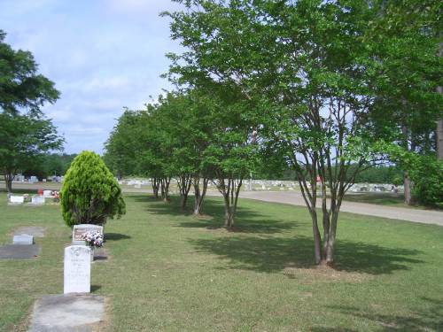
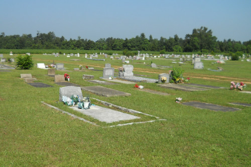
| Description | : | The Lucy Hill Cemetery complex consists of three cemeteries named Stallworth, Fairview and Lucious. Fairview is the section located to the east that is bordered by Harris and Johnson streets. Stallworth is the cemetery located to the north and Lucious is the cemetery that lies to the south (oldest section). Lucious and Stallworth are bordered by Harris Street on the east and an open meadow/field to the north, west and south. The two are separated by a gravel utility road where a tall flag pole is standing; Stallworth on the right and Lucious on the left. Each cemetery... Read More |
frequently asked questions (FAQ):
-
Where is Lucy Hill Cemetery Complex?
Lucy Hill Cemetery Complex is located at Atmore, Escambia County ,Alabama ,USA.
-
Lucy Hill Cemetery Complex cemetery's updated grave count on graveviews.com?
1 memorials
-
Where are the coordinates of the Lucy Hill Cemetery Complex?
Latitude: 31.0413710
Longitude: -87.4840580
Nearby Cemetories:
1. Oak Hill Cemetery
Atmore, Escambia County, USA
Coordinate: 31.0414009, -87.4955978
2. Gaines Chapel AME Church Cemetery
Atmore, Escambia County, USA
Coordinate: 31.0294000, -87.4868130
3. Pine Level Cemetery
Atmore, Escambia County, USA
Coordinate: 31.0465508, -87.5072174
4. Williams Station Cemetery
Escambia County, USA
Coordinate: 31.0227800, -87.4966700
5. Serenity Gardens Cemetery
Atmore, Escambia County, USA
Coordinate: 31.0244007, -87.4467010
6. Freemanville Church Cemetery
Escambia County, USA
Coordinate: 31.0670260, -87.5216170
7. Mothershed Cemetery
Freemanville, Escambia County, USA
Coordinate: 31.0557900, -87.5318900
8. Canoe United Methodist Church Cemetery
Robinsonville, Escambia County, USA
Coordinate: 31.0599995, -87.4377975
9. Davis Cemetery
Freemanville, Escambia County, USA
Coordinate: 31.0726766, -87.5204899
10. Canaan Freewill Cemetery
Canoe, Escambia County, USA
Coordinate: 31.0272007, -87.4207993
11. Hall Family Cemetery
Atmore, Escambia County, USA
Coordinate: 31.0256004, -87.4191971
12. Robinsonville Church Cemetery
Atmore, Escambia County, USA
Coordinate: 31.0713997, -87.4238968
13. Myrick Family Cemetery
Canoe, Escambia County, USA
Coordinate: 31.0353490, -87.4145650
14. Williams Family Cemetery
Atmore, Escambia County, USA
Coordinate: 31.0880020, -87.5424800
15. New Home Indian Cemetery
Poarch, Escambia County, USA
Coordinate: 31.1101300, -87.4967300
16. Pierce Rabb Cemetery
Atmore, Escambia County, USA
Coordinate: 31.1049060, -87.5223960
17. Lee Family Cemetery
Escambia County, USA
Coordinate: 30.9775670, -87.5234340
18. Hollingsworth Family Cemetery
Nokomis, Escambia County, USA
Coordinate: 31.0012100, -87.5556280
19. Big Pine Barren Baptist Church Cemetery
Pine Barren, Escambia County, USA
Coordinate: 30.9662018, -87.4723740
20. Rolin Indian Cemetery
Poarch, Escambia County, USA
Coordinate: 31.0813860, -87.5629230
21. Nokomis Church Cemetery
Atmore, Escambia County, USA
Coordinate: 31.0077991, -87.5721970
22. Poarch Mission Cemetery
Escambia County, USA
Coordinate: 31.1208000, -87.5124969
23. Godwin Cemetery
Bratt, Escambia County, USA
Coordinate: 30.9683800, -87.4351900
24. Poarch Baptist Church Indian Cemetery
Poarch, Escambia County, USA
Coordinate: 31.1209110, -87.5264240


