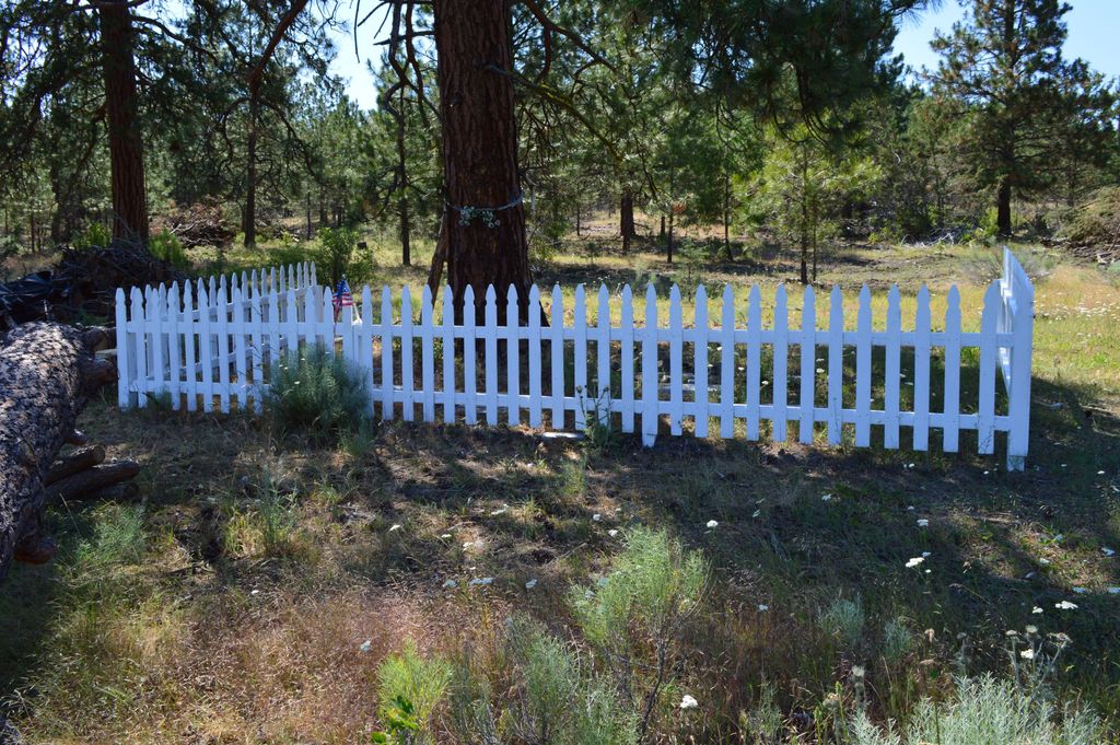
| Memorials | : | 0 |
| Location | : | Mitchell, Wheeler County, USA |
| Coordinate | : | 44.6240730, -119.7498810 |
| Description | : | Family cemetery for descendants of Rhys Humphreys, Sr. and Loula South Potter Humphreys. The cemetery is actually closer to the former town of Waterman Flat, however, this town is not an option under Wheeler County towns, so the town of Mitchell was chosen as it is the next closest town. |
frequently asked questions (FAQ):
-
Where is Buckhorn Cemetery?
Buckhorn Cemetery is located at Mitchell, Wheeler County ,Oregon ,USA.
-
Buckhorn Cemetery cemetery's updated grave count on graveviews.com?
0 memorials
-
Where are the coordinates of the Buckhorn Cemetery?
Latitude: 44.6240730
Longitude: -119.7498810
Nearby Cemetories:
1. Foppiano Family Cemetery
Mitchell, Wheeler County, USA
Coordinate: 44.5954000, -119.9433000
2. Frederic Arnecke Burial Site
Wheeler County, USA
Coordinate: 44.4740700, -119.8121100
3. Mary Waterman Burial Site
Mitchell, Wheeler County, USA
Coordinate: 44.4727402, -119.8117371
4. Spanish Gulch Cemetery
Wheeler County, USA
Coordinate: 44.4667015, -119.7722015
5. Caleb Cemetery
Mitchell, Wheeler County, USA
Coordinate: 44.5231018, -119.9383011
6. Camp Watson Cemetery
Mitchell, Wheeler County, USA
Coordinate: 44.4844437, -119.8994675
7. Dayville Cemetery
Dayville, Grant County, USA
Coordinate: 44.4834222, -119.5748805
8. Richmond Cemetery
Richmond, Wheeler County, USA
Coordinate: 44.7311096, -119.9911118
9. Richmond Cemetery
Wheeler County, USA
Coordinate: 44.7296982, -120.0105972
10. Spray Cemetery
Spray, Wheeler County, USA
Coordinate: 44.8471985, -119.8110962
11. Toney Cemetery
Mitchell, Wheeler County, USA
Coordinate: 44.6394500, -120.0818000
12. Haystack Cemetery
Wheeler County, USA
Coordinate: 44.8800011, -119.7352982
13. Aldrich Gravesite
Grant County, USA
Coordinate: 44.4528008, -119.4499969
14. Cupper Canyon Cemetery
Monument, Grant County, USA
Coordinate: 44.8374300, -119.5015100
15. Mitchell Cemetery Upper
Mitchell, Wheeler County, USA
Coordinate: 44.5619850, -120.1425934
16. Lower Mitchell Cemetery
Mitchell, Wheeler County, USA
Coordinate: 44.5699387, -120.1636124
17. Cottonwood Cemetery
Monument, Grant County, USA
Coordinate: 44.8127747, -119.4158936
18. Monument Cemetery
Monument, Grant County, USA
Coordinate: 44.8208008, -119.4235992
19. Winlock Cemetery
Winlock, Wheeler County, USA
Coordinate: 44.9124985, -119.8985977
20. Hamilton Cemetery
Hamilton, Grant County, USA
Coordinate: 44.7435989, -119.3167038
21. Cummings Cemetery
Mount Vernon, Grant County, USA
Coordinate: 44.4398000, -119.3452000
22. Carroll Cemetery
Mitchell, Wheeler County, USA
Coordinate: 44.6580009, -120.2342987
23. Twickenham Cemetery
Twickenham, Wheeler County, USA
Coordinate: 44.7675820, -120.1990560
24. Lowrey Family Burial Site
Crook County, USA
Coordinate: 44.3641600, -120.1516200

