
| Memorials | : | 0 |
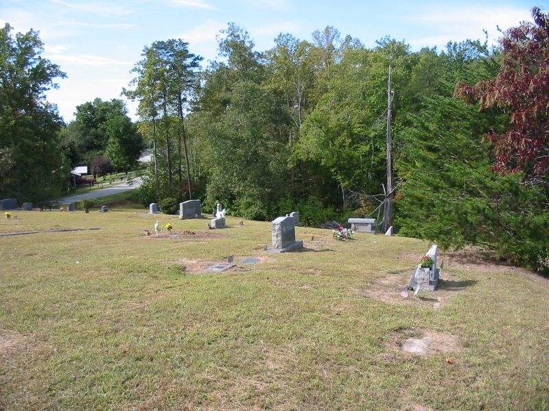
| Location | : | McDowell County, USA |
| Coordinate | : | 35.6638380, -82.0587210 |
| Description | : | Directions from Marion: Sugar Hill Road, turn right onto Veterans Drive. Go 1.9 miles, turn left onto Nix Creek Road. Continue 1.8 miles and turn right onto Westwood Drive. Cemetery is .5 miles on the left. |
frequently asked questions (FAQ):
-
Where is McDowell Cemetery?
McDowell Cemetery is located at McDowell County ,North Carolina ,USA.
-
McDowell Cemetery cemetery's updated grave count on graveviews.com?
0 memorials
-
Where are the coordinates of the McDowell Cemetery?
Latitude: 35.6638380
Longitude: -82.0587210
Nearby Cemetories:
1. Mount Calvary Free Will Baptist Church Cemetery
McDowell County, USA
Coordinate: 35.6617550, -82.0401430
2. Nix Creek Free Will Baptist Church
Marion, McDowell County, USA
Coordinate: 35.6461500, -82.0699590
3. Glades Cemetery
McDowell County, USA
Coordinate: 35.6422005, -82.0669022
4. Providence United Methodist Church Cemetery
Marion, McDowell County, USA
Coordinate: 35.6368860, -82.0503680
5. West Marion United Methodist Church Cemetery
Marion, McDowell County, USA
Coordinate: 35.6609920, -82.0235890
6. Patton-Logan Cemetery
Pleasant Gardens, McDowell County, USA
Coordinate: 35.6907230, -82.0767370
7. Cross Mill Cemetery
Marion, McDowell County, USA
Coordinate: 35.6736341, -82.0221047
8. Pleasant Gardens Baptist Church Cemetery
Marion, McDowell County, USA
Coordinate: 35.6933390, -82.0719010
9. Zion Hill Baptist Church Cemetery
Marion, McDowell County, USA
Coordinate: 35.6314011, -82.0686035
10. Brown Family Cemetery
Pleasant Gardens, McDowell County, USA
Coordinate: 35.6967239, -82.0679550
11. Liberty Cemetery
Marion, McDowell County, USA
Coordinate: 35.6892014, -82.0939026
12. Vess Family Cemetery
Pleasant Gardens, McDowell County, USA
Coordinate: 35.6993532, -82.0866362
13. Round Hill Baptist Church Cemetery
McDowell County, USA
Coordinate: 35.7050620, -82.0468440
14. Greenlee Hill Cemetery
McDowell County, USA
Coordinate: 35.6688700, -82.1106810
15. Mount Olive Cemetery
Pleasant Gardens, McDowell County, USA
Coordinate: 35.6815300, -82.1076500
16. Patton Cemetery
McDowell County, USA
Coordinate: 35.7008630, -82.0873780
17. Carsons Chapel Cemetery
McDowell County, USA
Coordinate: 35.7070550, -82.0706850
18. Saint John's Episcopal Church Columbarium
Marion, McDowell County, USA
Coordinate: 35.6793360, -82.0058020
19. Old Marion Methodist Episcopal Church Cemetery
McDowell County, USA
Coordinate: 35.6856260, -82.0063220
20. Duncan Family Cemetery
Marion, McDowell County, USA
Coordinate: 35.6791540, -82.0011160
21. First United Methodist Church Columbarium
Marion, McDowell County, USA
Coordinate: 35.6917680, -82.0063040
22. Proctor-Henline Cemetery
Marion, McDowell County, USA
Coordinate: 35.7047030, -82.0192750
23. Oak Grove Cemetery
Marion, McDowell County, USA
Coordinate: 35.6768990, -81.9966965
24. Morehead Cemetery
Marion, McDowell County, USA
Coordinate: 35.6787420, -81.9956450