
| Memorials | : | 0 |
| Location | : | Pleasant Gardens, McDowell County, USA |
| Coordinate | : | 35.6907230, -82.0767370 |
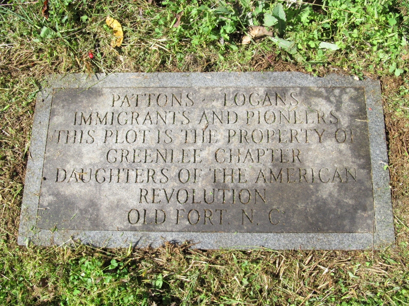
| Description | : | Directions: From Marion, take Hwy 70 West to Pleasant Gardens. Turn right onto Padgett Road. Go to the end of the road to the driveway between the last two houses (private property). The wall of the cemetery can be seen from this driveway. It is a very small cemetery with a 3 1/2 foot wall around it. There are only two readable tombstones and several non-readable tombstones. The pictured plaque is outside the wall. |
frequently asked questions (FAQ):
-
Where is Patton-Logan Cemetery?
Patton-Logan Cemetery is located at Pleasant Gardens, McDowell County ,North Carolina ,USA.
-
Patton-Logan Cemetery cemetery's updated grave count on graveviews.com?
0 memorials
-
Where are the coordinates of the Patton-Logan Cemetery?
Latitude: 35.6907230
Longitude: -82.0767370
Nearby Cemetories:
1. Pleasant Gardens Baptist Church Cemetery
Marion, McDowell County, USA
Coordinate: 35.6933390, -82.0719010
2. Brown Family Cemetery
Pleasant Gardens, McDowell County, USA
Coordinate: 35.6967239, -82.0679550
3. Vess Family Cemetery
Pleasant Gardens, McDowell County, USA
Coordinate: 35.6993532, -82.0866362
4. Patton Cemetery
McDowell County, USA
Coordinate: 35.7008630, -82.0873780
5. Liberty Cemetery
Marion, McDowell County, USA
Coordinate: 35.6892014, -82.0939026
6. Carsons Chapel Cemetery
McDowell County, USA
Coordinate: 35.7070550, -82.0706850
7. Mount Olive Cemetery
Pleasant Gardens, McDowell County, USA
Coordinate: 35.6815300, -82.1076500
8. Round Hill Baptist Church Cemetery
McDowell County, USA
Coordinate: 35.7050620, -82.0468440
9. McDowell Cemetery
McDowell County, USA
Coordinate: 35.6638380, -82.0587210
10. Greenlee Hill Cemetery
McDowell County, USA
Coordinate: 35.6688700, -82.1106810
11. Mount Calvary Free Will Baptist Church Cemetery
McDowell County, USA
Coordinate: 35.6617550, -82.0401430
12. Nix Creek Free Will Baptist Church
Marion, McDowell County, USA
Coordinate: 35.6461500, -82.0699590
13. Cross Mill Cemetery
Marion, McDowell County, USA
Coordinate: 35.6736341, -82.0221047
14. Proctor-Henline Cemetery
Marion, McDowell County, USA
Coordinate: 35.7047030, -82.0192750
15. Glades Cemetery
McDowell County, USA
Coordinate: 35.6422005, -82.0669022
16. West Marion United Methodist Church Cemetery
Marion, McDowell County, USA
Coordinate: 35.6609920, -82.0235890
17. Craig Family Cemetery
McDowell County, USA
Coordinate: 35.7403200, -82.0500100
18. First United Methodist Church Columbarium
Marion, McDowell County, USA
Coordinate: 35.6917680, -82.0063040
19. Old Marion Methodist Episcopal Church Cemetery
McDowell County, USA
Coordinate: 35.6856260, -82.0063220
20. Providence United Methodist Church Cemetery
Marion, McDowell County, USA
Coordinate: 35.6368860, -82.0503680
21. Saint John's Episcopal Church Columbarium
Marion, McDowell County, USA
Coordinate: 35.6793360, -82.0058020
22. Zion Hill Baptist Church Cemetery
Marion, McDowell County, USA
Coordinate: 35.6314011, -82.0686035
23. Duncan Family Cemetery
Marion, McDowell County, USA
Coordinate: 35.6791540, -82.0011160
24. Oak Grove Cemetery
Marion, McDowell County, USA
Coordinate: 35.6768990, -81.9966965