
| Memorials | : | 0 |
| Location | : | McDowell County, USA |
| Coordinate | : | 35.6617550, -82.0401430 |
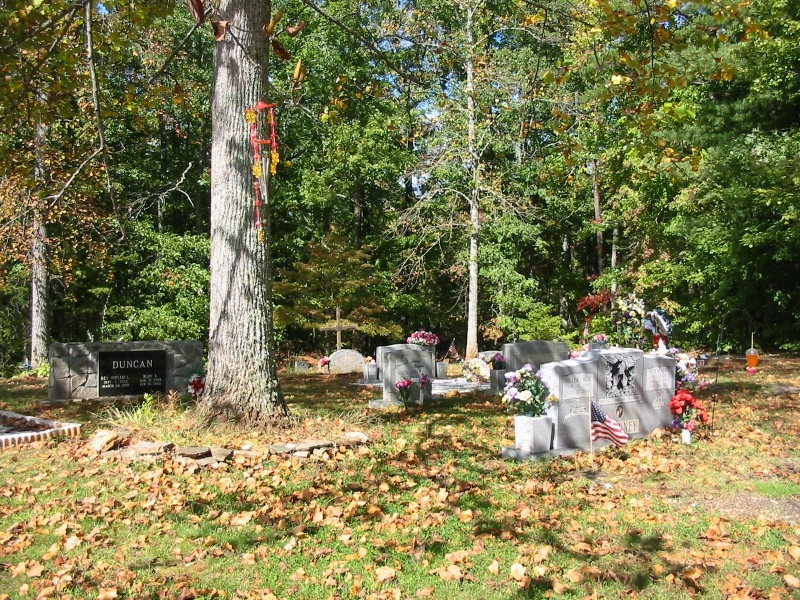
| Description | : | Directions: From Marion, Sugar Hill Road, turn right onto Veterans Drive. Go .6 miles and turn left onto McKinney Road. Make an immediate right onto Cemetery Court Road. Just before West Court Cemetery, turn left onto gravel road, Mt. Calvary Cemetery Road. Follow road till it forks, bear right and go to top of the hill. |
frequently asked questions (FAQ):
-
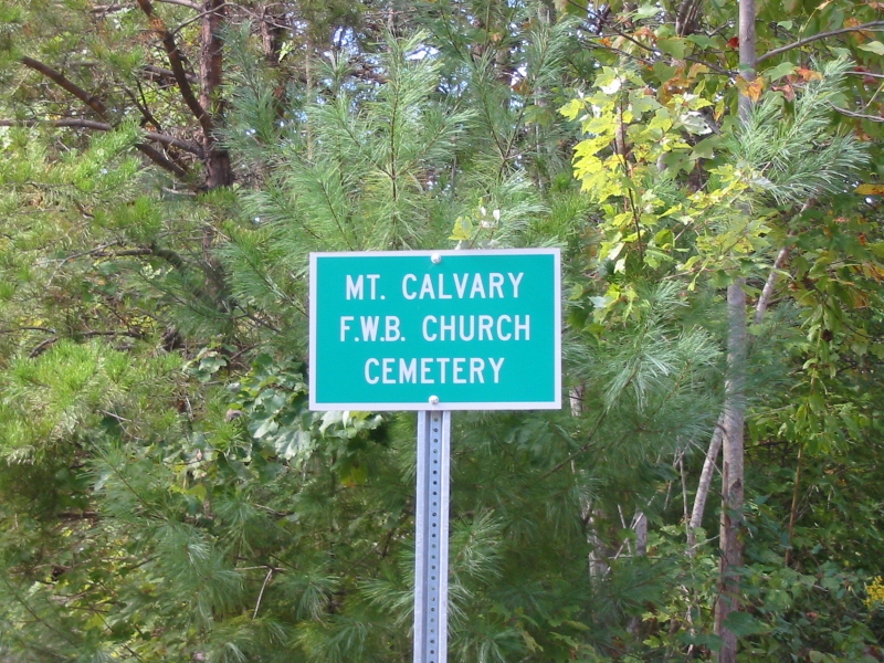
Where is Mount Calvary Free Will Baptist Church Cemetery?
Mount Calvary Free Will Baptist Church Cemetery is located at McDowell County ,North Carolina ,USA.
-
Mount Calvary Free Will Baptist Church Cemetery cemetery's updated grave count on graveviews.com?
0 memorials
-
Where are the coordinates of the Mount Calvary Free Will Baptist Church Cemetery?
Latitude: 35.6617550
Longitude: -82.0401430
Nearby Cemetories:
1. West Marion United Methodist Church Cemetery
Marion, McDowell County, USA
Coordinate: 35.6609920, -82.0235890
2. McDowell Cemetery
McDowell County, USA
Coordinate: 35.6638380, -82.0587210
3. Cross Mill Cemetery
Marion, McDowell County, USA
Coordinate: 35.6736341, -82.0221047
4. Providence United Methodist Church Cemetery
Marion, McDowell County, USA
Coordinate: 35.6368860, -82.0503680
5. Nix Creek Free Will Baptist Church
Marion, McDowell County, USA
Coordinate: 35.6461500, -82.0699590
6. Glades Cemetery
McDowell County, USA
Coordinate: 35.6422005, -82.0669022
7. Saint John's Episcopal Church Columbarium
Marion, McDowell County, USA
Coordinate: 35.6793360, -82.0058020
8. Duncan Family Cemetery
Marion, McDowell County, USA
Coordinate: 35.6791540, -82.0011160
9. Old Marion Methodist Episcopal Church Cemetery
McDowell County, USA
Coordinate: 35.6856260, -82.0063220
10. Zion Hill Baptist Church Cemetery
Marion, McDowell County, USA
Coordinate: 35.6314011, -82.0686035
11. Oak Grove Cemetery
Marion, McDowell County, USA
Coordinate: 35.6768990, -81.9966965
12. Morehead Cemetery
Marion, McDowell County, USA
Coordinate: 35.6787420, -81.9956450
13. First United Methodist Church Columbarium
Marion, McDowell County, USA
Coordinate: 35.6917680, -82.0063040
14. Pleasant Gardens Baptist Church Cemetery
Marion, McDowell County, USA
Coordinate: 35.6933390, -82.0719010
15. Patton-Logan Cemetery
Pleasant Gardens, McDowell County, USA
Coordinate: 35.6907230, -82.0767370
16. Brown Family Cemetery
Pleasant Gardens, McDowell County, USA
Coordinate: 35.6967239, -82.0679550
17. Ridgeway Freewill Baptist Church Cemetery
McDowell County, USA
Coordinate: 35.6319070, -82.0010530
18. Round Hill Baptist Church Cemetery
McDowell County, USA
Coordinate: 35.7050620, -82.0468440
19. Elhannon Cemetery
Marion, McDowell County, USA
Coordinate: 35.6861350, -81.9924160
20. Proctor-Henline Cemetery
Marion, McDowell County, USA
Coordinate: 35.7047030, -82.0192750
21. Mount Pleasant Baptist Church Cemetery
Marion, McDowell County, USA
Coordinate: 35.6174650, -82.0190030
22. Liberty Cemetery
Marion, McDowell County, USA
Coordinate: 35.6892014, -82.0939026
23. Carsons Chapel Cemetery
McDowell County, USA
Coordinate: 35.7070550, -82.0706850
24. Chapel Hill Cemetery
Marion, McDowell County, USA
Coordinate: 35.6613998, -81.9756012