
| Memorials | : | 1 |
| Location | : | Morven, Anson County, USA |
| Coordinate | : | 34.8363590, -80.0145810 |
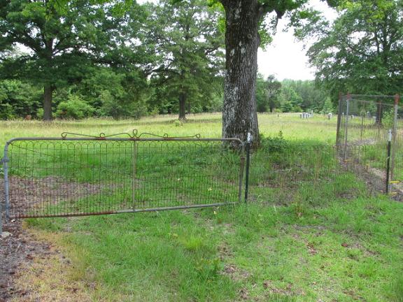
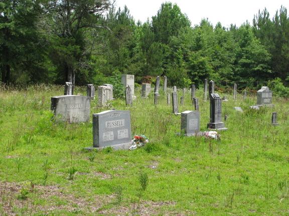
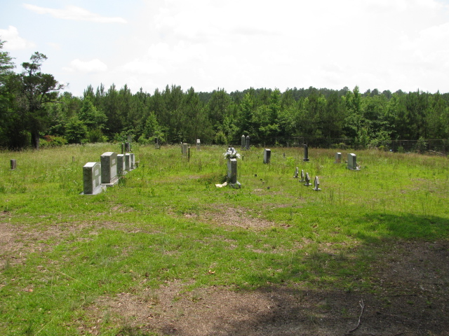
| Description | : | From the intersection of US52 and NC145 in Morven, take NC145 West (towards Chesterfield, SC) for 1.6 miles. Turn left (south) onto Previtte Road (SR1834) and follow it for .7 miles. Turn left (east)onto a sand road and follow it to the cemetery. There is a gate with a small, wooden "McLaurin Cemetery" sign (with worn and difficult to read lettering) at the entrance of the sand road. In this Cemetery are the Immigrant Scotish Familiy members of the McLaurin Family who moved to the Scottish Settlement area around Old Morven before the Civil War. |
frequently asked questions (FAQ):
-
Where is McLaurin Cemetery?
McLaurin Cemetery is located at SR1834 Morven, Anson County ,North Carolina , 28119USA.
-
McLaurin Cemetery cemetery's updated grave count on graveviews.com?
1 memorials
-
Where are the coordinates of the McLaurin Cemetery?
Latitude: 34.8363590
Longitude: -80.0145810
Nearby Cemetories:
1. Pittman Cemetery
Morven, Anson County, USA
Coordinate: 34.8362360, -80.0242320
2. Ramah Grove Missionary Baptist Church Cemetery
McFarlan, Anson County, USA
Coordinate: 34.8241437, -79.9897166
3. Sandy Ridge Missionary Baptist Church Cemetery
Morven, Anson County, USA
Coordinate: 34.8406570, -80.0453100
4. Lebanon Presbyterian Church Cemetery
Morven, Anson County, USA
Coordinate: 34.8645770, -80.0233200
5. Sandy Plains United Methodist Church Cemetery
Morven, Anson County, USA
Coordinate: 34.8245800, -80.0488600
6. Morven Cemetery
Morven, Anson County, USA
Coordinate: 34.8669800, -79.9931600
7. Campbell Family Cemetery
Chesterfield, Chesterfield County, USA
Coordinate: 34.8048360, -80.0441280
8. Pleasant Hill Cemetery
McFarlan, Anson County, USA
Coordinate: 34.8161011, -79.9728012
9. Short Family Cemetery
Chesterfield County, USA
Coordinate: 34.7931670, -80.0118550
10. Burr Cemetery
Cason Old Field, Anson County, USA
Coordinate: 34.8319120, -80.0709340
11. Jones-Hinson Family Cemetery
Chesterfield, Chesterfield County, USA
Coordinate: 34.7989860, -79.9805010
12. Westfield Creek Baptist Church Cemetery
Chesterfield County, USA
Coordinate: 34.7888985, -80.0108032
13. Smith Cemetery
Chesterfield, Chesterfield County, USA
Coordinate: 34.7974840, -80.0480710
14. Covington Cemetery
Morven, Anson County, USA
Coordinate: 34.8827010, -79.9988790
15. Gatewood Cemetery
Morven, Anson County, USA
Coordinate: 34.8857020, -80.0104450
16. McClain Grove Missionary Baptist Church Cemetery
Cheraw, Chesterfield County, USA
Coordinate: 34.7873270, -80.0011380
17. Old Scottish Cemetery
Morven, Anson County, USA
Coordinate: 34.8757920, -79.9746320
18. Pratt Cemetery
Morven, Anson County, USA
Coordinate: 34.8871760, -80.0054130
19. Teal Cemetery
Cason Old Field, Anson County, USA
Coordinate: 34.8503075, -80.0794067
20. Mount Zion United Methodist Church Cemetery
Cheraw, Chesterfield County, USA
Coordinate: 34.7972880, -79.9647960
21. Griggs Family Cemetery
Chesterfield, Chesterfield County, USA
Coordinate: 34.8042150, -80.0732200
22. Sneedsborough Cemetery
Old Sneedsboro, Anson County, USA
Coordinate: 34.8256300, -79.9365900
23. Edwards Cemetery
Cason Old Field, Anson County, USA
Coordinate: 34.8512840, -80.0920486
24. New Hope United Methodist Church Cemetery
Wadesboro, Anson County, USA
Coordinate: 34.8382390, -80.0943390