
| Memorials | : | 0 |
| Location | : | Chesterfield, Chesterfield County, USA |
| Coordinate | : | 34.7974840, -80.0480710 |
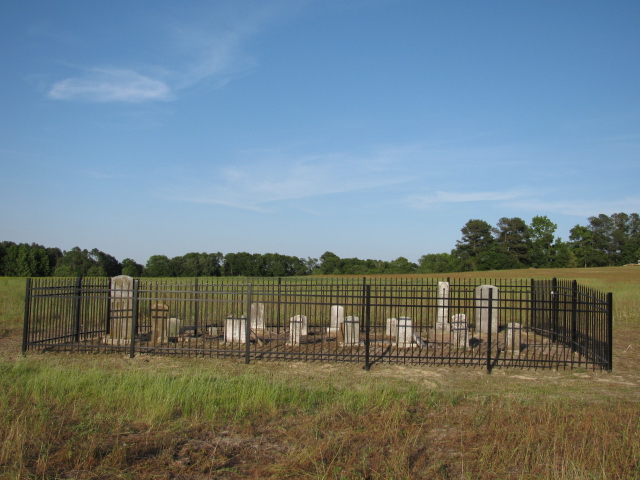
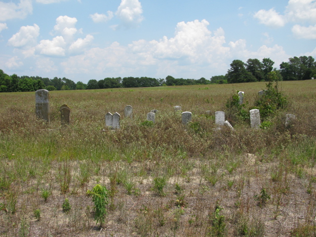
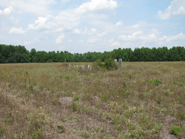
| Description | : | Take highway 145 north from Chesterfield, South Carolina. Turn right on Snow Hill Road. Turn left on Crawford Road. Cemetery is on the left about 100 yards off road in field belonging to the Crawford family. Note: The Brock family, descendants of Catherine Josephine Smith Brock, daughter of Elisha B. Smith and Delilah Wallace Smith, cleaned the cemetery and installed a new fence around it on May 8, 2010. While digging holes for the fence posts we unearthed the stones of William B. Duncan and Sarah A. Duncan, his daughter, that had not been recorded as being in this cemetery. |
frequently asked questions (FAQ):
-
Where is Smith Cemetery?
Smith Cemetery is located at Crawford Road Chesterfield, Chesterfield County ,South Carolina ,USA.
-
Smith Cemetery cemetery's updated grave count on graveviews.com?
0 memorials
-
Where are the coordinates of the Smith Cemetery?
Latitude: 34.7974840
Longitude: -80.0480710
Nearby Cemetories:
1. Campbell Family Cemetery
Chesterfield, Chesterfield County, USA
Coordinate: 34.8048360, -80.0441280
2. Griggs Family Cemetery
Chesterfield, Chesterfield County, USA
Coordinate: 34.8042150, -80.0732200
3. Sandy Plains United Methodist Church Cemetery
Morven, Anson County, USA
Coordinate: 34.8245800, -80.0488600
4. Stroud Family Cemetery
Chesterfield, Chesterfield County, USA
Coordinate: 34.7919380, -80.0813360
5. Davis Cemetery
Chesterfield, Chesterfield County, USA
Coordinate: 34.7676600, -80.0456570
6. Short Family Cemetery
Chesterfield County, USA
Coordinate: 34.7931670, -80.0118550
7. Westfield Creek Baptist Church Cemetery
Chesterfield County, USA
Coordinate: 34.7888985, -80.0108032
8. Dred Cemetery
Chesterfield, Chesterfield County, USA
Coordinate: 34.7821920, -80.0837230
9. Davids Grove Baptist Church Cemetery
Chesterfield, Chesterfield County, USA
Coordinate: 34.7928009, -80.0903015
10. Privett Family Cemetery
Chesterfield, Chesterfield County, USA
Coordinate: 34.7658230, -80.0220910
11. Zoar United Methodist Church Cemetery
Brocks Mill, Chesterfield County, USA
Coordinate: 34.7648277, -80.0217819
12. Teal Family Cemetery
Chesterfield, Chesterfield County, USA
Coordinate: 34.7583530, -80.0463330
13. Burr Cemetery
Cason Old Field, Anson County, USA
Coordinate: 34.8319120, -80.0709340
14. McClain Grove Missionary Baptist Church Cemetery
Cheraw, Chesterfield County, USA
Coordinate: 34.7873270, -80.0011380
15. Mount Level Baptist Church Cemetery
Chesterfield, Chesterfield County, USA
Coordinate: 34.7990910, -80.0970350
16. Sandy Ridge Missionary Baptist Church Cemetery
Morven, Anson County, USA
Coordinate: 34.8406570, -80.0453100
17. Pittman Cemetery
Morven, Anson County, USA
Coordinate: 34.8362360, -80.0242320
18. Friendship United Methodist Church Cemetery
Chesterfield, Chesterfield County, USA
Coordinate: 34.7655983, -80.0883026
19. Pleasant Grove AME Zion Church Cemetery
Chesterfield, Chesterfield County, USA
Coordinate: 34.7587490, -80.0172040
20. McLaurin Cemetery
Morven, Anson County, USA
Coordinate: 34.8363590, -80.0145810
21. Sowell Cemetery
Chesterfield, Chesterfield County, USA
Coordinate: 34.7654220, -80.0933680
22. Rivers Family Cemetery
Chesterfield, Chesterfield County, USA
Coordinate: 34.7484950, -80.0539370
23. Adams Family Cemetery
Chesterfield, Chesterfield County, USA
Coordinate: 34.8073080, -80.1096060
24. Bittle Family Cemetery
Chesterfield, Chesterfield County, USA
Coordinate: 34.7535050, -80.0828380