| Memorials | : | 0 |
| Location | : | Chesterfield, Chesterfield County, USA |
| Coordinate | : | 34.7989860, -79.9805010 |
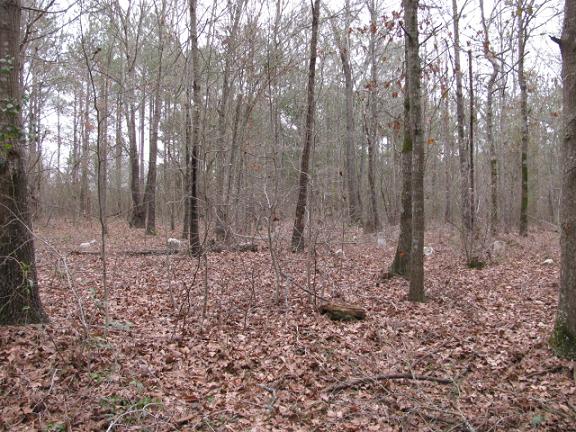
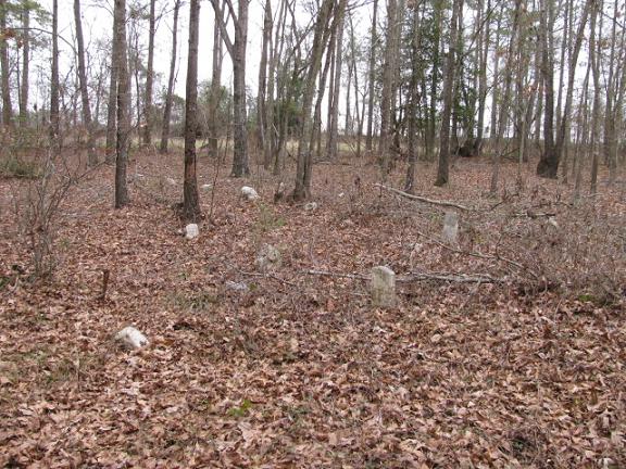
| Description | : | directions: From McFarlan, N.C. take Highway 52 South. Cross the state line and turn right on Hinson Hill Road. Go past the turkey houses and the first brick house. Cemetery will be behind the second brick house about one quarter mile from the highway. |
frequently asked questions (FAQ):
-
Where is Jones-Hinson Family Cemetery?
Jones-Hinson Family Cemetery is located at Hinson Hill Road. Chesterfield, Chesterfield County ,South Carolina ,USA.
-
Jones-Hinson Family Cemetery cemetery's updated grave count on graveviews.com?
0 memorials
-
Where are the coordinates of the Jones-Hinson Family Cemetery?
Latitude: 34.7989860
Longitude: -79.9805010
Nearby Cemetories:
1. Mount Zion United Methodist Church Cemetery
Cheraw, Chesterfield County, USA
Coordinate: 34.7972880, -79.9647960
2. Pleasant Hill Cemetery
McFarlan, Anson County, USA
Coordinate: 34.8161011, -79.9728012
3. McClain Grove Missionary Baptist Church Cemetery
Cheraw, Chesterfield County, USA
Coordinate: 34.7873270, -80.0011380
4. Ramah Grove Missionary Baptist Church Cemetery
McFarlan, Anson County, USA
Coordinate: 34.8241437, -79.9897166
5. Short Family Cemetery
Chesterfield County, USA
Coordinate: 34.7931670, -80.0118550
6. Westfield Creek Baptist Church Cemetery
Chesterfield County, USA
Coordinate: 34.7888985, -80.0108032
7. Brock Family Cemetery
Brocks Mill, Chesterfield County, USA
Coordinate: 34.7627750, -79.9916350
8. Sellers Cemetery
Brocks Mill, Chesterfield County, USA
Coordinate: 34.7604070, -79.9992870
9. Brocks Mill Baptist Church Cemetery
Chesterfield, Chesterfield County, USA
Coordinate: 34.7582730, -79.9917660
10. Brocks Mill Baptist Church Cemetery Annex
Brocks Mill, Chesterfield County, USA
Coordinate: 34.7578990, -79.9919590
11. Sneedsborough Cemetery
Old Sneedsboro, Anson County, USA
Coordinate: 34.8256300, -79.9365900
12. McLaurin Cemetery
Morven, Anson County, USA
Coordinate: 34.8363590, -80.0145810
13. Privett Family Cemetery
Chesterfield, Chesterfield County, USA
Coordinate: 34.7658230, -80.0220910
14. Zoar United Methodist Church Cemetery
Brocks Mill, Chesterfield County, USA
Coordinate: 34.7648277, -80.0217819
15. Brock Cemetery
Brocks Mill, Chesterfield County, USA
Coordinate: 34.7503930, -79.9863370
16. Pleasant Grove AME Zion Church Cemetery
Chesterfield, Chesterfield County, USA
Coordinate: 34.7587490, -80.0172040
17. Pittman Cemetery
Morven, Anson County, USA
Coordinate: 34.8362360, -80.0242320
18. Campbell Family Cemetery
Chesterfield, Chesterfield County, USA
Coordinate: 34.8048360, -80.0441280
19. Smith Cemetery
Chesterfield, Chesterfield County, USA
Coordinate: 34.7974840, -80.0480710
20. Sandy Plains United Methodist Church Cemetery
Morven, Anson County, USA
Coordinate: 34.8245800, -80.0488600
21. Davis Cemetery
Chesterfield, Chesterfield County, USA
Coordinate: 34.7676600, -80.0456570
22. Sandy Ridge Missionary Baptist Church Cemetery
Morven, Anson County, USA
Coordinate: 34.8406570, -80.0453100
23. Teal Family Cemetery
Chesterfield, Chesterfield County, USA
Coordinate: 34.7583530, -80.0463330
24. Morven Cemetery
Morven, Anson County, USA
Coordinate: 34.8669800, -79.9931600


