
| Memorials | : | 0 |
| Location | : | Bellevue, Sarpy County, USA |
| Coordinate | : | 41.1413500, -95.8917000 |
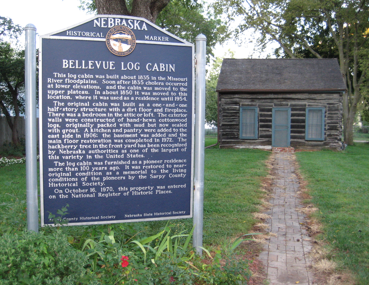
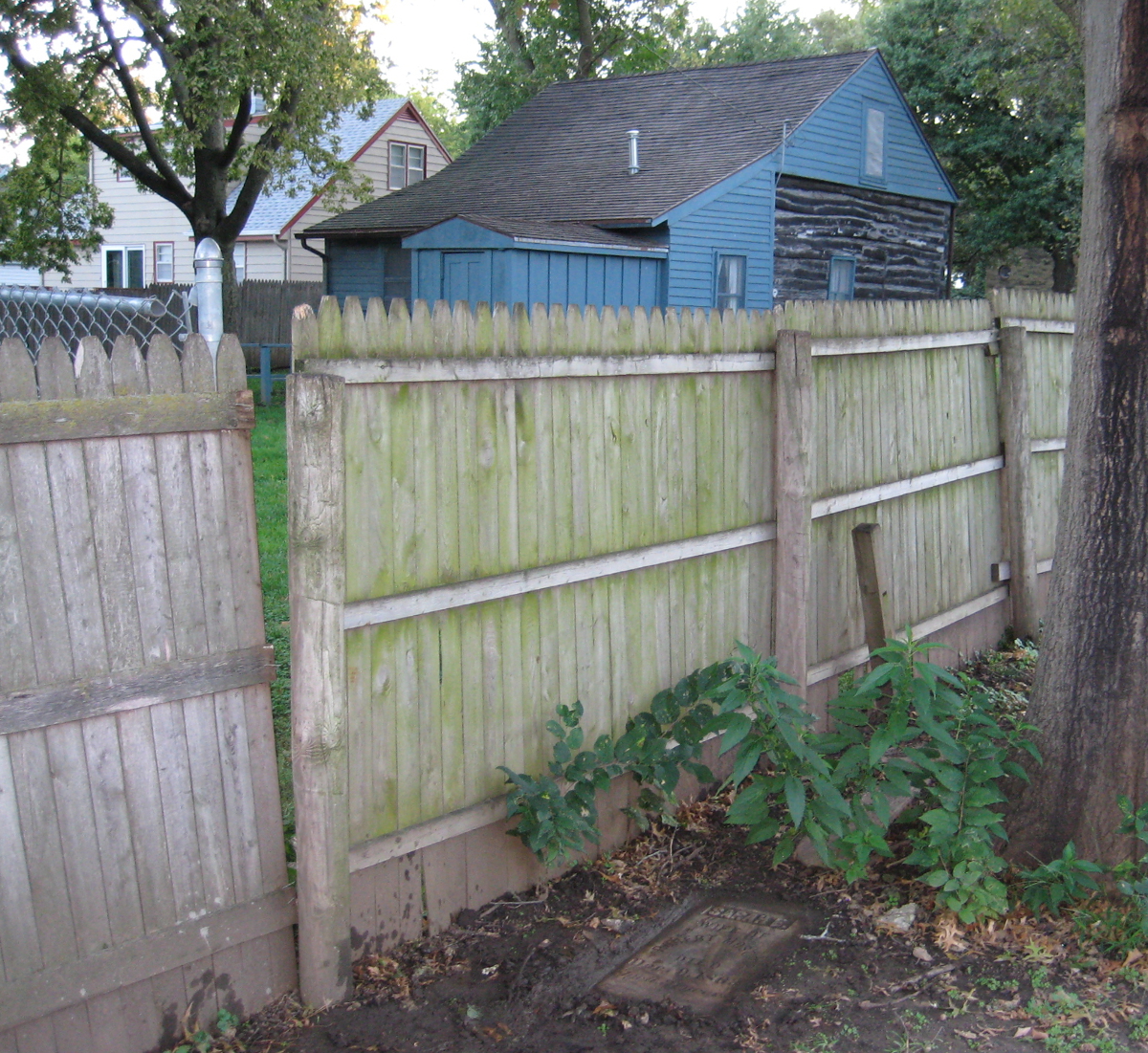
| Description | : | The cemetery, which only has two graves, is located immediately northeast of the historic log cabin at 1805 Hancock St., just outside the fence that protects the cabin. |
frequently asked questions (FAQ):
-
Where is Moscrip Cemetery?
Moscrip Cemetery is located at 1805 Hancock Street Bellevue, Sarpy County ,Nebraska ,USA.
-
Moscrip Cemetery cemetery's updated grave count on graveviews.com?
0 memorials
-
Where are the coordinates of the Moscrip Cemetery?
Latitude: 41.1413500
Longitude: -95.8917000
Nearby Cemetories:
1. Bellevue Cemetery
Bellevue, Sarpy County, USA
Coordinate: 41.1492004, -95.8944016
2. Columban Martyrs Memorial Garden
Bellevue, Sarpy County, USA
Coordinate: 41.1403220, -95.9034390
3. Offutt AFB Cemetery
Sarpy County, USA
Coordinate: 41.1325607, -95.9096451
4. Fontenelle Forest Cemetery
Bellevue, Sarpy County, USA
Coordinate: 41.1636430, -95.8887200
5. Church of the Holy Spirit Columbarium
Bellevue, Sarpy County, USA
Coordinate: 41.1475000, -95.9244000
6. Immanuel Lutheran Church Columbarium
Bellevue, Sarpy County, USA
Coordinate: 41.1602700, -95.9218900
7. Saint Marys Cemetery
Mills County, USA
Coordinate: 41.1517580, -95.8514000
8. Tunison Cemetery
Bellevue, Sarpy County, USA
Coordinate: 41.1357570, -95.9481150
9. Anderson Grove Cemetery
Bellevue, Sarpy County, USA
Coordinate: 41.1285286, -95.9670334
10. Wall Cemetery
Mineola, Mills County, USA
Coordinate: 41.1157990, -95.8153000
11. Laurel Hill Cemetery
Omaha, Douglas County, USA
Coordinate: 41.1918983, -95.9417038
12. Council Point Cemetery
Council Bluffs, Pottawattamie County, USA
Coordinate: 41.2110830, -95.8788610
13. Fisher Farm Cemetery
Bellevue, Sarpy County, USA
Coordinate: 41.1727982, -95.9760971
14. Hrabik Cemetery
Bellevue, Sarpy County, USA
Coordinate: 41.1726540, -95.9768200
15. Saint Johns Cemetery
Bellevue, Sarpy County, USA
Coordinate: 41.1864014, -95.9682999
16. LaPlatte Cemetery
La Platte, Sarpy County, USA
Coordinate: 41.0694008, -95.9336014
17. Saint Mary's Cemetery
Omaha, Douglas County, USA
Coordinate: 41.2042007, -95.9646988
18. Saar's Field Cemetery
Mills County, USA
Coordinate: 41.1255500, -95.7725000
19. Saint Mary Magdalene Cemetery
Omaha, Douglas County, USA
Coordinate: 41.2039420, -95.9850610
20. Godsey Cemetery
Mills County, USA
Coordinate: 41.0705986, -95.8075027
21. Graceland Park Cemetery
Omaha, Douglas County, USA
Coordinate: 41.2113991, -95.9785995
22. Salem Lutheran Church Cemetery
Glenwood, Mills County, USA
Coordinate: 41.1556015, -95.7617035
23. Gowens-Turner Cemetery
Glenwood, Mills County, USA
Coordinate: 41.0715510, -95.7952420
24. Maple Grove Cemetery
Council Bluffs, Pottawattamie County, USA
Coordinate: 41.2265560, -95.8187100