
| Memorials | : | 0 |
| Location | : | Cross Roads, Dyer County, USA |
| Coordinate | : | 35.8980720, -89.3245320 |
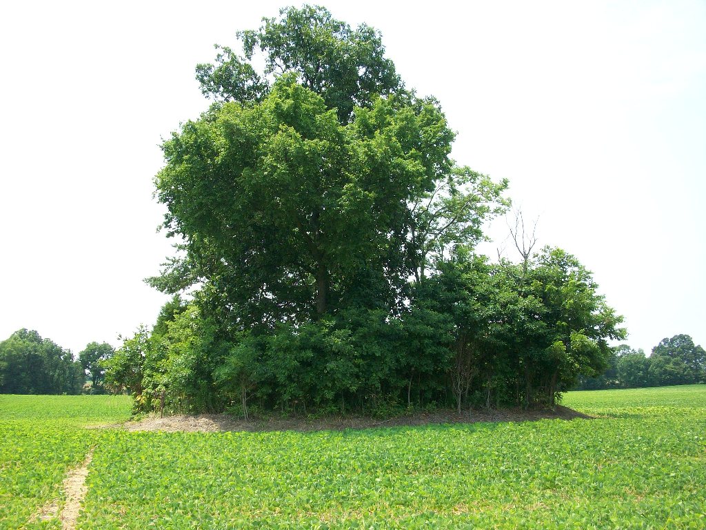
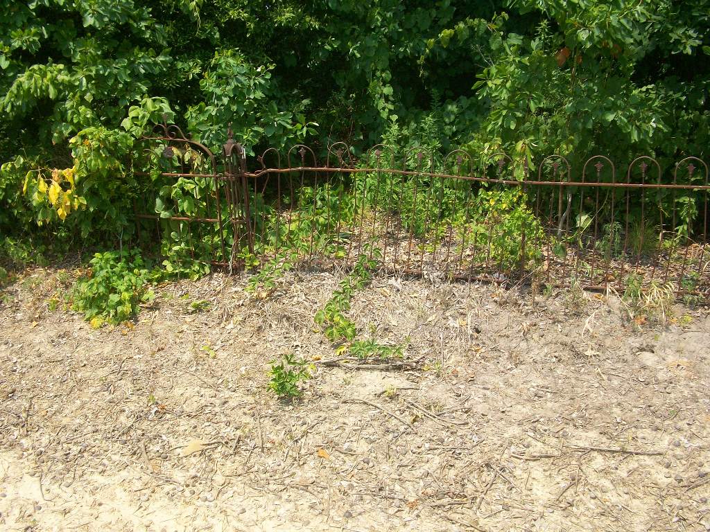
| Description | : | From the intersection of Old Hwy 20 & US-51 S, at Four Points, travel east on Old Hwy 20 for 0.1 mi.; turning south (right) onto TN-210 S, going 2.8 mi.; turning east (left) onto Bruceville Slab Rd., going 3.9 mi.; turning east (left) onto Allen Hines Rd. Exn, going 0.2 mi.; turning slightly left to continue on Allen Hines Rd., going 0.9 mi.; turning east (left) onto a farm road leading about 1000' between the cultivated fields to be within 100 yards of the cemetery to the east, located within a clump of trees, as indicated on USGS topo... Read More |
frequently asked questions (FAQ):
-
Where is Stallcup Family Cemetery?
Stallcup Family Cemetery is located at 68-198 Allen Hines Road Cross Roads, Dyer County ,Tennessee ,USA.
-
Stallcup Family Cemetery cemetery's updated grave count on graveviews.com?
0 memorials
-
Where are the coordinates of the Stallcup Family Cemetery?
Latitude: 35.8980720
Longitude: -89.3245320
Nearby Cemetories:
1. Cock and Irvin Cemetery
Hawkinsville, Dyer County, USA
Coordinate: 35.9104430, -89.3046210
2. Zion Hill Church Cemetery
Friendship, Dyer County, USA
Coordinate: 35.9095110, -89.2900760
3. Palestine Cemetery
Bruceville, Dyer County, USA
Coordinate: 35.9183080, -89.3536090
4. Mount Pisgah Cemetery
Friendship, Dyer County, USA
Coordinate: 35.9162470, -89.2901740
5. South Fork Cemetery
Chestnut Bluff, Crockett County, USA
Coordinate: 35.8646420, -89.3206200
6. Parker - York Cemetery
Chestnut Bluff, Crockett County, USA
Coordinate: 35.8625990, -89.3290210
7. Peal and Bailey Land Cemetery
Bruceville, Dyer County, USA
Coordinate: 35.9256960, -89.3584940
8. Brooks Cemetery
Chestnut Bluff, Crockett County, USA
Coordinate: 35.8593500, -89.3319110
9. Beasley-Albritton Cemetery
Chestnut Bluff, Crockett County, USA
Coordinate: 35.8584710, -89.3160610
10. Millers Chapel Cemetery
Dyersburg, Dyer County, USA
Coordinate: 35.9385986, -89.3163986
11. Shelton Cemetery
Fowlkes, Dyer County, USA
Coordinate: 35.9416530, -89.3281750
12. Nash Cemetery
Dyersburg, Dyer County, USA
Coordinate: 35.9252500, -89.2822230
13. Rowland Cemetery
Chestnut Bluff, Crockett County, USA
Coordinate: 35.8534820, -89.3267150
14. Hardin Cemetery
Friendship, Dyer County, USA
Coordinate: 35.9243270, -89.2766430
15. Mose M. Thompson Cemetery
Friendship, Dyer County, USA
Coordinate: 35.9243680, -89.2765870
16. Glenn Cemetery
Crockett County, USA
Coordinate: 35.8509390, -89.3087660
17. Carter Cemetery
Chestnut Bluff, Crockett County, USA
Coordinate: 35.8500090, -89.3122250
18. Williams Chapel Cemetery
Bonicord, Dyer County, USA
Coordinate: 35.9472008, -89.3221970
19. Staggs Cemetery
Friendship, Dyer County, USA
Coordinate: 35.9397930, -89.2896620
20. Mount Moriah Cemetery
Friendship, Crockett County, USA
Coordinate: 35.8955420, -89.2576300
21. Lebanon United Methodist Church Cemetery
Friendship, Crockett County, USA
Coordinate: 35.8450880, -89.3062070
22. Murray Cemetery
Bonicord, Dyer County, USA
Coordinate: 35.9485000, -89.2969000
23. Green Hill Memorial Garden Cemetery
Halls, Lauderdale County, USA
Coordinate: 35.9139570, -89.3922510
24. Jordan Cemetery
Halls, Lauderdale County, USA
Coordinate: 35.8795030, -89.3917070