
| Memorials | : | 0 |
| Location | : | Harmony Township, Union County, USA |
| Coordinate | : | 39.5682983, -84.9468994 |
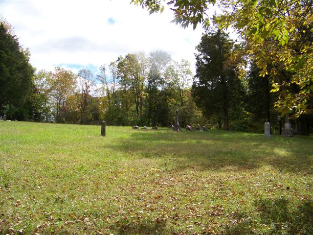
| Description | : | The cemetery is located in Harmony Township (SW quadrant of the SW quadrant of the SW quadrant of Section 36, Township 11N, Range 2W) on the east side of Indiana State Highway 101 about 0.1 miles south of its intersection with W Bull Hill Road and with W Contreras Pike. Indiana Cemetery Locations, Volume 1, published by the Indiana Genealogical Society (02 April 2005), gives the primary cemetery name as New Hope Cemetery. The cemetery is listed in the Cemetery and Burial Grounds Registry of the Indiana Department of Natural Resources (DNR) and in the State Historical Architectural... Read More |
frequently asked questions (FAQ):
-
Where is New Hope Cemetery?
New Hope Cemetery is located at Indiana State Highway 101 Harmony Township, Union County ,Indiana , 47533USA.
-
New Hope Cemetery cemetery's updated grave count on graveviews.com?
0 memorials
-
Where are the coordinates of the New Hope Cemetery?
Latitude: 39.5682983
Longitude: -84.9468994
Nearby Cemetories:
1. Old DuBois Cemetery
Harmony Township, Union County, USA
Coordinate: 39.5522750, -84.9577740
2. Coe Family Cemetery
Billingsville, Union County, USA
Coordinate: 39.5404000, -84.9205000
3. Bath Springs Cemetery
Harmony Township, Union County, USA
Coordinate: 39.5307990, -84.9575700
4. Dunlapsville Cemetery
Dunlapsville, Union County, USA
Coordinate: 39.5894852, -84.9926453
5. Silver Creek Friends Cemetery
Center Township, Union County, USA
Coordinate: 39.6110440, -84.9384080
6. Ward Cemetery
Liberty, Union County, USA
Coordinate: 39.6062280, -84.9090640
7. Sims Cemetery (Defunct)
Liberty, Union County, USA
Coordinate: 39.5309750, -84.9956820
8. Calvary Cemetery
Liberty, Union County, USA
Coordinate: 39.6217003, -84.9364014
9. Sims-Brier Cemetery
Old Bath, Franklin County, USA
Coordinate: 39.5158386, -84.9646606
10. Salem Friends Cemetery
Salem, Union County, USA
Coordinate: 39.6047058, -84.8904114
11. Hand Cemetery
Charlottesville, Union County, USA
Coordinate: 39.5527000, -84.8708000
12. Old Franklin Cemetery
Fairfield Township, Franklin County, USA
Coordinate: 39.5060380, -84.9482280
13. Flint Cemetery
Bath Township, Franklin County, USA
Coordinate: 39.5133710, -84.9052810
14. Drook Cemetery
Liberty, Union County, USA
Coordinate: 39.6306000, -84.9167023
15. Silver Creek Cemetery
Liberty, Union County, USA
Coordinate: 39.6363690, -84.9536790
16. West Point Cemetery
Liberty, Union County, USA
Coordinate: 39.6393890, -84.9372450
17. Keiffer Cemetery
Cottage Grove, Union County, USA
Coordinate: 39.5816994, -84.8525009
18. Poplar Ridge Cemetery
Everton, Fayette County, USA
Coordinate: 39.5619000, -85.0447000
19. Mount Pleasant Cemetery
Dunlapsville, Union County, USA
Coordinate: 39.6280400, -85.0159240
20. Patterson Cemetery
Liberty, Union County, USA
Coordinate: 39.6514015, -84.9468994
21. Hanson-Crandel Cemetery
Connersville, Fayette County, USA
Coordinate: 39.5984100, -85.0501400
22. Sering Cemetery
Liberty, Union County, USA
Coordinate: 39.6530991, -84.9269028
23. Bethlehem Cemetery
Bath, Franklin County, USA
Coordinate: 39.5159190, -84.8555230
24. Young Cemetery
Cottage Grove, Union County, USA
Coordinate: 39.5665260, -84.8269710