
| Memorials | : | 0 |
| Location | : | Washington County, USA |
| Coordinate | : | 35.8481865, -94.2252731 |
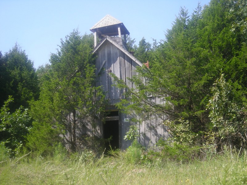
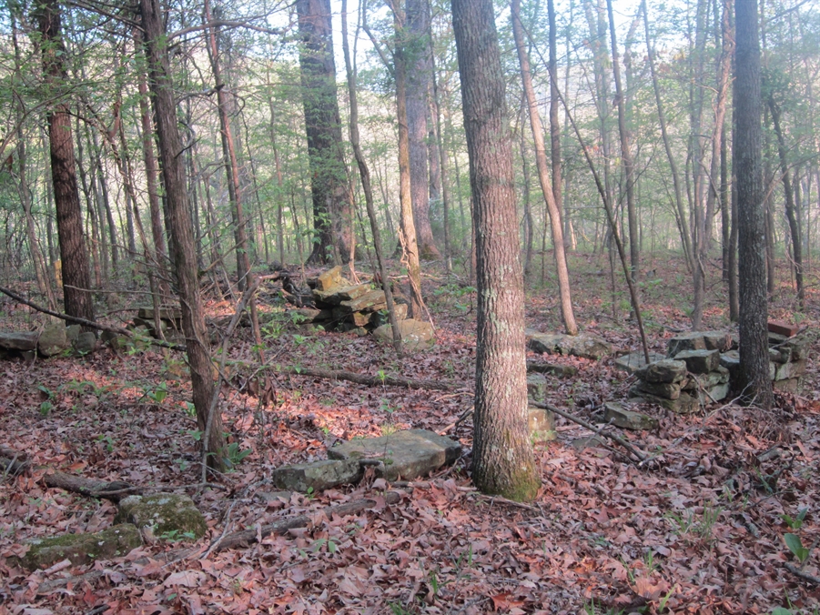
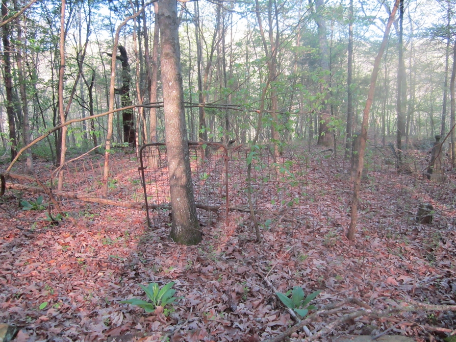
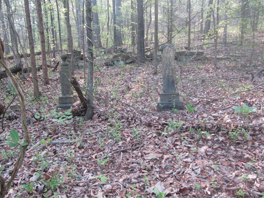
| Description | : | This cemetery is only accessable by walking or horse back; steep terrian, rock cliffs, over grown brush and trees will keep most all folks from trying to find this cemetery. The land now is privitely owned. Its located in Section 1, Township 14, Rage 31 of Lee's Creek. This was the original spot of the Old Bethlehem Baptist Church (which was moved over 50 years ago) to a new location on top of the mountain along side of the county road known now as county rd. 237, approximately one and half miles north of the original location down near... Read More |
frequently asked questions (FAQ):
-
Where is Old Bethlehem Baptist Church Cemetery?
Old Bethlehem Baptist Church Cemetery is located at Washington County ,Arkansas ,USA.
-
Old Bethlehem Baptist Church Cemetery cemetery's updated grave count on graveviews.com?
0 memorials
-
Where are the coordinates of the Old Bethlehem Baptist Church Cemetery?
Latitude: 35.8481865
Longitude: -94.2252731

Nearby Cemetories:
1. McClelland Cemetery
Washington County, USA
Coordinate: 35.8635950, -94.2410980
2. Low Gap Cemetery
West Fork, Washington County, USA
Coordinate: 35.8658218, -94.2063904
3. Serenity Place Cemetery
Washington County, USA
Coordinate: 35.8312100, -94.2665000
4. Zinnamon Cemetery
West Fork, Washington County, USA
Coordinate: 35.8230000, -94.2682000
5. Union Star Cemetery
West Fork, Washington County, USA
Coordinate: 35.8922005, -94.2031021
6. Burris Cemetery
Washington County, USA
Coordinate: 35.8935000, -94.2482650
7. Holcomb Cemetery
West Fork, Washington County, USA
Coordinate: 35.8954065, -94.2519087
8. McDonald Cemetery
Onda, Washington County, USA
Coordinate: 35.8806000, -94.2799988
9. Dripping Springs Cemetery
Onda, Washington County, USA
Coordinate: 35.8584310, -94.2932080
10. Friendship Cemetery
West Fork, Washington County, USA
Coordinate: 35.9043740, -94.2217230
11. Baker Cemetery
Onda, Washington County, USA
Coordinate: 35.8680992, -94.2910995
12. Choate Cemetery
Onda, Washington County, USA
Coordinate: 35.8938200, -94.2732500
13. Karnes Cemetery
West Fork, Washington County, USA
Coordinate: 35.9084930, -94.1865082
14. Phillips Cemetery
Hogeye, Washington County, USA
Coordinate: 35.9119760, -94.2556360
15. Fall Creek Cemetery
Strickler, Washington County, USA
Coordinate: 35.8344110, -94.3098330
16. Parks Cemetery
Hogeye, Washington County, USA
Coordinate: 35.8988991, -94.2906036
17. Howell Cemetery
Prairie Grove, Washington County, USA
Coordinate: 35.9056015, -94.2835999
18. Billingsley Cemetery
West Fork, Washington County, USA
Coordinate: 35.9132996, -94.2716980
19. Carney Cemetery
Washington County, USA
Coordinate: 35.9242710, -94.2484530
20. English Cemetery
Strickler, Washington County, USA
Coordinate: 35.7970000, -94.3015770
21. Liberty 86 Cemetery
Strickler, Washington County, USA
Coordinate: 35.7844009, -94.2910995
22. West Fork Cemetery
West Fork, Washington County, USA
Coordinate: 35.9324989, -94.1932983
23. Morrow Cemetery
Washington County, USA
Coordinate: 35.8492012, -94.3380966
24. Brewster Simpson Cemetery
Washington County, USA
Coordinate: 35.8609620, -94.3390260