
| Memorials | : | 3 |
| Location | : | Nassington, East Northamptonshire Borough, England |
| Coordinate | : | 52.5530000, -0.4332000 |
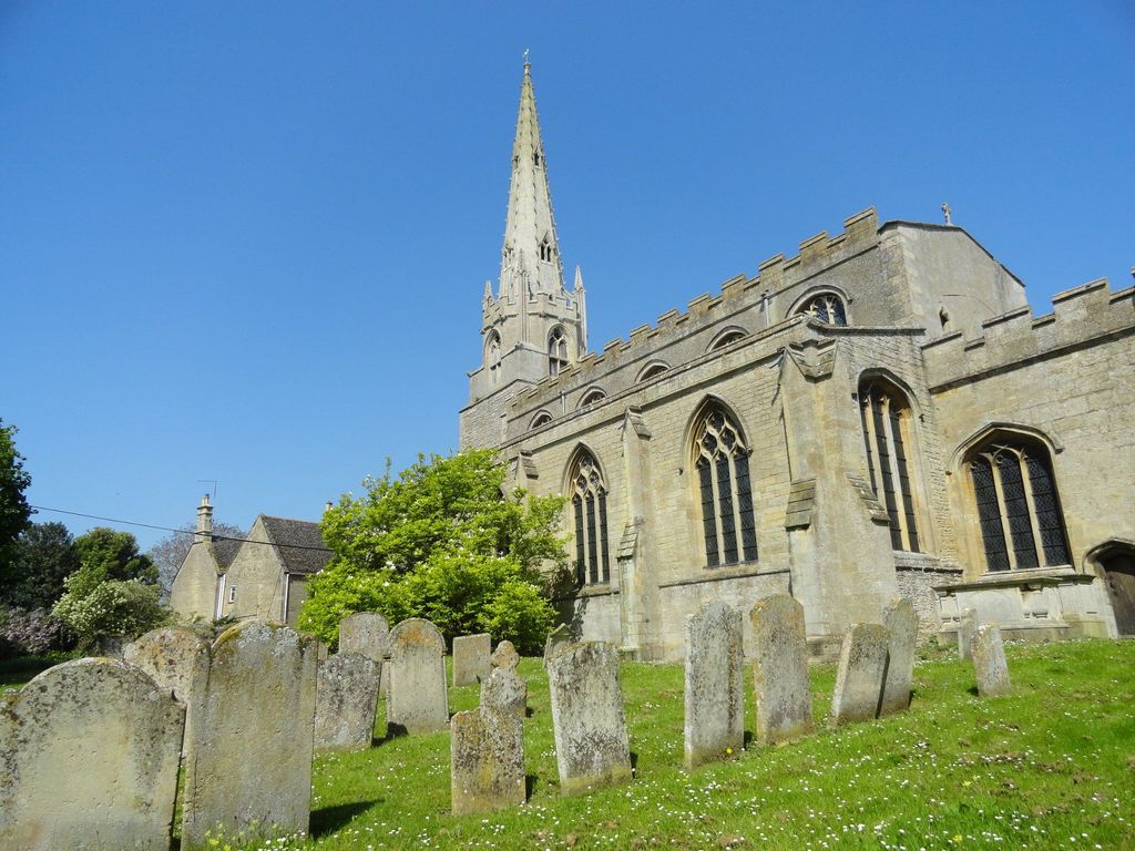
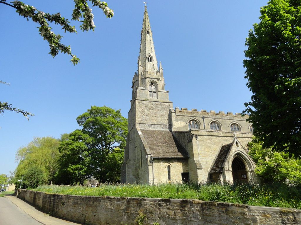
| Description | : | St Mary's Church dates back to 1193 and was restored in 1885 but respected it's ancient fabric. The churchyard was closed along with the one at neighbouring Yarwell in the late 1880’s; or more specifically were served with closure by Order in Council in the years 1881 and 1882 respectively. Some of the headstones can be deciphered while others are covered in lichens perhaps because they are sheltered by a large tree or located near the Millennium Yews/Shrubs. The headstones on the other side of the church are much harder to decipher as they have clearly spent a long time in the... Read More |
frequently asked questions (FAQ):
-
Where is Saint Mary the Virgin & All Saints Churchyard?
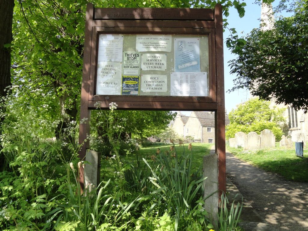
Saint Mary the Virgin & All Saints Churchyard is located at Church Street Nassington, East Northamptonshire Borough ,Northamptonshire , PE8 6QGEngland.
-
Saint Mary the Virgin & All Saints Churchyard cemetery's updated grave count on graveviews.com?
2 memorials
-
Where are the coordinates of the Saint Mary the Virgin & All Saints Churchyard?
Latitude: 52.5530000
Longitude: -0.4332000
Nearby Cemetories:
1. Yarwell Anglican and Methodist Church
Yarwell, East Northamptonshire Borough, England
Coordinate: 52.5671280, -0.4216160
2. Nassington and Yarwell Cemetery
Yarwell, East Northamptonshire Borough, England
Coordinate: 52.5682373, -0.4263580
3. All Saints Churchyard
Elton, Huntingdonshire District, England
Coordinate: 52.5320200, -0.4063200
4. St Mary the Virgin and All Saints Churchyard
Fotheringhay, East Northamptonshire Borough, England
Coordinate: 52.5258330, -0.4390740
5. Fotheringhay Castle
Fotheringhay, East Northamptonshire Borough, England
Coordinate: 52.5243170, -0.4363420
6. St Mary the Virgin Church
Wansford, Huntingdonshire District, England
Coordinate: 52.5805160, -0.4173890
7. St Mary Churchyard
Woodnewton, East Northamptonshire Borough, England
Coordinate: 52.5392210, -0.4795790
8. St John the Baptist Churchyard
Stibbington, Huntingdonshire District, England
Coordinate: 52.5748920, -0.3926720
9. St Leonard Churchyard
Apethorpe, East Northamptonshire Borough, England
Coordinate: 52.5495140, -0.4899340
10. St. Michael & All Angels
Sutton, Peterborough Unitary Authority, England
Coordinate: 52.5754356, -0.3853515
11. St Remigius Churchyard
Water Newton, Huntingdonshire District, England
Coordinate: 52.5624550, -0.3656390
12. Kings Cliffe Cemetery
Kings Cliffe, East Northamptonshire Borough, England
Coordinate: 52.5605586, -0.5102005
13. Saint Mary the Virgin Churchyard
Warmington, East Northamptonshire Borough, England
Coordinate: 52.5064111, -0.4144919
14. St. Mary's Churchyard
Tansor, East Northamptonshire Borough, England
Coordinate: 52.5057500, -0.4493700
15. All Saints Churchyard
Kings Cliffe, East Northamptonshire Borough, England
Coordinate: 52.5622450, -0.5160080
16. All Saints Churchyard
Wittering, Peterborough Unitary Authority, England
Coordinate: 52.6058600, -0.4421600
17. St. Michael's Churchyard
Chesterton, Huntingdonshire District, England
Coordinate: 52.5451434, -0.3400366
18. St Kyneburgha Churchyard
Castor, Peterborough Unitary Authority, England
Coordinate: 52.5729580, -0.3417630
19. St. Andrew's Church
Alwalton, Huntingdonshire District, England
Coordinate: 52.5495800, -0.3297610
20. Alwalton Cemetery
Alwalton, Huntingdonshire District, England
Coordinate: 52.5501113, -0.3288831
21. St Leonard's Churchyard
Glapthorn, East Northamptonshire Borough, England
Coordinate: 52.5001397, -0.4924849
22. St. Mary's Churchyard
Peterborough, Peterborough Unitary Authority, England
Coordinate: 52.5184227, -0.3295881
23. St. Peter's Churchyard
Oundle, East Northamptonshire Borough, England
Coordinate: 52.4817430, -0.4671130
24. St. Andrew's Churchyard
Ufford, Peterborough Unitary Authority, England
Coordinate: 52.6230210, -0.3864660