
| Memorials | : | 1 |
| Location | : | Greenwood, El Dorado County, USA |
| Coordinate | : | 38.9431600, -120.9158000 |
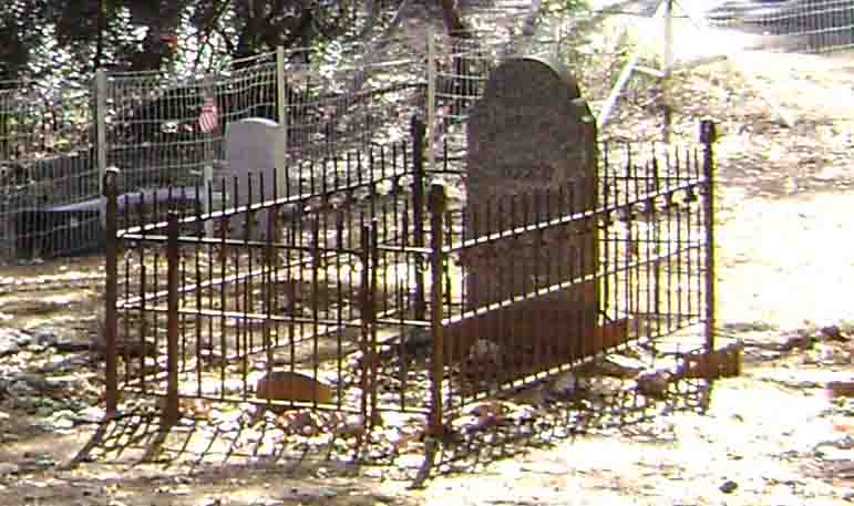
| Description | : | Located outside of Greenwood on Sliger Mine Road. It is .227 of a acre. About 70 plots are shown in a Ground Penetrating Radar map. Spanish Dry Diggings was established in 1850 as a mining community that lasted until the 1940's. ~~~~~~~~~~~~~~~~~~~~~~~~~ From the book: Historical souvenir of El Dorado County, California/page 185 Spanish Dry Diggings is situated in the northern part of El Dorado county, on the summit of the hill above the Middle Fork of the American river, five miles from Georgetown, four miles from Greenwood. In 1848, Don Andreas Pico, brother of ex-Governor Pio Pico, organized a... Read More |
frequently asked questions (FAQ):
-
Where is Spanish Dry Diggings Cemetery?
Spanish Dry Diggings Cemetery is located at Greenwood, El Dorado County ,California ,USA.
-
Spanish Dry Diggings Cemetery cemetery's updated grave count on graveviews.com?
1 memorials
-
Where are the coordinates of the Spanish Dry Diggings Cemetery?
Latitude: 38.9431600
Longitude: -120.9158000


Nearby Cemetories:
1. Greenwood Pioneer Cemetery
Greenwood, El Dorado County, USA
Coordinate: 38.8985786, -120.9099274
2. Georgetown-Renke Cemetery Annex
Georgetown, El Dorado County, USA
Coordinate: 38.8964610, -120.9116240
3. Spring Garden Indian Cemetery
Foresthill, Placer County, USA
Coordinate: 38.9998620, -120.9049310
4. Georgia Slide Cemetery
Georgetown, El Dorado County, USA
Coordinate: 38.9218063, -120.8377838
5. Esoteric Fraternity Cemetery
Applegate, Placer County, USA
Coordinate: 38.9946190, -120.9687490
6. Georgetown Pioneer Cemetery
Georgetown, El Dorado County, USA
Coordinate: 38.9068108, -120.8430862
7. Todd Valley Cemetery
Placer County, USA
Coordinate: 38.9970900, -120.8541000
8. Carmelite Monastery Cemetery
Georgetown, El Dorado County, USA
Coordinate: 38.9273300, -120.8173840
9. Clipper Gap Cemetery
Clipper Gap, Placer County, USA
Coordinate: 38.9784880, -121.0256590
10. Yankee Jims Cemetery
Foresthill, Placer County, USA
Coordinate: 39.0292511, -120.8614349
11. Josephine Mine Cemetery
Volcanoville, El Dorado County, USA
Coordinate: 38.9798000, -120.7892170
12. Weimar Sanatorium Cemetery
Weimar, Placer County, USA
Coordinate: 39.0350200, -120.9834400
13. Alabama Flat Cemetery
Garden Valley, El Dorado County, USA
Coordinate: 38.8413660, -120.8770510
14. Foresthill Community Cemetery
Foresthill, Placer County, USA
Coordinate: 39.0184500, -120.8114700
15. Saint Joseph Catholic Cemetery
Foresthill, Placer County, USA
Coordinate: 39.0240200, -120.8068800
16. First Congregational Church Memorial Garden
Auburn, Placer County, USA
Coordinate: 38.9118660, -121.0711770
17. Bayley Family Cemetery
Pilot Hill, El Dorado County, USA
Coordinate: 38.8438800, -121.0148900
18. Placer County Hospital Cemetery
Auburn, Placer County, USA
Coordinate: 38.9045120, -121.0721320
19. Chinese Cemetery
Auburn, Placer County, USA
Coordinate: 38.9183502, -121.0802383
20. Bethlehem Lutheran Church Columbarium
Auburn, Placer County, USA
Coordinate: 38.8932350, -121.0749690
21. Clark Ashton Smith Gravesite
Auburn, Placer County, USA
Coordinate: 38.8952100, -121.0770500
22. Pilot Hill Cemetery
Pilot Hill, El Dorado County, USA
Coordinate: 38.8301010, -121.0093307
23. Old Auburn Cemetery
Auburn, Placer County, USA
Coordinate: 38.9023720, -121.0812230
24. New Auburn Cemetery
Auburn, Placer County, USA
Coordinate: 38.9026900, -121.0870800