
| Memorials | : | 97 |
| Location | : | Delphos, Allen County, USA |
| Coordinate | : | 40.8451390, -84.2889380 |
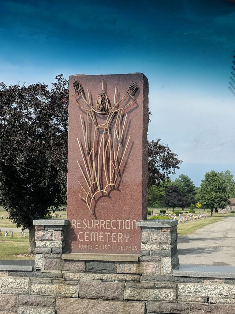
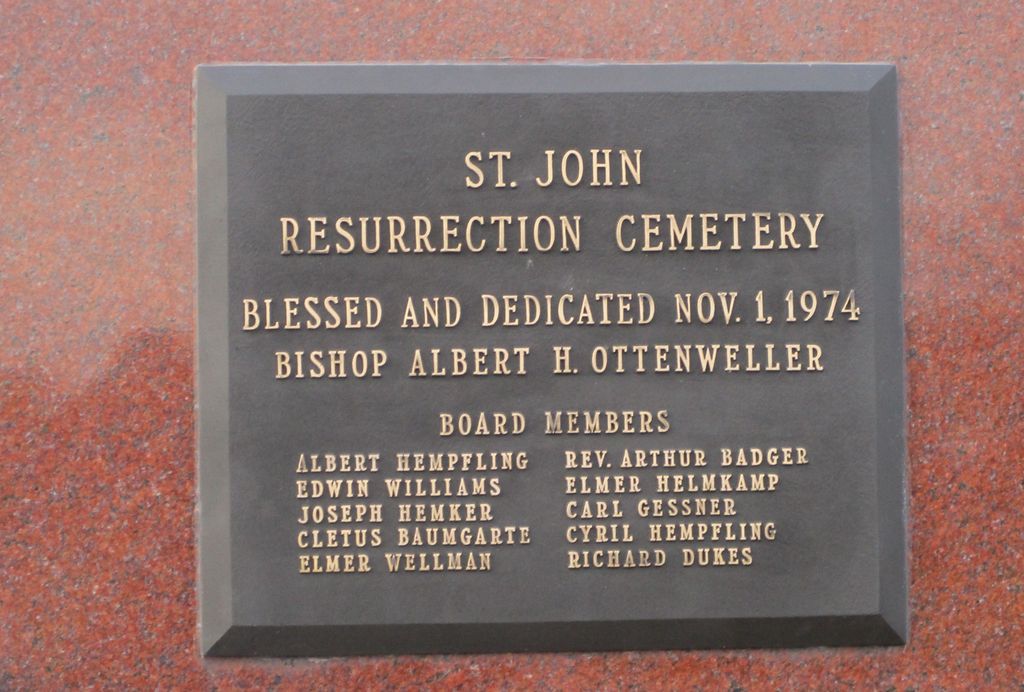
| Description | : | The cemetery is located on the northeast corner of the intersection of Lincoln Highway and N Defiance Trail. This cemetery, designed in 1973, is the newer of two cemeteries, which are 2.2 miles apart, associated with the Saint John The Evangelist Catholic Parish in Delphos. The cemetery is located in Marion Township, Allen County, Ohio, and is # 180 (New Saint Johns Catholic Cemetery / Resurrection Cemetery) in “Ohio Cemeteries 1803-2003”, compiled by the Ohio Genealogical Society. |
frequently asked questions (FAQ):
-
Where is New Saint John's Catholic Cemetery?
New Saint John's Catholic Cemetery is located at N Defiance Trail and Lincoln Highway Delphos, Allen County ,Ohio , 45844USA.
-
New Saint John's Catholic Cemetery cemetery's updated grave count on graveviews.com?
91 memorials
-
Where are the coordinates of the New Saint John's Catholic Cemetery?
Latitude: 40.8451390
Longitude: -84.2889380
Nearby Cemetories:
1. Hartshorn Cemetery
Allen County, USA
Coordinate: 40.8424988, -84.2908020
2. Walnut Grove Cemetery
Delphos, Allen County, USA
Coordinate: 40.8300018, -84.2906036
3. Saint John's Catholic Cemetery
Delphos, Allen County, USA
Coordinate: 40.8423620, -84.3319580
4. King Cemetery
Marion Township, Allen County, USA
Coordinate: 40.8060989, -84.2869034
5. Westside Cemetery
Delphos, Van Wert County, USA
Coordinate: 40.8452988, -84.3507996
6. Mount Calvary Cemetery
Fort Jennings, Putnam County, USA
Coordinate: 40.8986015, -84.3035965
7. Raabe Cemetery
Fort Jennings, Putnam County, USA
Coordinate: 40.8993988, -84.2789001
8. Pike Cemetery
Elida, Allen County, USA
Coordinate: 40.7947006, -84.2585983
9. Carmen Cemetery
Gomer, Allen County, USA
Coordinate: 40.8531380, -84.2118660
10. Saint Joseph Cemetery
Fort Jennings, Putnam County, USA
Coordinate: 40.9056015, -84.2928009
11. Hadding Cemetery
Gomer, Allen County, USA
Coordinate: 40.8319016, -84.2035980
12. Doner Cemetery
Elida, Allen County, USA
Coordinate: 40.7951330, -84.2277470
13. Keirns Cemetery
Sugar Creek Township, Putnam County, USA
Coordinate: 40.8875008, -84.2181015
14. Sharon Mennonite Cemetery
Elida, Allen County, USA
Coordinate: 40.7828080, -84.2332721
15. Salem Mennonite Cemetery
Elida, Allen County, USA
Coordinate: 40.8171220, -84.1851000
16. Lutheran Cemetery
Elida, Allen County, USA
Coordinate: 40.7877998, -84.2050018
17. Ottawa River Cemetery
Rimer, Putnam County, USA
Coordinate: 40.9061012, -84.2080994
18. Saint John the Baptist Catholic Cemetery
Landeck, Allen County, USA
Coordinate: 40.7999992, -84.3874969
19. Saint Marys Cemetery
Ottoville, Putnam County, USA
Coordinate: 40.9261017, -84.3399963
20. Pike Run Cemetery
Gomer, Allen County, USA
Coordinate: 40.8432999, -84.1669006
21. Hammons Cemetery
Ottoville, Putnam County, USA
Coordinate: 40.9223370, -84.3701410
22. Greenlawn Cemetery
Elida, Allen County, USA
Coordinate: 40.7691994, -84.2024994
23. Reynolds Cemetery
Sugar Creek Township, Putnam County, USA
Coordinate: 40.9232940, -84.1986030
24. West Union Cemetery
Spencerville, Allen County, USA
Coordinate: 40.7574997, -84.3641968