
| Memorials | : | 0 |
| Location | : | Bishops Caundle, West Dorset District, England |
| Coordinate | : | 50.9171310, -2.4336400 |
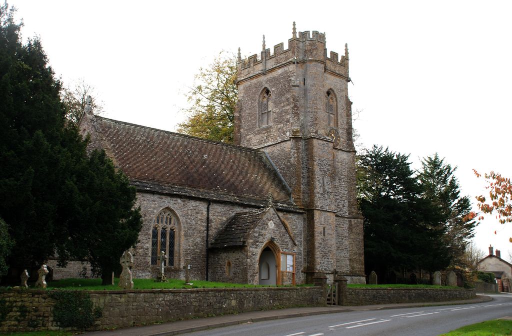
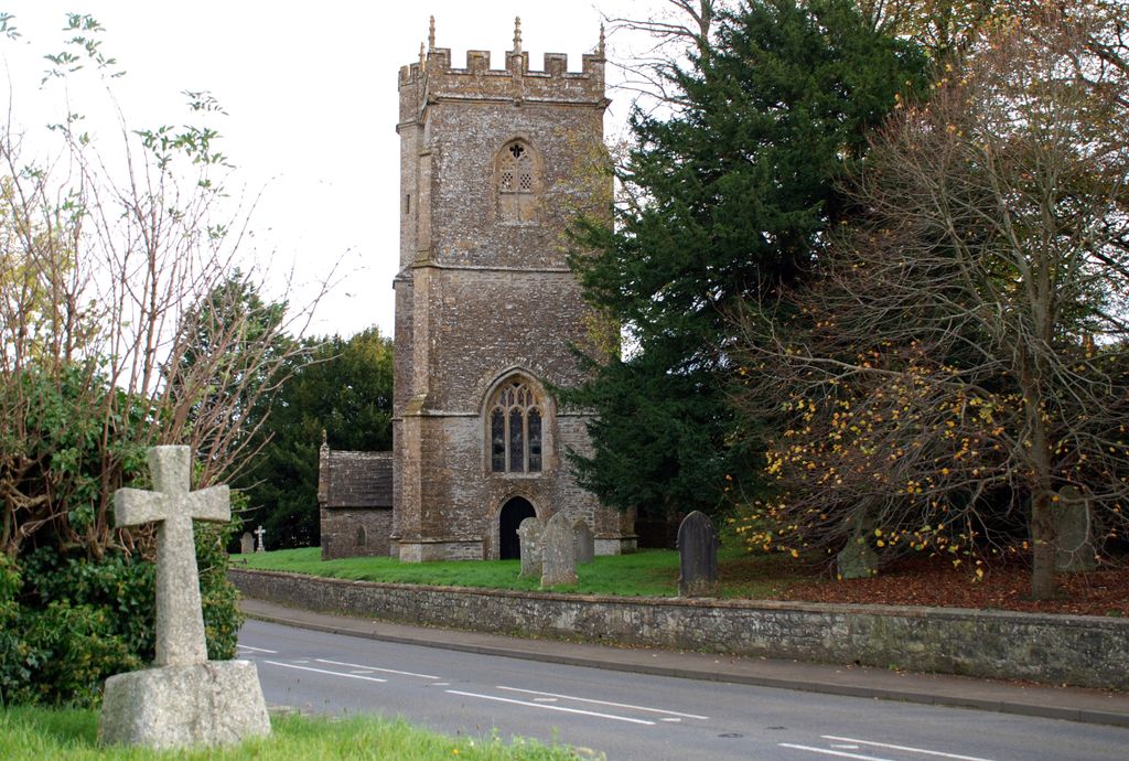
| Description | : | Bishop's Caundle or Caundle Bishop is a parish in the area of Sherborne, about 5 miles South-east by east from Sherborne, and 6 miles South-west from Sturminster Newton in England. The origin of the name Caundle is probably Celtic, and was formerly the name of the range of low hills that lay mainly to the north of the village of Caundle Bishop in England. The church is an ancient edifice with a tower containing four bells. The dedication of the church is unknown. Much of the main body of the church dates from the 14th century. |
frequently asked questions (FAQ):
-
Where is Bishops Caundle?
Bishops Caundle is located at Caundle Street Bishops Caundle, West Dorset District ,Dorset , DT9 5NLEngland.
-
Bishops Caundle cemetery's updated grave count on graveviews.com?
0 memorials
-
Where are the coordinates of the Bishops Caundle?
Latitude: 50.9171310
Longitude: -2.4336400
Nearby Cemetories:
1. Bishop's Caundle Extension Cemetery
Bishops Caundle, West Dorset District, England
Coordinate: 50.9169370, -2.4343580
2. Saint Laurence Churchyard
Holwell, West Dorset District, England
Coordinate: 50.9063460, -2.4288180
3. St. Peter and St. Paul's Churchyard
Caundle Marsh, West Dorset District, England
Coordinate: 50.9176840, -2.4596680
4. St Barnabas Church
Stock Gaylard, North Dorset District, England
Coordinate: 50.9148900, -2.3968200
5. Saint Barnabas Churchyard
Lydlinch, North Dorset District, England
Coordinate: 50.9157030, -2.3961520
6. St. Peter's Churchyard
Stourton Caundle, North Dorset District, England
Coordinate: 50.9354210, -2.4080470
7. Stourton Caundle Civic Cemetery
Stourton Caundle, North Dorset District, England
Coordinate: 50.9349030, -2.4065510
8. St Lawrence Churchyard
Folke, West Dorset District, England
Coordinate: 50.9179430, -2.4854020
9. St. Catherine's Churchyard
Haydon, West Dorset District, England
Coordinate: 50.9404290, -2.4702910
10. St. Mary Magdalene Churchyard
North Wootton, West Dorset District, England
Coordinate: 50.9281260, -2.4895320
11. Purse Caundle Civic Cemetery
Purse Caundle, West Dorset District, England
Coordinate: 50.9553680, -2.4327770
12. St. Peter's Churchyard
Purse Caundle, West Dorset District, England
Coordinate: 50.9569440, -2.4342330
13. St. Peter's Churchyard
Goathill, West Dorset District, England
Coordinate: 50.9534230, -2.4628960
14. St. Thomas A. Beckett Churchyard
Lydlinch, North Dorset District, England
Coordinate: 50.9190370, -2.3675640
15. Long Burton Methodist Churchyard
Longburton, West Dorset District, England
Coordinate: 50.9074120, -2.4988250
16. St. James The Great Churchyard
Longburton, West Dorset District, England
Coordinate: 50.9130390, -2.5010040
17. St. Thomas A' Beckett Churchyard
Pulham, North Dorset District, England
Coordinate: 50.8753720, -2.4111670
18. Holnest Churchyard
Holnest, West Dorset District, England
Coordinate: 50.8870090, -2.4895200
19. St. Mary's Churchyard
Glanvilles Wootton, North Dorset District, England
Coordinate: 50.8717800, -2.4558510
20. Milborne Port Churchyard
Milborne Port, South Somerset District, England
Coordinate: 50.9653900, -2.4621550
21. Milborne Port Cemetery
Milborne Port, South Somerset District, England
Coordinate: 50.9662940, -2.4605880
22. St Mary Magdalene Churchyard
Castleton, West Dorset District, England
Coordinate: 50.9496210, -2.5050130
23. St Mary Churchyard
Stalbridge, North Dorset District, England
Coordinate: 50.9623690, -2.3808740
24. St. Cuthbert's Old Church
Oborne, West Dorset District, England
Coordinate: 50.9588620, -2.4947350