
| Memorials | : | 1 |
| Location | : | Stock Gaylard, North Dorset District, England |
| Coordinate | : | 50.9148900, -2.3968200 |
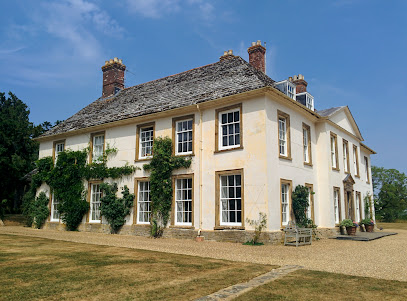
| Description | : | The church is the parish church of Stock Gaylard. It is not known precisely when it was built but it existed at the time of the Crusades since a Crusader, Sir Ingelramus de Waleys, was buried here and his effigy still exists, which dates the church back to the 12 or 13th Century. The church was restored in 1884, in memory of Mr and Mrs H.F. Yeatman by their children, Bishop Huyshe Walcott Yeatman-Biggs of Worcester, and his brother and sister. |
frequently asked questions (FAQ):
-
Where is St Barnabas Church?
St Barnabas Church is located at Stock Gaylard, North Dorset District ,Dorset ,England.
-
St Barnabas Church cemetery's updated grave count on graveviews.com?
1 memorials
-
Where are the coordinates of the St Barnabas Church?
Latitude: 50.9148900
Longitude: -2.3968200
Nearby Cemetories:
1. Saint Barnabas Churchyard
Lydlinch, North Dorset District, England
Coordinate: 50.9157030, -2.3961520
2. St. Thomas A. Beckett Churchyard
Lydlinch, North Dorset District, England
Coordinate: 50.9190370, -2.3675640
3. Stourton Caundle Civic Cemetery
Stourton Caundle, North Dorset District, England
Coordinate: 50.9349030, -2.4065510
4. St. Peter's Churchyard
Stourton Caundle, North Dorset District, England
Coordinate: 50.9354210, -2.4080470
5. Saint Laurence Churchyard
Holwell, West Dorset District, England
Coordinate: 50.9063460, -2.4288180
6. Bishops Caundle
Bishops Caundle, West Dorset District, England
Coordinate: 50.9171310, -2.4336400
7. Bishop's Caundle Extension Cemetery
Bishops Caundle, West Dorset District, England
Coordinate: 50.9169370, -2.4343580
8. St. Peter and St. Paul's Churchyard
Caundle Marsh, West Dorset District, England
Coordinate: 50.9176840, -2.4596680
9. St. Thomas A' Beckett Churchyard
Pulham, North Dorset District, England
Coordinate: 50.8753720, -2.4111670
10. All Saints Church, Fifehead Neville
Fifehead Neville, North Dorset District, England
Coordinate: 50.8980180, -2.3312380
11. All Saints
Fifehead Neville, North Dorset District, England
Coordinate: 50.8980320, -2.3311970
12. Purse Caundle Civic Cemetery
Purse Caundle, West Dorset District, England
Coordinate: 50.9553680, -2.4327770
13. St. Peter's Churchyard
Purse Caundle, West Dorset District, England
Coordinate: 50.9569440, -2.4342330
14. St Mary Churchyard
Stalbridge, North Dorset District, England
Coordinate: 50.9623690, -2.3808740
15. St. Mary and St. James Churchyard
Hazelbury Bryan, North Dorset District, England
Coordinate: 50.8736000, -2.3520000
16. St. Catherine's Churchyard
Haydon, West Dorset District, England
Coordinate: 50.9404290, -2.4702910
17. St Lawrence Churchyard
Folke, West Dorset District, England
Coordinate: 50.9179430, -2.4854020
18. St. Peter's Churchyard
Goathill, West Dorset District, England
Coordinate: 50.9534230, -2.4628960
19. St. Mary's Churchyard
Glanvilles Wootton, North Dorset District, England
Coordinate: 50.8717800, -2.4558510
20. Sturminster Newton Cemetery
Sturminster Newton, North Dorset District, England
Coordinate: 50.9211500, -2.3043400
21. St Mary Churchyard
Sturminster Newton, North Dorset District, England
Coordinate: 50.9246320, -2.3031860
22. St. Mary Magdalene Churchyard
North Wootton, West Dorset District, England
Coordinate: 50.9281260, -2.4895320
23. St Nicholas Churchyard
Henstridge, South Somerset District, England
Coordinate: 50.9762610, -2.3957980
24. St Peter and St Paul Churchyard
Mappowder, North Dorset District, England
Coordinate: 50.8527740, -2.3773230