
| Memorials | : | 1 |
| Location | : | Godstone, Tandridge District, England |
| Coordinate | : | 51.2465740, -0.0567650 |
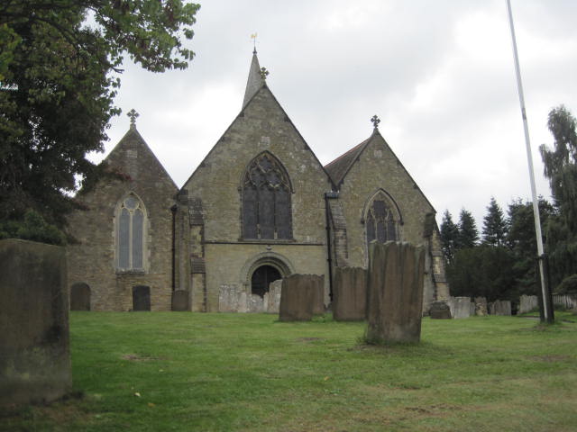
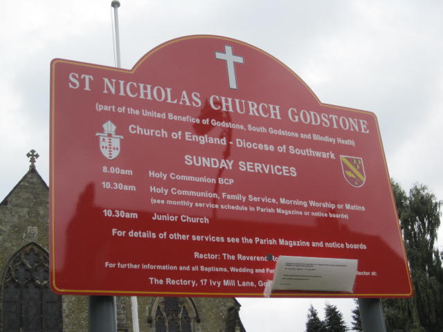
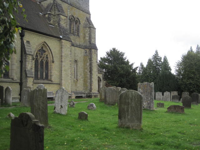
| Description | : | The Church of Saint Nicholas at ChurchLane, Godstone, RH9 8BW is in Church Town. Although Church Lane was part of themain route from London to the south coast after the Roman road sank, the laneis very narrow and often extremely congested, whereas around the green there areseveral free car parks and some on-street parking. From the village green to thelytchgate at St. Nicholas is less than half a mile on level ground by a footpathon the south side of the partly 16th century White Hart public house/restaurantand the Bay Pond nature reserve. On the site of a Norman church,building from... Read More |
frequently asked questions (FAQ):
-
Where is Saint Nicholas Churchyard?
Saint Nicholas Churchyard is located at Church Lane Godstone, Tandridge District ,Surrey ,England.
-
Saint Nicholas Churchyard cemetery's updated grave count on graveviews.com?
1 memorials
-
Where are the coordinates of the Saint Nicholas Churchyard?
Latitude: 51.2465740
Longitude: -0.0567650
Nearby Cemetories:
1. St Peter Churchyard
Tandridge, Tandridge District, England
Coordinate: 51.2429480, -0.0320950
2. Bletchingley Cemetery
Bletchingley, Tandridge District, England
Coordinate: 51.2411080, -0.0911120
3. St Mary Churchyard
Bletchingley, Tandridge District, England
Coordinate: 51.2413460, -0.0994430
4. Convent of the Sacred Heart Cemetery
Woldingham, Tandridge District, England
Coordinate: 51.2755490, -0.0508110
5. St Mary the Virgin Churchyard
Oxted, Tandridge District, England
Coordinate: 51.2590680, -0.0086690
6. St. Agatha Churchyard
Woldingham, Tandridge District, England
Coordinate: 51.2771930, -0.0350300
7. Caterham Cemetery
Caterham, Tandridge District, England
Coordinate: 51.2824240, -0.0846160
8. St. Mary the Virgin Churchyard
Caterham, Tandridge District, England
Coordinate: 51.2821440, -0.0856350
9. St Lawrence Church
Caterham, Tandridge District, England
Coordinate: 51.2820880, -0.0858740
10. St Peter and St Paul Churchyard
Nutfield, Tandridge District, England
Coordinate: 51.2419780, -0.1258540
11. St Peter Churchyard
Limpsfield, Tandridge District, England
Coordinate: 51.2609596, 0.0123030
12. St. John the Evangelist Churchyard
Blindley Heath, Tandridge District, England
Coordinate: 51.1961510, -0.0536070
13. St. Lawrence's Hospital Burial Ground
Caterham, Tandridge District, England
Coordinate: 51.2878640, -0.1079560
14. St James Churchyard
Titsey, Tandridge District, England
Coordinate: 51.2763810, 0.0186740
15. Chaldon Saint Peter and Saint Paul Churchyard
Whyteleafe, Tandridge District, England
Coordinate: 51.2852778, -0.1248302
16. St John the Baptist Churchyard
Outwood, Tandridge District, England
Coordinate: 51.1981770, -0.1127510
17. Greenlawn Memorial Park
Warlingham, Tandridge District, England
Coordinate: 51.3079900, -0.0395000
18. St Katharine's Churchyard
Merstham, Reigate and Banstead Borough, England
Coordinate: 51.2689900, -0.1514700
19. St Luke Churchyard
Whyteleafe, Tandridge District, England
Coordinate: 51.3079740, -0.0827840
20. Redstone Cemetery
Redhill, Reigate and Banstead Borough, England
Coordinate: 51.2310910, -0.1601330
21. All Saints Churchyard
Warlingham, Tandridge District, England
Coordinate: 51.3133408, -0.0557738
22. St. Mary the Virgin Churchyard
Horne, Tandridge District, England
Coordinate: 51.1827330, -0.0886630
23. St Mary Churchyard
Tatsfield, Tandridge District, England
Coordinate: 51.2867530, 0.0309620
24. St. Leonard's Churchyard
Chelsham, Tandridge District, England
Coordinate: 51.3134100, -0.0083000