
| Memorials | : | 0 |
| Location | : | Outwood, Tandridge District, England |
| Coordinate | : | 51.1981770, -0.1127510 |
frequently asked questions (FAQ):
-
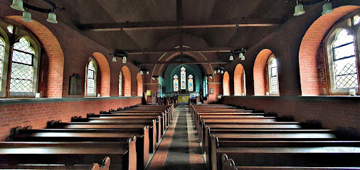
Where is St John the Baptist Churchyard?
St John the Baptist Churchyard is located at Outwood, Tandridge District ,Surrey ,England.
-
St John the Baptist Churchyard cemetery's updated grave count on graveviews.com?
0 memorials
-
Where are the coordinates of the St John the Baptist Churchyard?
Latitude: 51.1981770
Longitude: -0.1127510
Nearby Cemetories:
1. Smallfield Ebenezer Chapel Cemetery
Smallfield, Tandridge District, England
Coordinate: 51.1770230, -0.1151960
2. St. Mary the Virgin Churchyard
Horne, Tandridge District, England
Coordinate: 51.1827330, -0.0886630
3. St. John the Evangelist Churchyard
Blindley Heath, Tandridge District, England
Coordinate: 51.1961510, -0.0536070
4. St Bartholomew Churchyard
Burstow, Tandridge District, England
Coordinate: 51.1558610, -0.1247750
5. St Mary Churchyard
Bletchingley, Tandridge District, England
Coordinate: 51.2413460, -0.0994430
6. Redstone Cemetery
Redhill, Reigate and Banstead Borough, England
Coordinate: 51.2310910, -0.1601330
7. St Peter and St Paul Churchyard
Nutfield, Tandridge District, England
Coordinate: 51.2419780, -0.1258540
8. Bletchingley Cemetery
Bletchingley, Tandridge District, England
Coordinate: 51.2411080, -0.0911120
9. Parish of Horley's New Churchyard
Horley, Reigate and Banstead Borough, England
Coordinate: 51.1711120, -0.1747610
10. St. Bartholomew's Churchyard
Horley, Reigate and Banstead Borough, England
Coordinate: 51.1698000, -0.1758000
11. Sidlow Bridge Emmanuel Churchyard
Sidlow, Reigate and Banstead Borough, England
Coordinate: 51.2077270, -0.1989510
12. St John the Evangelist Churchyard
Copthorne, Crawley Borough, England
Coordinate: 51.1394100, -0.1175700
13. Saint Nicholas Churchyard
Godstone, Tandridge District, England
Coordinate: 51.2465740, -0.0567650
14. Quakers Burial Ground
Reigate, Reigate and Banstead Borough, England
Coordinate: 51.2372600, -0.1936700
15. Reigate Cemetery
Reigate, Reigate and Banstead Borough, England
Coordinate: 51.2353550, -0.1977820
16. St Peter and St Paul Churchyard
Lingfield, Tandridge District, England
Coordinate: 51.1763840, -0.0142480
17. St Mary Magdalene Churchyard
Reigate, Reigate and Banstead Borough, England
Coordinate: 51.2368540, -0.1972560
18. Surrey and Sussex Crematorium
Crawley, Crawley Borough, England
Coordinate: 51.1357000, -0.1469230
19. St Peter Churchyard
Tandridge, Tandridge District, England
Coordinate: 51.2429480, -0.0320950
20. St John The Divine
Felbridge, Tandridge District, England
Coordinate: 51.1414480, -0.0392460
21. St Katharine's Churchyard
Merstham, Reigate and Banstead Borough, England
Coordinate: 51.2689900, -0.1514700
22. All Saints Churchyard
Crawley Down, Mid Sussex District, England
Coordinate: 51.1211200, -0.0830650
23. Dormansland Baptist Chapelyard
Dormansland, Tandridge District, England
Coordinate: 51.1634300, 0.0073300
24. St John the Evangelist Churchyard
Dormansland, Tandridge District, England
Coordinate: 51.1597320, 0.0054300