
| Memorials | : | 0 |
| Location | : | Wellington County, Canada |
| Coordinate | : | 43.9511810, -80.8071900 |
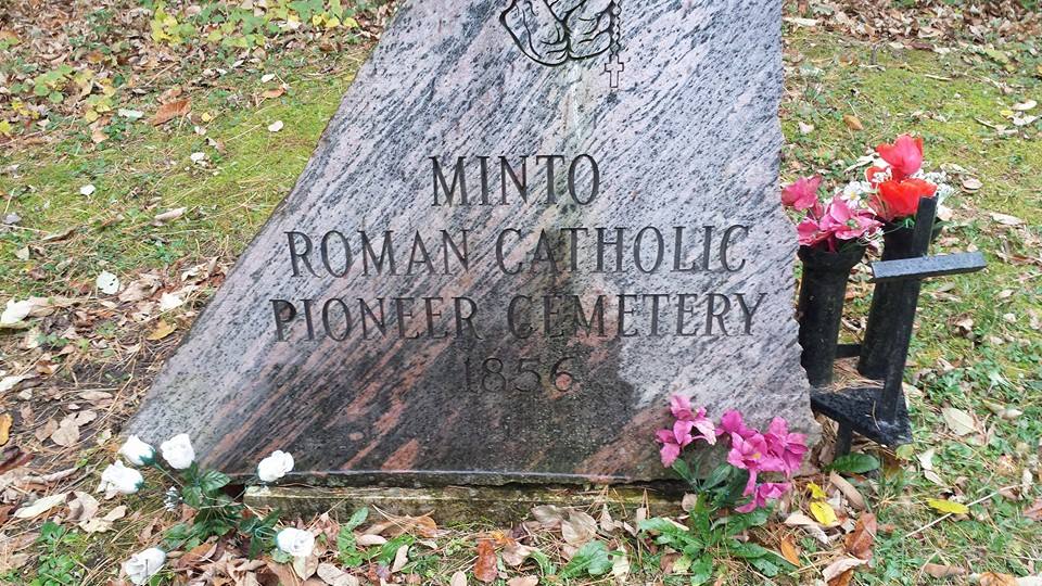
| Description | : | In 1854 John Page and Jeremiah Burke donated five acres in equal shares and a log church was erected with adjacent cemetery. This building served the settlers from Harriston and Mount Forest until 1865, not only as a church, but also as a school for the 12th Concession where John Page was teacher. In 1865 the Mount Forest Catholic Church was built and it became the church home of Harriston Catholics. The log church fell into disuse and it was demolished. Also known (shown on some death records) as "Page's Cemetery". |
frequently asked questions (FAQ):
-
Where is Saint Thomas Roman Catholic Cemetery?
Saint Thomas Roman Catholic Cemetery is located at 6549 12th Line Road, West of Hwy 6, Minto Twp. Wellington County ,Ontario ,Canada.
-
Saint Thomas Roman Catholic Cemetery cemetery's updated grave count on graveviews.com?
0 memorials
-
Where are the coordinates of the Saint Thomas Roman Catholic Cemetery?
Latitude: 43.9511810
Longitude: -80.8071900

Nearby Cemetories:
1. Westdale Mennonite Cemetery
Minto, Wellington County, Canada
Coordinate: 43.9300750, -80.8287760
2. Chilton Cemetery
Normanby Township, Grey County, Canada
Coordinate: 43.9811480, -80.8129810
3. Holy Cross Roman Catholic Cemetery
Mount Forest, Wellington County, Canada
Coordinate: 43.9679450, -80.7519100
4. Cochrane Cemetery
Mount Forest, Wellington County, Canada
Coordinate: 44.0028500, -80.7740300
5. Harriston Cemetery
Harriston, Wellington County, Canada
Coordinate: 43.9139099, -80.8708725
6. Bethel Pioneer Cemetery
Wellington County, Canada
Coordinate: 43.9274480, -80.7271960
7. Mount Forest Cemetery
Southgate Township, Grey County, Canada
Coordinate: 44.0039100, -80.7266500
8. Farewell Mennonite Cemetery
Farewell, Wellington County, Canada
Coordinate: 43.9053140, -80.7182690
9. Mount Pleasant Cemetery
Calderwood, Grey County, Canada
Coordinate: 44.0185310, -80.8731250
10. Hiltz Methodist Cemetery
Southgate Township, Grey County, Canada
Coordinate: 44.0415434, -80.7565276
11. Chapel Hill Roman Catholic Cemetery
Orchardville, Grey County, Canada
Coordinate: 44.0547780, -80.7958600
12. Cedarvale Conservative Mennonite Cemetery
Minto, Wellington County, Canada
Coordinate: 43.9136800, -80.9522600
13. Woodland Cemetery
Egremont Township, Grey County, Canada
Coordinate: 44.0238904, -80.6774183
14. Kenilworth Pioneer Catholic Cemetery
Kenilworth, Wellington County, Canada
Coordinate: 43.9085900, -80.6464300
15. Palmerston Cemetery
Palmerston, Wellington County, Canada
Coordinate: 43.8316800, -80.8683000
16. Sacred Heart Roman Catholic Cemetery
Kenilworth, Wellington County, Canada
Coordinate: 43.9067993, -80.6410217
17. Lauderbach Cemetery
Lauderbach, Grey County, Canada
Coordinate: 44.0071710, -80.9676960
18. Holstein Cemetery
Holstein, Grey County, Canada
Coordinate: 44.0708100, -80.7424700
19. Saint Peter's Catholic Cemetery
Ayton, Grey County, Canada
Coordinate: 44.0492700, -80.9312200
20. Ayton Union Cemetery
Ayton, Grey County, Canada
Coordinate: 44.0490600, -80.9318300
21. Clifford Public Cemetery
Howick Township, Huron County, Canada
Coordinate: 43.9761400, -80.9914260
22. Trinity Lutheran Cemetery
Ayton, Grey County, Canada
Coordinate: 44.0579900, -80.9234900
23. Ayton Evangelical United Brethren Cemetery
Ayton, Grey County, Canada
Coordinate: 44.0588600, -80.9267700
24. Redgrave Cemetery
Howick Township, Huron County, Canada
Coordinate: 43.8933390, -80.9841470